Showing posts with label day hikes. Show all posts

Wednesday, April 17, 2019

Hurricane's Backside

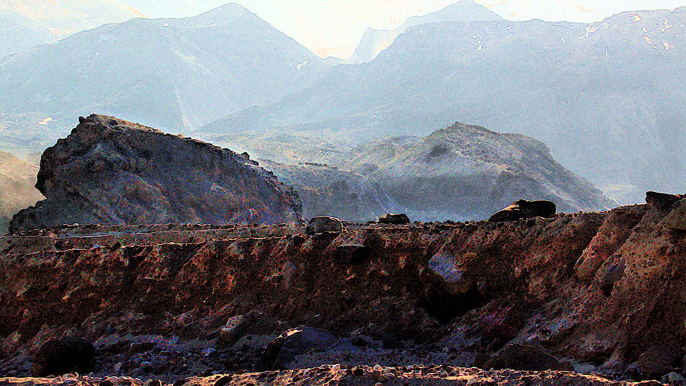
Looking away off west.


So, much effort for little result, i.e., this blog post.

I'm faking it while cleaning out old photo files, and being a little mouse of a blogger way off to the side of what is currently the internet, well shucks then. What more do you need? It's a gesture, isn't it? A gesture to show you that I still love you, even if we'd get along for no more than four seconds in real life, you and I. But since I live in the abstract, gestures count.


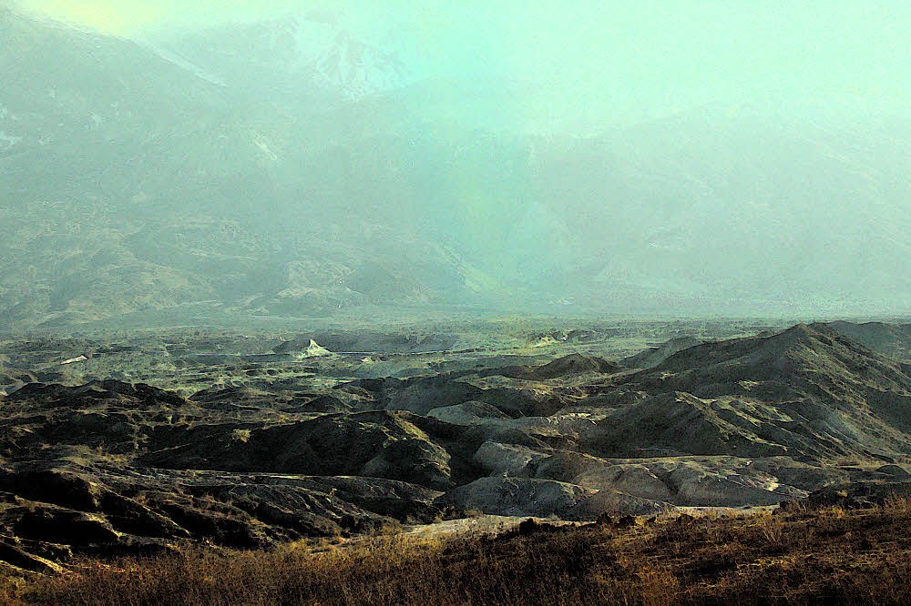
To the southwest, toward the heart of Olympic National Park.


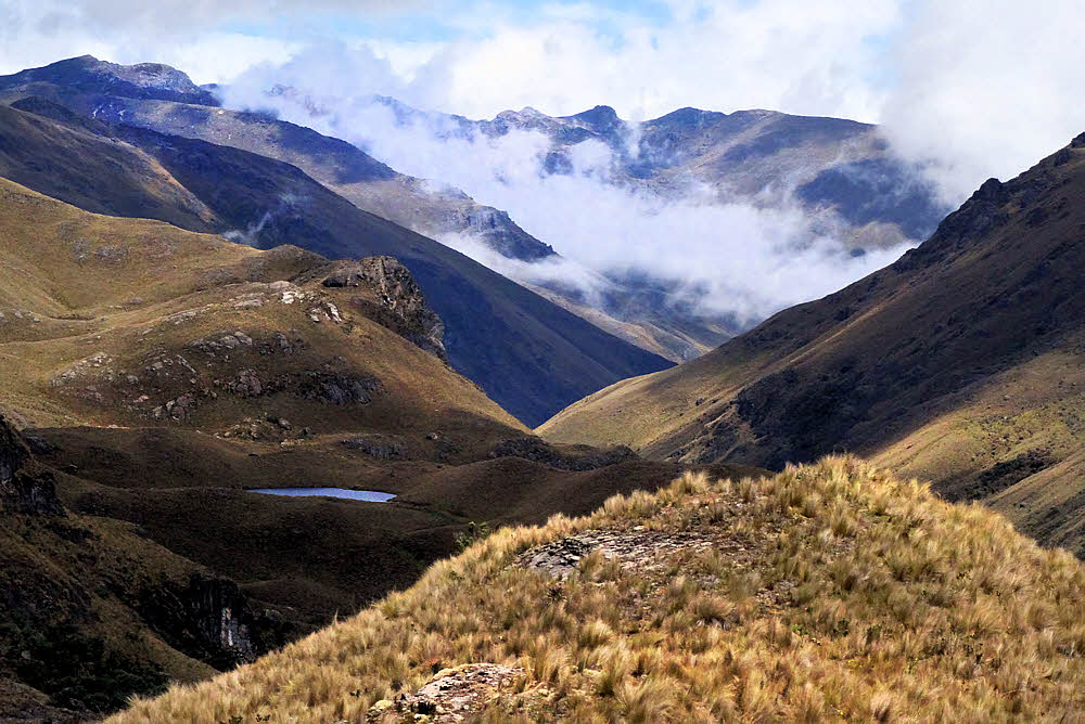
Living in paradise as I'm doing at the moment, wouldn't we expect that there is ever so much going on, to do, to share, to experience? Yep, I think so. But since reality don't give a snit what I think, no. It's dead here. Things were better six years ago when I first got to Cuenca. (That's in Ecuador.) More squirrelly, less predictable, odder.


I've never understood this place. That seems right, the way you never understand home.


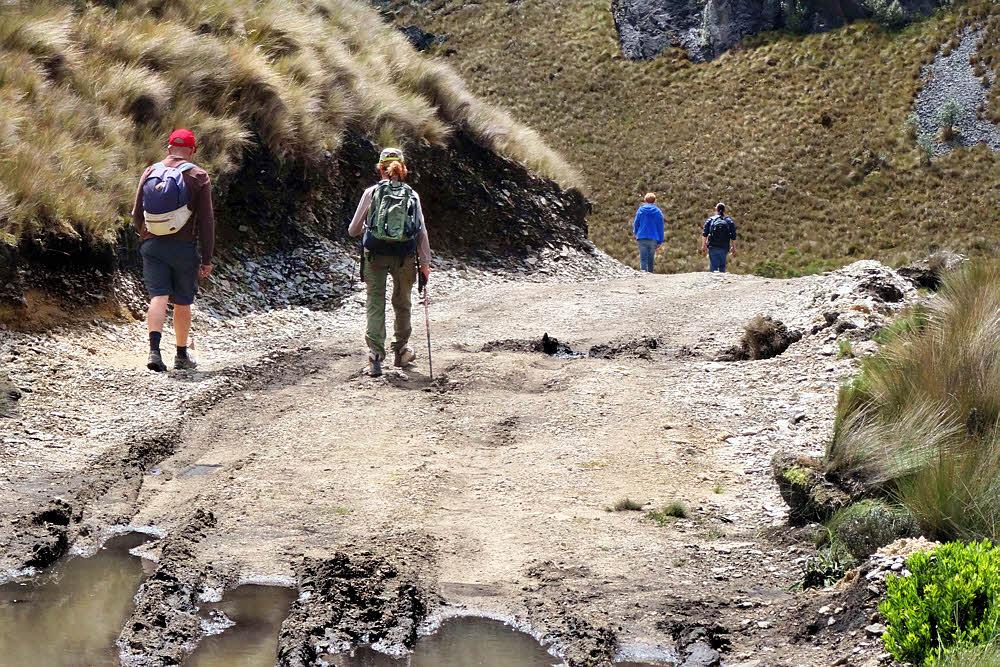
Since I can't seem to keep away, I was back in the U.S. from the start of March, 2018 until the end of July. Had big ideas. Uck fupt big time. Bailed. Figured I'd make up for it here in Ecuador. I've been back over eight months, watching, checking every day, looking, and still have not found a single person wanting to go out hiking. At least there used to be a few people. Maybe they saw me coming.


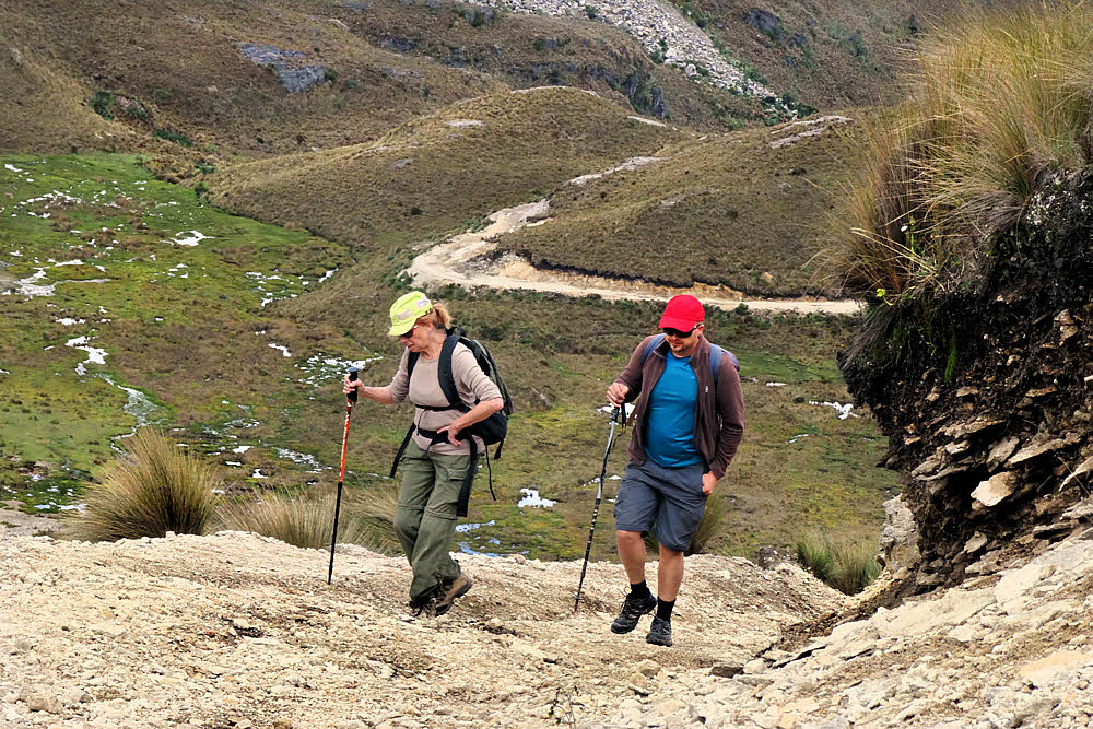
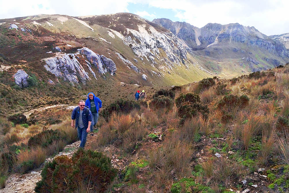
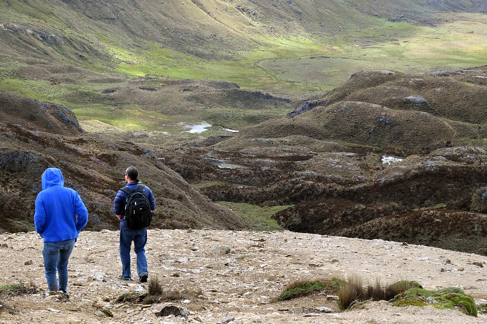
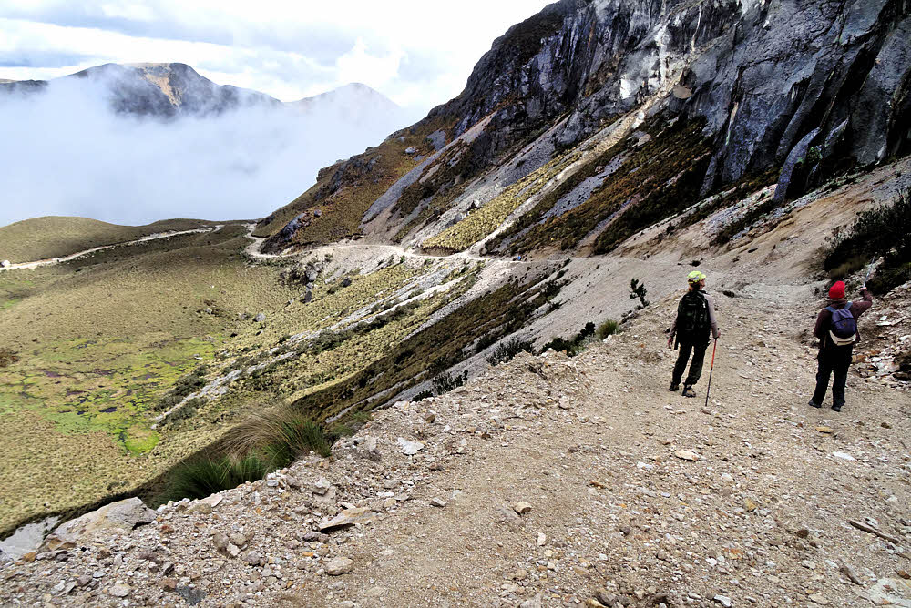
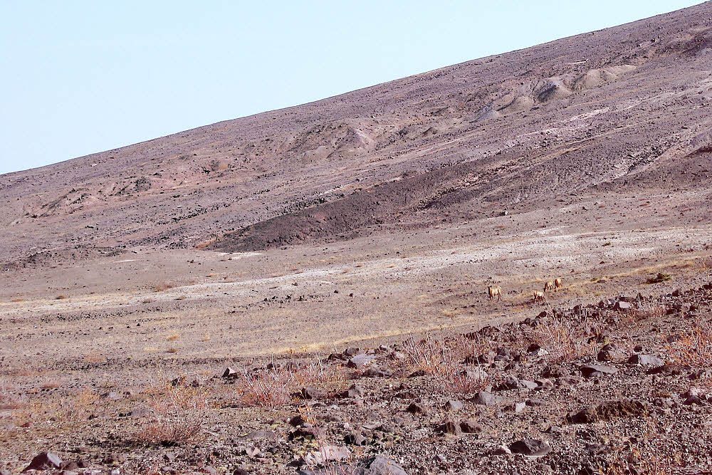
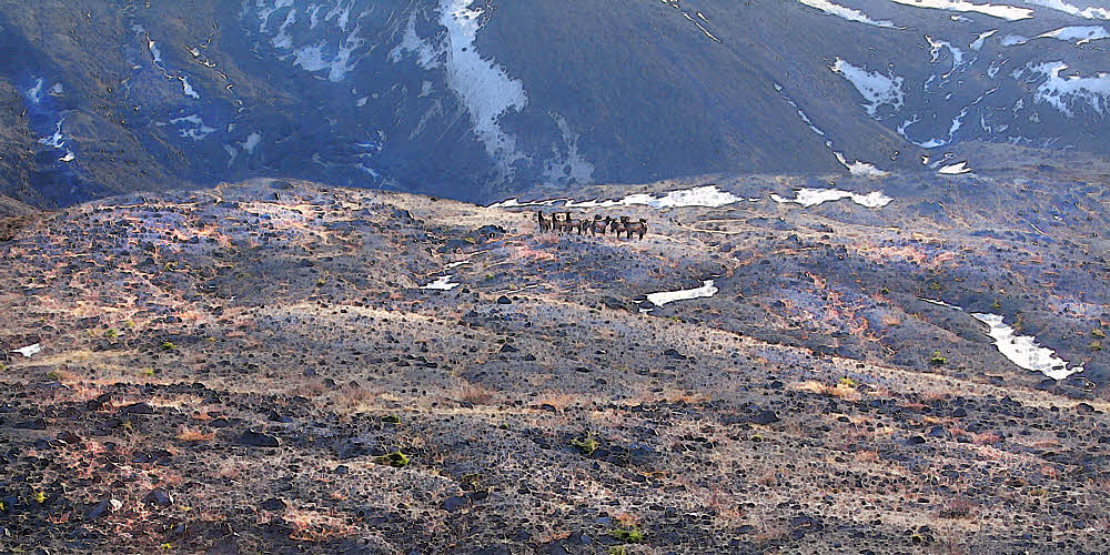
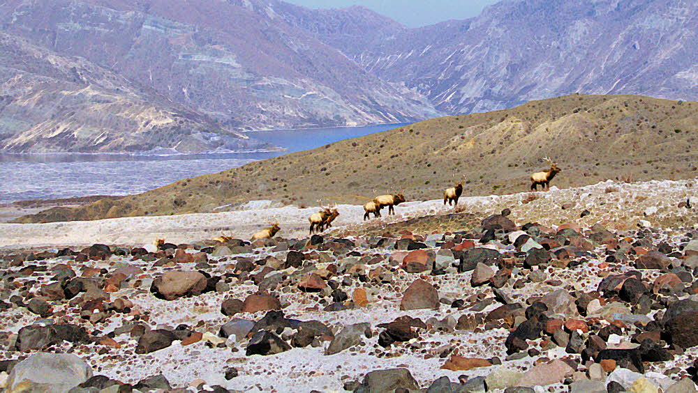
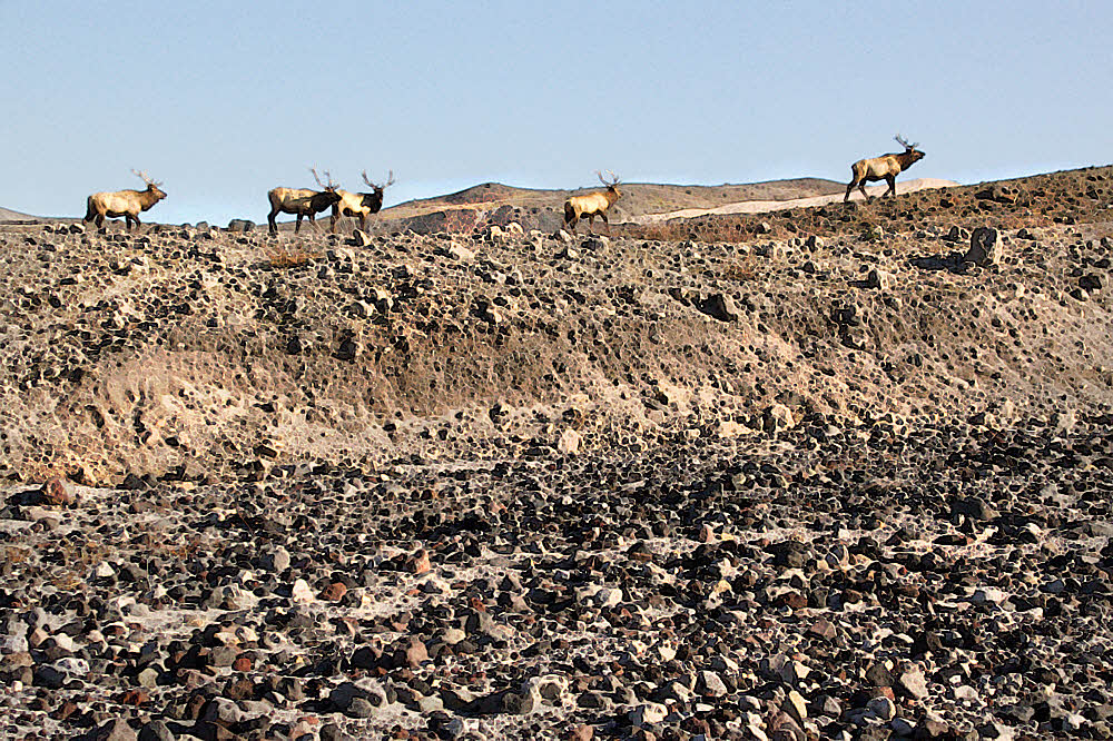
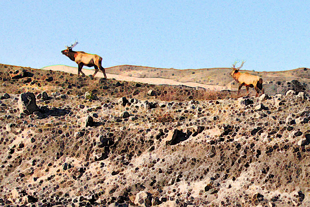
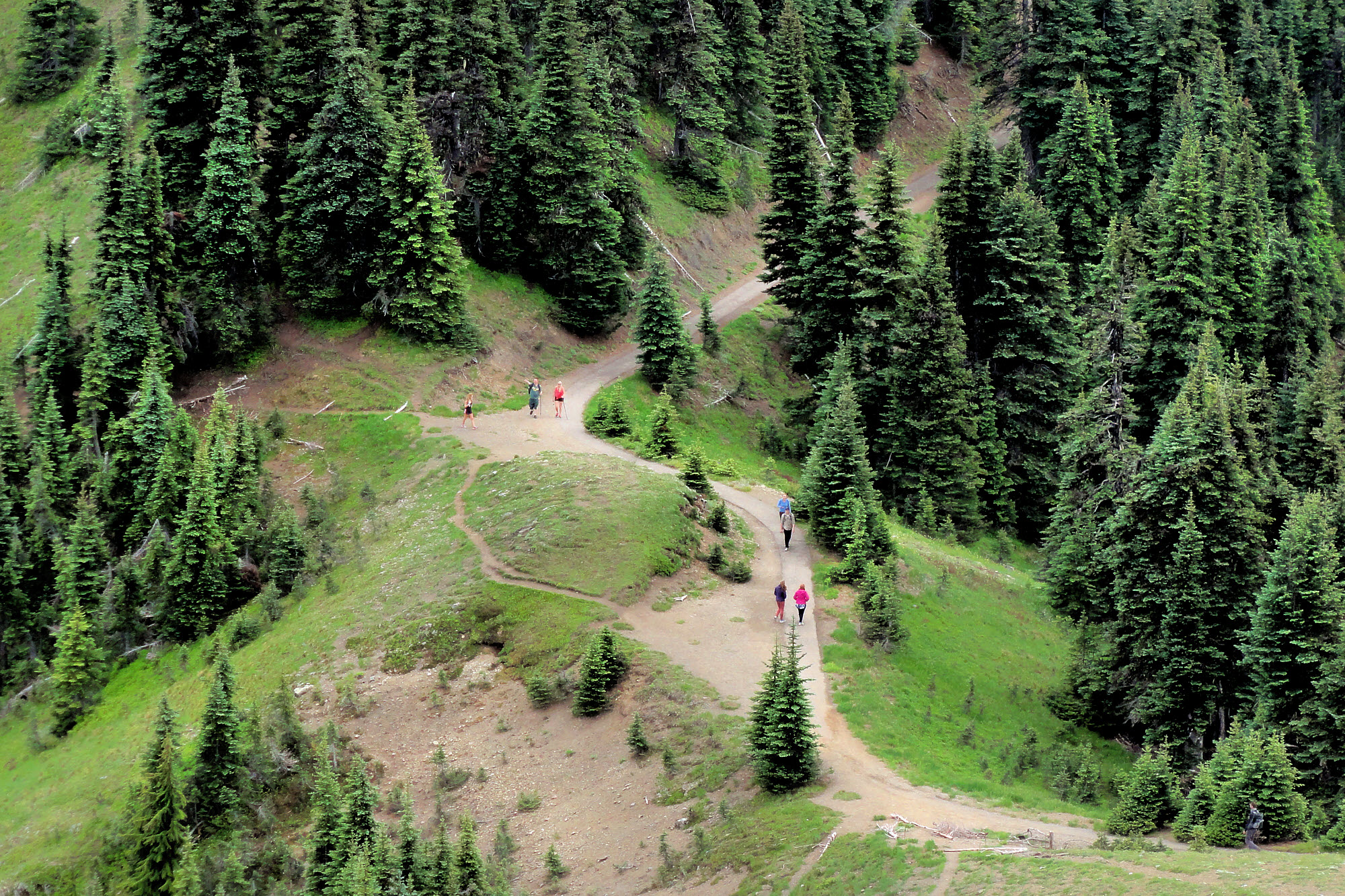
Hikers. One man, two girls. They came in peace and left with no trace.


This place is getting settled.

It's a lot more "civilized" than it was in November, 2012, when I first stepped off the shuttle van from Guayaquil, looked around and thought "grubby". My first impression. Grubby. Not quite so much any more.


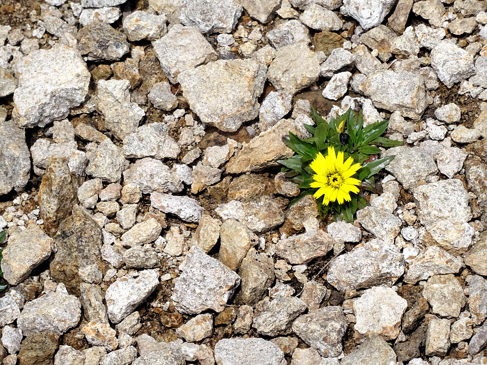
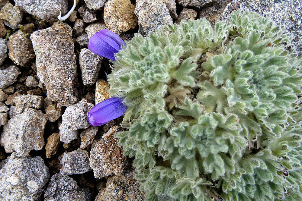
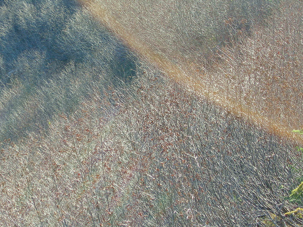
This grassy swathe appears blank or even snowy on the Google Earth images below. Anything but. Lovely, don't you think?


Six years on, there is still construction going on everywhere. New buildings. Remodeled old buildings. More traffic lights. Better internet. Retired gringos getting over their wonder and settling into brain-dead old age. Less experimentation, more suburbanization, if we can call it that. (Smells like it.) No hiking groups. At all.


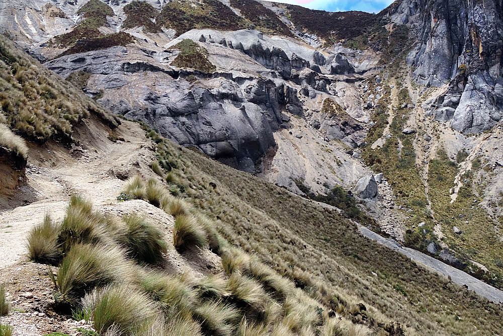
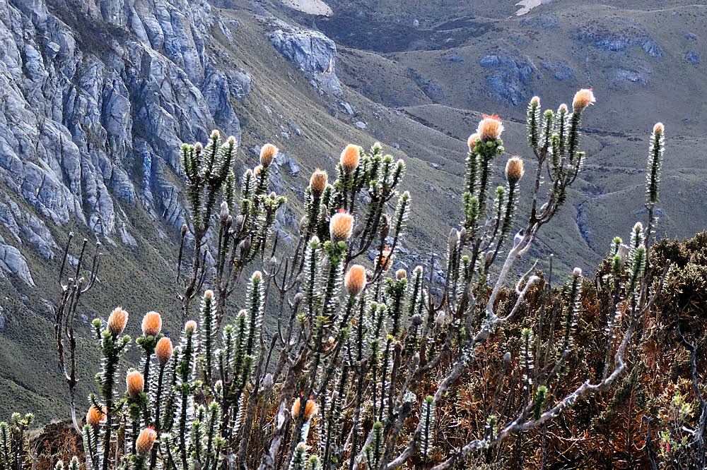
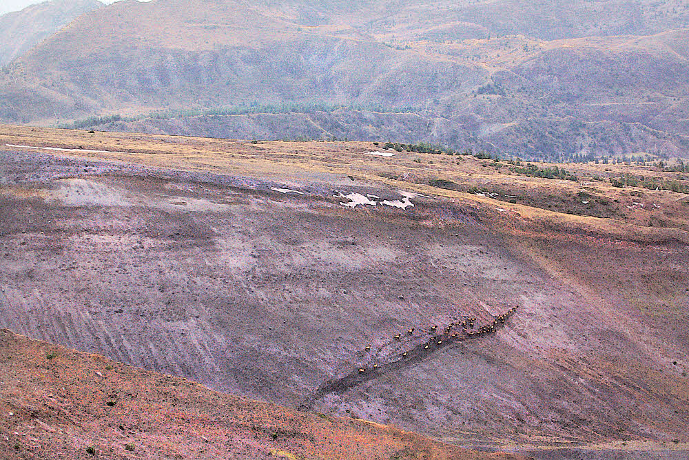
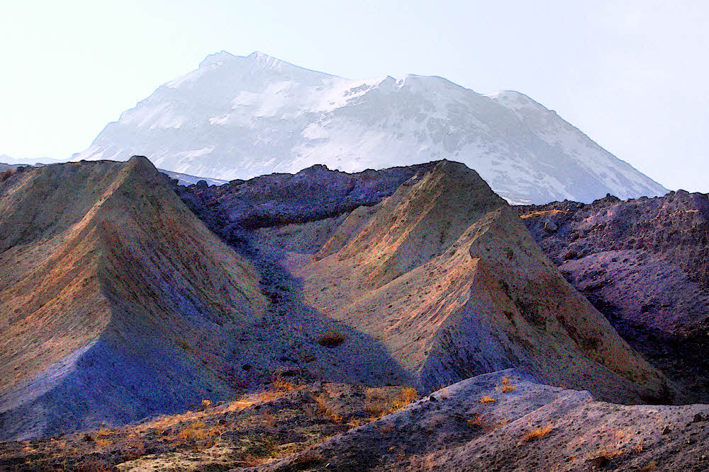
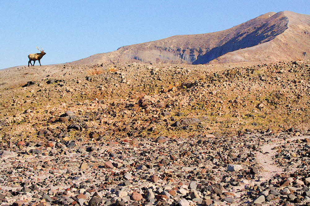
From above and to the right of the rocky outcrop in the previous two images.


Anyway, I myself am not dead yet, but any day now I could wake up dead, so maybe I'll be back in the U.S. for one very last ultimate try at being a gnarly backpacker and traveling around and stuff. Possibly. Am I just old and stupid? Also possibly.


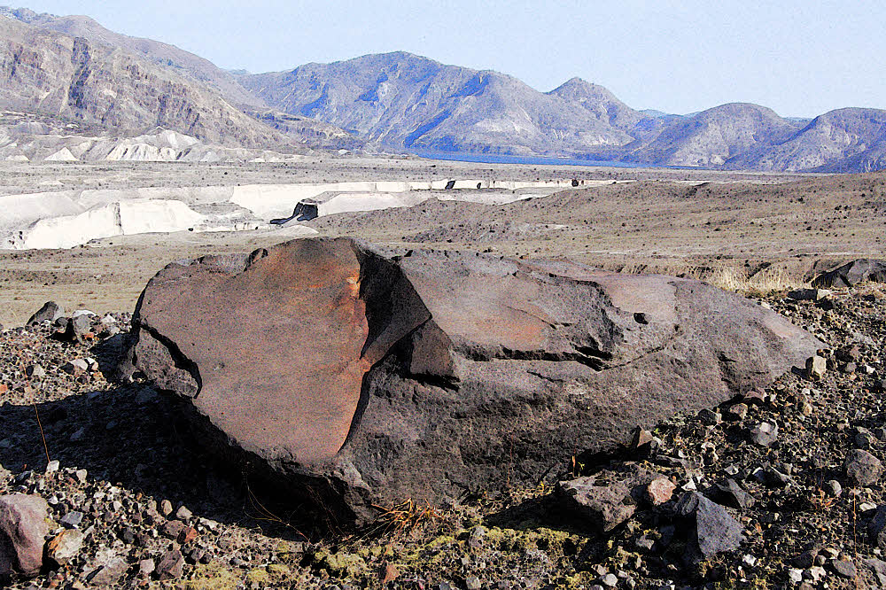
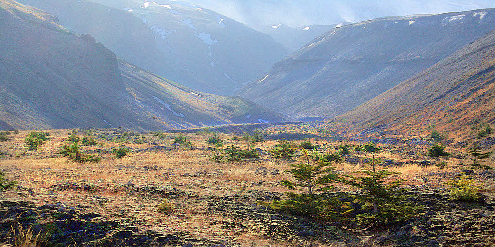
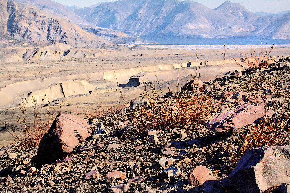
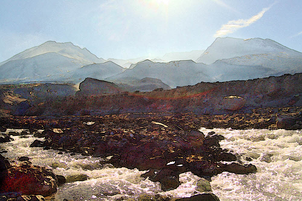
The now free-flowing Elwha.


Last year definitely did not work out, though 2014/2015 was not all that bad, when I was living in Port Angeles, WA, right underneath Olympic National Park, and going there quite a bit, and this is where today's photos came from. (July, 2014.)


And they, far ahead, prepare to vanish into forest.


Drive up to the Hurricane Ridge Visitor Center, go right for a mile or two, and you get to the Hurricane Hill parking lot and trailhead. Everything in the U.S. has a parking lot, doesn't it? That's how you can tell you're there. If not, then it isn't real.


Another view off west.


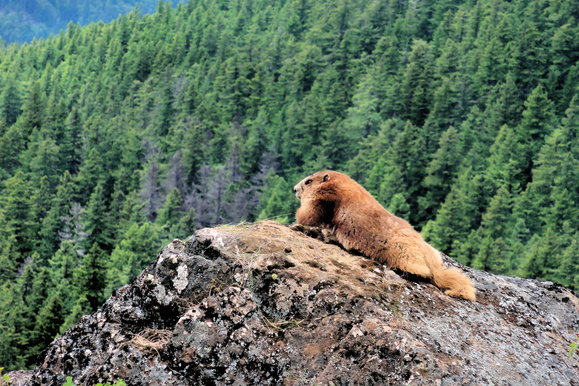
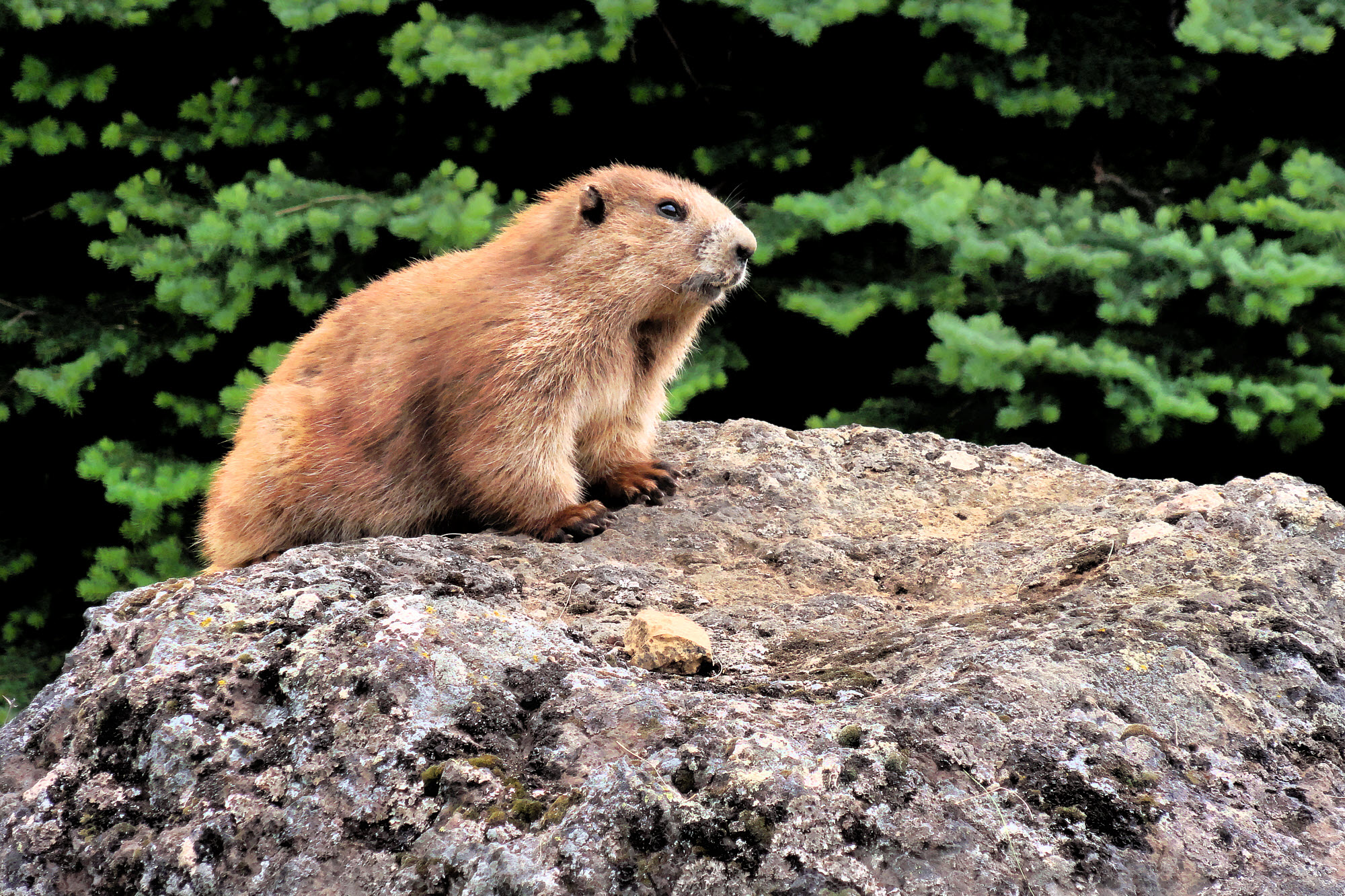
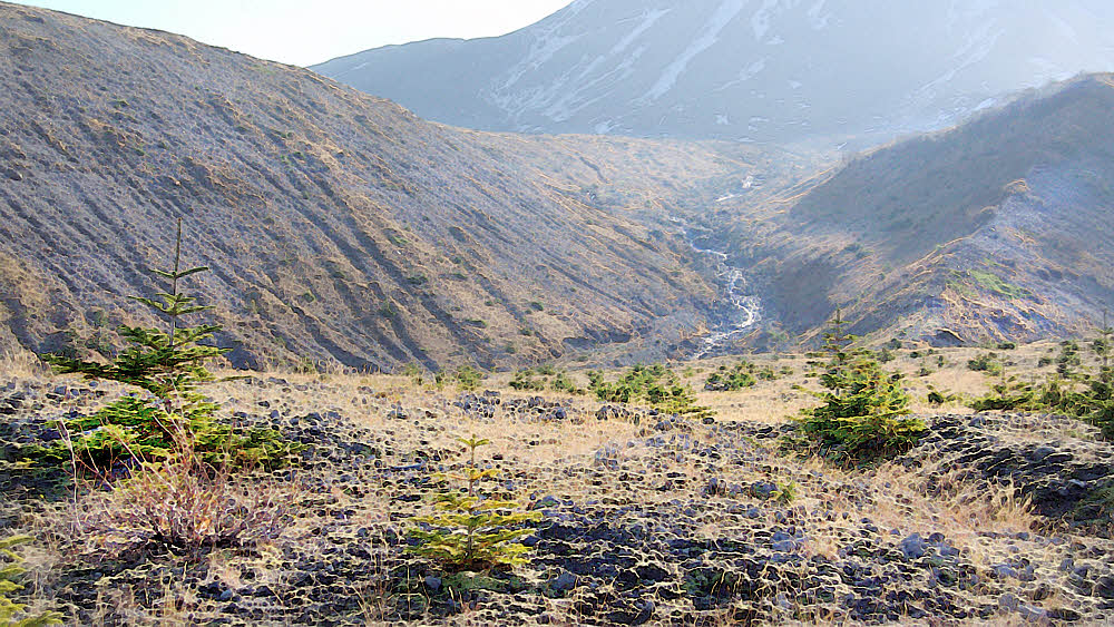
Anyway, hike up and look over the top to the Strait of Juan de Fuca or hike farther west, or do both. Go far enough and first you're on the backside of Hurricane Hill and later on, if you keep going, you're about a mile (1600 m) lower, and just about able to spit into the Elwha River, if that's your specialty. Don't go that far and you don't have to sweat so much, and can sort of noodle around and feel on top of the world because you are. If that isn't enough, and you get bored, you can whistle back at the marmots or take a nap on the grass. Nice.


Southwest. Summer here always seems like forever.


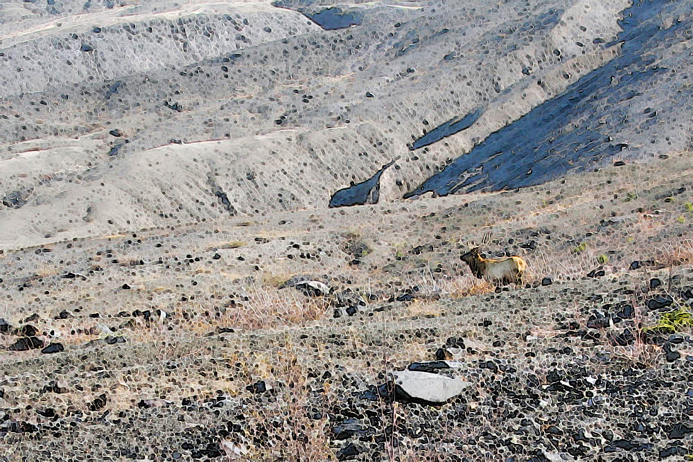
So here's what I've got out of it. The photos look a little impressionistic because that's what happens when you take a tiny little camera and point it at infinity and then try to make sense of it. But you get the idea. Forgive me.


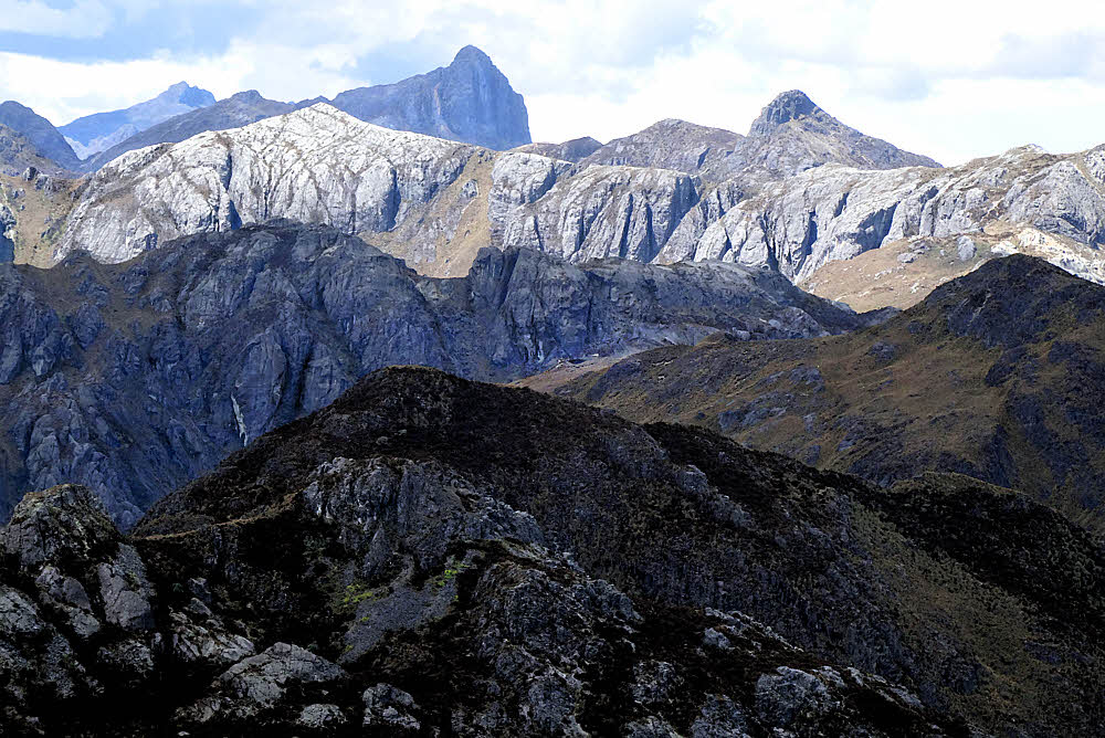
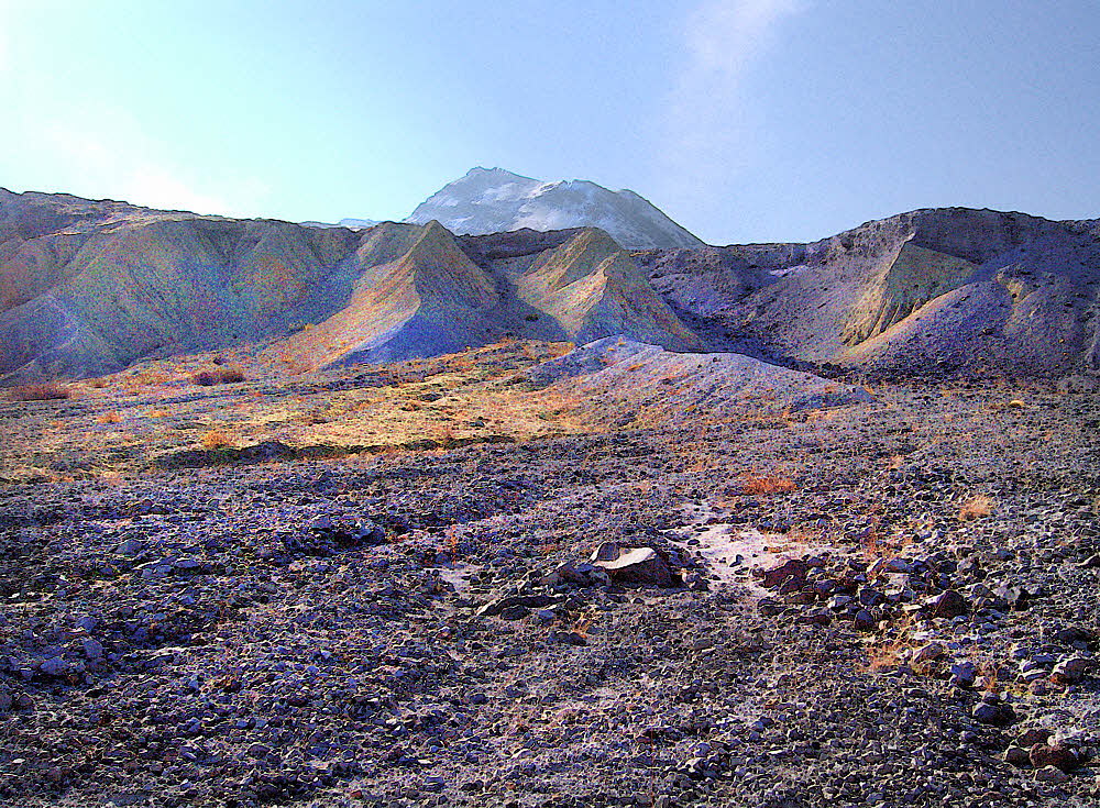
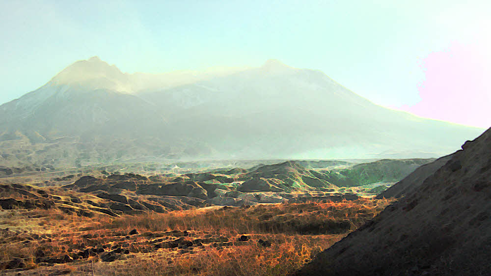
Toward Olympus. I think. Sky and peaks and snow and sky.


The start and the end. Start there and hike this way. Lots of "up". And then hike down again when it's all over. And then go home remembering that it's about more than just you.


Area map. Hurricane Hill in relation to Hurricane Ridge. Port Angeles is just off the map toward the top.


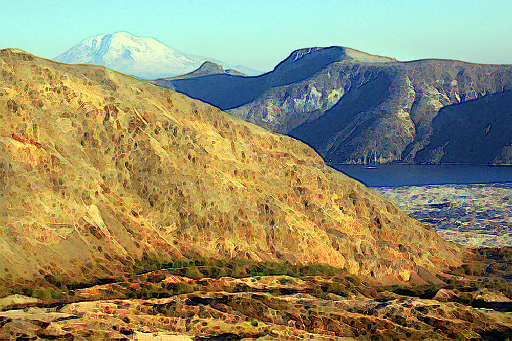
From Google Earth. Looking approximately ENE. The sort of "snowy" area is actually mostly grass.


From Google Earth. Looking roughly north. The long left-right light area near the top is Hurricane Hill. To the lower left is the former Lake Mills.


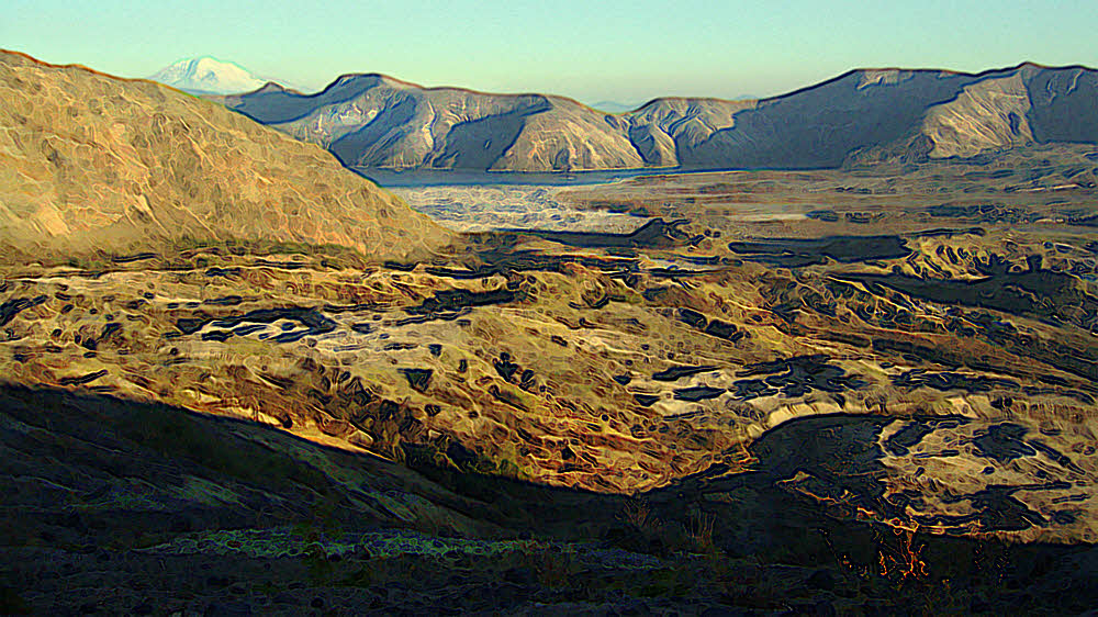
From Google Earth. Straight down, showing the trail from way up high down to the Elwha River


From Google Earth. Looking roughly west. Where you see "Windy Arm" is the former Lake Mills, now the restored Elwha river. Foreground is Hurricane Hill.


Elwha River Restoration

Restoration of the Elwha River


Remember, flies are nature's way of saying that you're still yummy.
Have something to add? Send email to sosayseff@nullabigmail.com
See if that helps.
As always, Effort or Eff it. No sniveling.

Wednesday, April 3, 2019

Marmot Olympics

"Marmota olympus". That's what they say, a big squirrel. I didn't know that. Them. Them facts. I didn't know them. Now I do.


Just up one side of Hurricane Hill and a little down the other, there be marmots.

Not Hurricane Hillary or Tropical Depression Hilary. None of that. Part-time hurricanes come and go up topside, but no depressions. No depressions because you feel good there, but occasional hurricanes, and not tropical either. "Temperate latitude" hurricanes. They come through every now and then.


This would be in Olympic National Park in western Washington state. I didn't know about temperate latitude hurricanes until a couple of years ago. True. Cliff Mass of the University of Washington mentioned it on one of his weekly weather talks, but oddly, the term "temperate latitude hurricane" does not occur on his blog.


Maybe he changed his mind about the term, or hasn't gotten around to writing about it, but there have been some big storms blowing through the area. (See link below.)


Anyhow, marmots are sleeping by then. Come winter, they sleep. Come summer, they munch grass and whistle. November is usually the stormiest month, but by then there wouldn't be much to eat, and normally there would be significant snow on the ground. Both good reasons to try sleeping it off.


"Whistle pigs", "woodchucks", "hoary marmots" — all closely related. I didn't know until yesterday that the olympic marmot was distinct: "it occurs only in the U.S. state of Washington, on the middle elevations of the Olympic Peninsula", according to Wikipedia. But I guess so, it is distinct, a little.


Hurricane Hill is off a bit to the west of Hurricane Ridge and its visitor center, which is accessible by paved road from the city of Port Angeles. The trip is about 15 miles (24km), though the direct distance is around a third of that. (A windy road to a windy spot.)


From Hurricane Hill there are good views of the Elwha River valley, including part of what used to be Lake Mills behind Glines Canyon Dam before the dam got taken down. You can look at the Bailey Range and peek at Mt Olympus, but I've never seen any gods over there, just more pointy rocks and snow. Might be worth another look some day.


Marmots is mostly it. Get out on the grassy parts, see something lumpy moving around, get whistled at, and maybe it's a marmot. If not, then that's a good time to turn around and go home, but so far it's been marmots and they've minded their own business and I've never tried to tickle any.


The trail does continue west, down a long slope to the Elwha Ranger Station, and on the day I grabbed these photos there was a group of three or so headed that way. Looked like a dad and two daughters.


I followed for a while, but the trail gets really steep after it enters the forest on the west side, and I didn't have any reason to go way down there, so I returned to hanging with the marmots. Might be a fun trip to do sometime.

The Olympic marmot is thought to have originated during the last glacial period as an isolated relict population of the hoary marmot in the Pleistocene ice-free refugia...The Olympic marmot is about the size of a domestic cat; adults weigh from 3.1 to 11 kg (6.8 to 24.3 lb) and are from 67 to 75 cm (26 to 30 in) in length, with the average being 71 cm (28 in). It is the largest marmot...The coat is double-layered, consisting of soft thick underfur, for warmth, and coarser outer hairs.

Olympic marmots eat meadow flora such as avalanche and glacier lilies, heather blossoms, subalpine lupine, mountain buckwheat, harebells, sedges, and mosses. They prefer green, tender, flowering plants over other sources of food, but roots are a large part of their diets in the early spring when other plants have not yet appeared.

And so on. (Info from Wikipedia.) Pretty nice for squirrels.


Olympic marmot

Columbus Day Storm, 1962

  • Winds exceeding 150 mph and a storm equal to Hurricane Katrina.
  • Huge forests leveled.
  • Dozens of deaths and hundreds of injuries.
  • Thousands of homes and buildings destroyed or seriously damaged.


Me? Breathing. Still breathing. Working on that today.
Have more info? Send email to sosayseff@nullabigmail.com
See if that helps.
And remember, Effort or Effit, and peace be upon you then, and dust be off you, if you can manage it.

Thursday, November 30, 2017

Cajas High

For a little while last summer I had some hiking buddies. We went to a few places like this. It and similar areas are in or near Cajas National Park west of Cuenca, Ecuador.


This was our big day, and last real hike, when two other friends of Mark showed up to accompany Barbara and me. Mark's little Chevrolet Sail was full to the gunwales.


I'm not really sure where we went. Not too far out. Mark, a Brit who is living in Cuenca, had been hiking on his own and knew some places. This one was fun because it was almost kinda-sorta strenuous.


We were able to park at a sort of odd little restaurant, fishing hole, hiking location and probably more called "Rancho Hermanos Prado", right along the highway. And since it is owned and private, and there are people around all day, it's a safe place to leave a vehicle.


Unfortunately, I decided to beg off the next trip to leave room for others, since Mark said he had to turn away a couple of people this time, and after that things sort of petered out somehow. Barbara is from Calgary, Alberta. She has seven dogs, all of which she was sane enough to leave at home. OK by me.


Several years ago I was out on another day hike along the same highway, and got up to 14,000 feet (4300m). I don't know how high this location is, but if you're acclimated it isn't a bad little trek. There is plenty to see.


Like little orange and yellow somewhat-crocusy flowers, evergreen shrubs, ridges, mist, hail, torrential rain, and wind. It has weather, and whether or not you're going to get some is not an issue. The only issues are what, when, and how much. It didn't hit this day until just after Mark dropped us off back in town. I got semi-drenched walking home even under my umbrella.


Rock. There is lots of rock. This is a volcanic area with frequent earthquakes. The land gets created and then endlessly churned. Meanwhile there is plenty of rain, and then things grow — sometimes unfamiliar things. Unfamiliar to me, but pleasant enough.


Up at the end of this hike there was some sort of radio equipment or an automated weather station. I have a couple of photos but left them out since they aren't too interesting in themselves, but there is something at the top, and the end of the road, such as it is, is there too, reasonably. So that's where we stopped and had a snack.


The ground is strange to me. It looks lush and vegetation-covered, and it is in a way, but get up close and the ground is mostly bare, with a layer of small, whitish, broken stone and scattered bunch-grass and shrubs.


Where there is low vegetation, it is green, but not soft and cuddly like moss. I'm not sure I've seen anything you could call moss. It isn't like that.


Touch it and it's hard. This isn't a soft landscape. All the plants feel like they're made of plastic.


Maybe it's the wind. This is a high place. Even if the days don't ever get warm, let alone hot, and there is plenty of rain, there is always wind, and so little atmosphere that what free water does coat the ground evaporates quickly. It's a land of succulents and pricklies.


No trees either. Not this high. But lots of empty space. Lots of vistas.


The good/bad news is that this area is easy to get to from Cuenca, costing less than a dollar each way to hop onto an intercity bus, but you have to speak Spanish and don't want to travel alone. My hearing is so poor that I'll never be conversational in Spanish, and it's hard to find anyone who likes to actually go out and hike in the dirt.


Once you do finish a day of hiking, you simply walk back to the highway and wait for the inbound bus to come along. Flag it down, pay a few cents, and end up back in town. But not so much if you're one person. Two or three or more, OK — but for one person out on the road, standing there all alone, anything could happen, and some of it less than agreeable, so I've been SOL for most of my time here. Haven't heard anything from Barbara or Mark for many months now. Due to leave soon anyway. This might be the last of my hiking here.


More info.

Cajas National Park

Páramo

Rancho-Hermanos-Prado

Wednesday, November 8, 2017

Elk In My Pocket

Hiking in.

There, that's it, what I came to see.

I've been cleaning out my photos. I have a lot, and a lot to discard. Once I went digital they began piling up like drifts of snow, and many are as useful, so they have to go.

And standing there I look down. A message underfoot. I must understand this in order to know, but what, how? What is my lesson?

I'm keeping the interesting ones, at least those that interest me, and there is a temptation to post them, so I'm doing that.

Moving west, crunching along, under the massive crater. To you it may look inhospitable. To me welcoming, like home, cliffs with their open arms.

So why not now?

Turn around, and then... The lake, Spirit Lake. So impressive that I forgot to level the photo. Or it's a magic lake. Attracted by the mountain, tilted. Perhaps yes.

If not now, when? If not these, then which? Etc. See?

Brush and lens flare.

I had to unpack these images from Canon RAW files, which my long-discarded Canon PowerShot S50 produced. Surprising. Surprising quality, given all the camera's limitations.

Witnesses. Fellow travelers. First encounter. We see each other.

The Canon dates from 2003, has a 1/1.8 CCD (7.2x5.3 mm), and would look silly if you set it into a bunch of today's cameras. It had a resolution of 2592x1944 and captures 5 megapixels of image data. The zoom range was 3x (in big-camera terms that was 35-105mm).

Some are large and confident.

The Sony has a 1/2.3 sensor (6.17x4.55 mm — slightly smaller), with a resolution of 5184x2920 at 21 megapixels, and a 30x optical zoom — in big-camera terms that's 24-720 mm, and it helps a lot. Files, though, are only hard-baked JPEGs. No RAW option.

Some prefer to ruminate at a distance.

Although the Canon is older, with much less resolution, its sensor is 1.4 times bigger than the Sony's, and there is that RAW option. It shows. This was really a great camera for its time, and its quality is still evident. Not too shabby, even after 14 years of technological improvement that it doesn't have.

And others group and move in long columns toward more lonesome locations.

But most of image quality is what the user does. Even 44 years after I got my first real camera, I'm still making beginner's mistakes, though slightly fewer as time goes by, but I did this hike in 2007, so excuses. There are always more — I has 'em.

Then, after half a day of walking, I turned back, and spent more time talking to the mountain.

So about halfway through the editing I got tired, got desperate, tried going impressionistic, and decided to start over and go with that, because easier, because I can say I intended that all along. Nurk.

First the willow thickets.

Still not great, but my crappy technique sort of looks not terrible and kind of artistically creative if you close one eye, squint, and turn your head sideways, and are feeling generous.

Then more landscape.

But really, it's the subject here.

And finally find myself under the cinder cone again.

It was a great day late in the year, I was out all alone on the north side of Mt St Helens, and the elk were in force. September and October in Western Washington can be great. On a good year the winter rains don't start until the third week of October. Some years they come in September. One year I will never forget had good weather into the middle of November, and I was smart enough to make use of it.


Hiking out.

You'd think that backtracking and hiking out would be an unwinding of the inbound route, and it was, but revealed different perspectives.

This year, 2007, I was out on October 28, right on the edge.

The mountain still makes it clear where the weight is, who has the mass, and where to find the rulebook.

Coming in from the Johnston Ridge Observatory, the tourist route, I was safe from hunters. Hunting season may not have opened yet, but if it had, few if any hunters would have been in the area. It's my opinion, based on what I've seen of hunters, that most don't know what they're doing, and look for game where it isn't.

Loowit Creek — never happy. Never sad either. Never nothing it ain't, but splashy, and no nonsense.


I've seen hundreds of elk at St Helens, and they don't hang out around parking lots or on the trails within half a mile of those parking lots, which is where the hunters look. Elk are in the brushy draws and creek beds around the edges of the mountain, and, at times, on the open plains which were once, long ago, blasted clean of all life and are now furred-over with tufted grasses.

In back again, Spirit Lake with its floating logs. In front, elk. In case you weren't sure. I'm sure. Trust me. Elk.

This open land was where I found them that October day.

Some quite big, going somewhere in the usual big way.

They were wary, but less so than usual, and I am small and quiet. On a normal summer day, seeing elk here, in the blast zone, on the pumice plain, means catching sight of three or four, or half a dozen, at distance, and briefly. They are skittish. They vanish, leaving only scuffs of dust to dissipate with the breeze. A quarter-mile is a close approach. Four hundred forty yards, 402m. At best.

But back at Loowit Creek, more of the same, with added emphasis, under the volcano's rough northern edge.

This day, though, they were out in force. Mating season, or a parade, a party, or just wandering around for the hell of it. Safety in numbers it seemed, because though I did not in any way get close, still, they were closer than usual, and there were dozens of them, and I was there stumbling around with my pocket camera, which I filled with photos.

And though it wasn't true, from photos like these you'd assume that I was rubbing haunches with beasts. Not quite. Not nearly quite, but close enough to be inspiring.

Now, 10 years later, I'm editing and posting those photos, in an impressionistic way, to bring back the sense of what I felt that day because if I don't do it now, I may not ever.

Detail with antlers "perhaps from Gallo-Roman cornu antoculare 'horn in front of the eyes,' from Latin ante 'before' (ant- 'front, forehead,' with derivatives meaning 'in front of, before') + ocularis 'of the eyes' (from Latin oculus 'an eye,' from PIE root *okw- 'to see')...compare German Augensprossen 'antlers,' literally 'eye-sprouts...'" Or so speculates the Online Etymology Dictionary. Intimidating tools at any rate.

With luck, I'll be back there next year and will see what I can see. We'll see.

Broken late afternoon country. Where I walked. Scary-looking.


But willows are always happy and not scary-looking.

Stand back, stand off, add some space, and the view broadens once again.


With altitude, Spirit Lake reveals some depth. Mt Adams sends a greeting.

Gain more altitude, stand farther back, take the time to look and you get a better idea of how the world is laid out. Mt Adams remains in charge of the far distance.


Extra info.

Washington State Elk Herd Plan: Mount St. Helens Elk Herd

Elk Viewing — at Mount St. Helens

Mt. St. Helens Elk Herd

Study: Mount St. Helens elk herd reduction accomplished

Mount St. Helens (Wikipedia)