Dear Mountain:
When I first saw you
I thought maybe we could be friends.
Was I wrong?
Yours truly, Dave
(By the way, I like your glaciers.)
- Trail #112 -
Well, now that I'm here, I'm even more impressed.
I'd like to see more.
If possible.
Within reason.
Maybe.
I feel small now.
Yet I decide to come closer,
Feeling smaller than small.
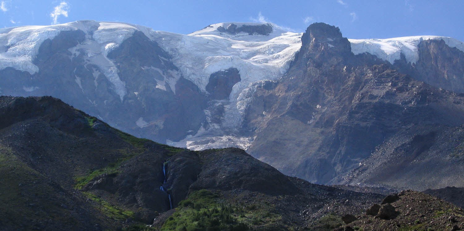
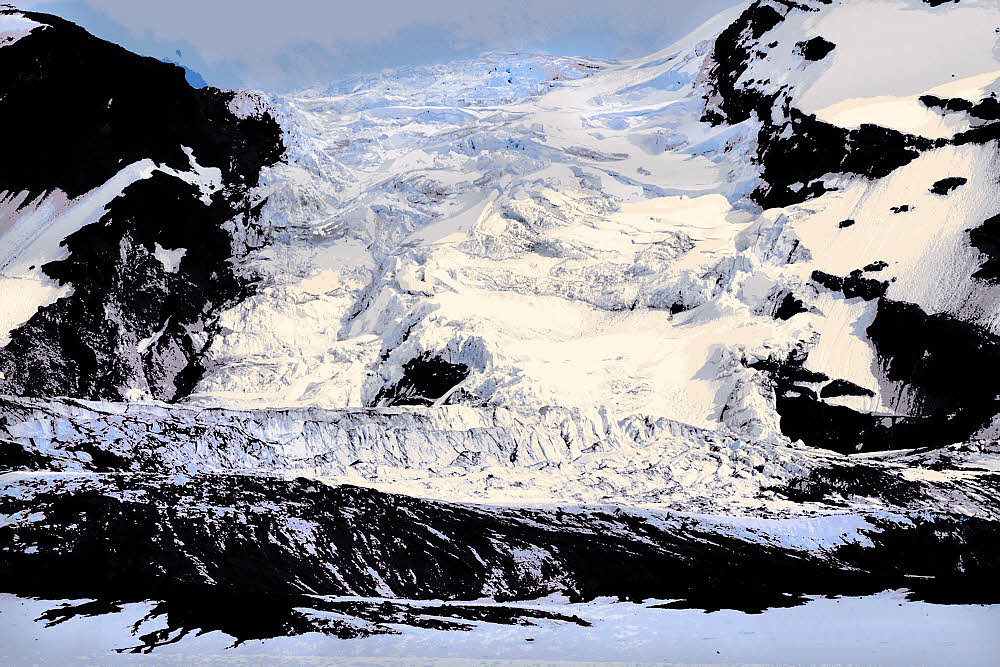
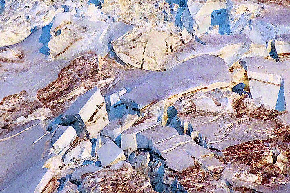
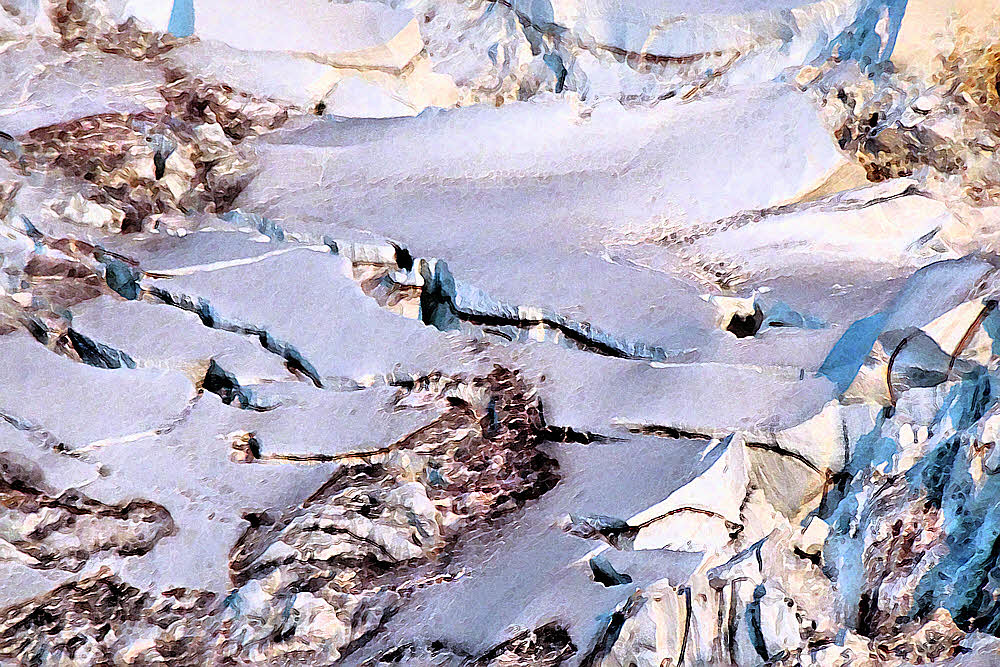
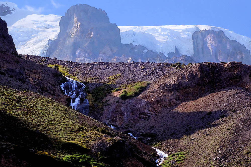
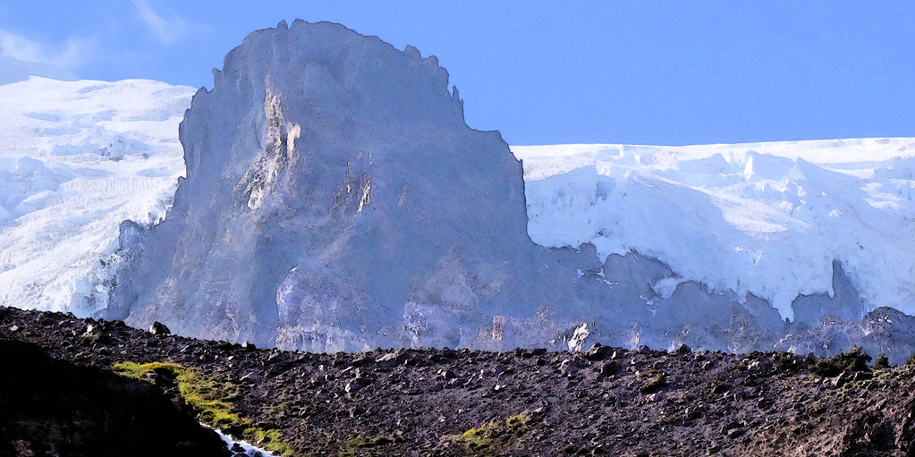
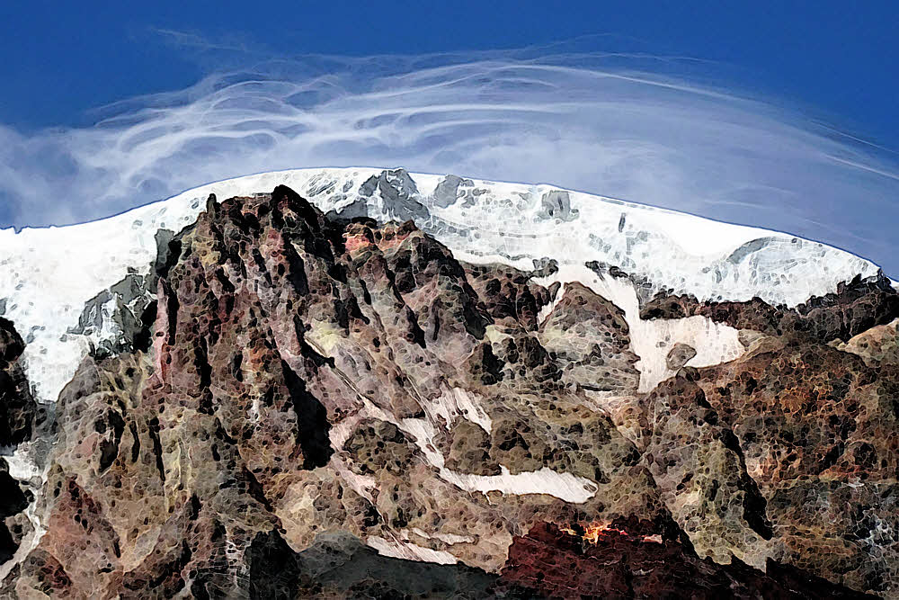
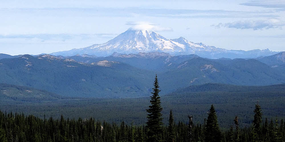
To see if I can touch you, ice. Glacier ice.
Glacier ice of Adams Glacier.
Well named.
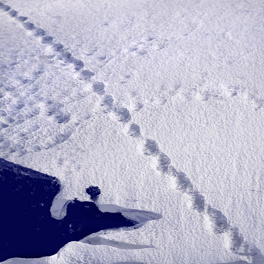
And to see these tracks.
Made by a stone departing on a summer adventure.
A stone. Am I right?

But when I get there, to the glacier,
The space is taken.
Just as I arrive at the lower skirts of ice,
A strange old man appears,
And then, after I leave, and turn to wave goodbye,
And wish him well,
He is no longer there.
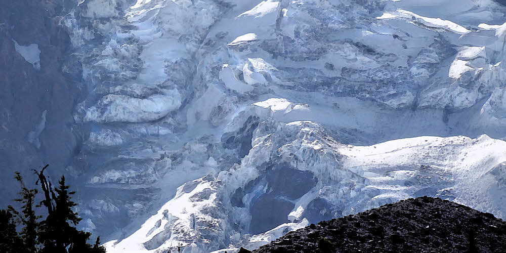
See?
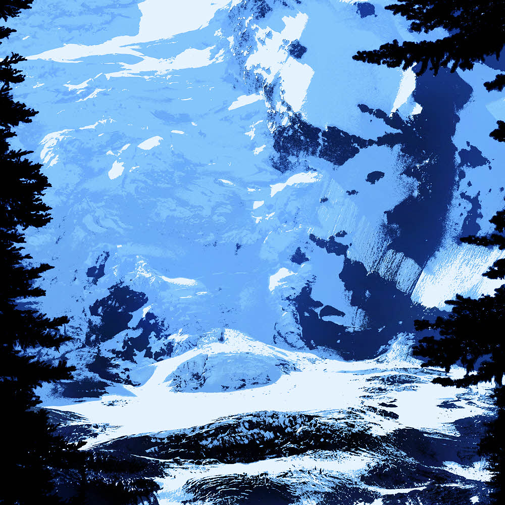
See that dark cliff along the bottom?
There. That's the ice. Where it meets snow.
That is where I went, where he was, where we were.
For a few moments. Together.
I have the photograph to prove it. You saw it.
Right against the ice we were, standing.
Standing in the wind, in the sun, in the after noon.
I touched the ice there, where the old man stood.
But now, descending, it's just me again.
Not even a strange old stranger to wave to.
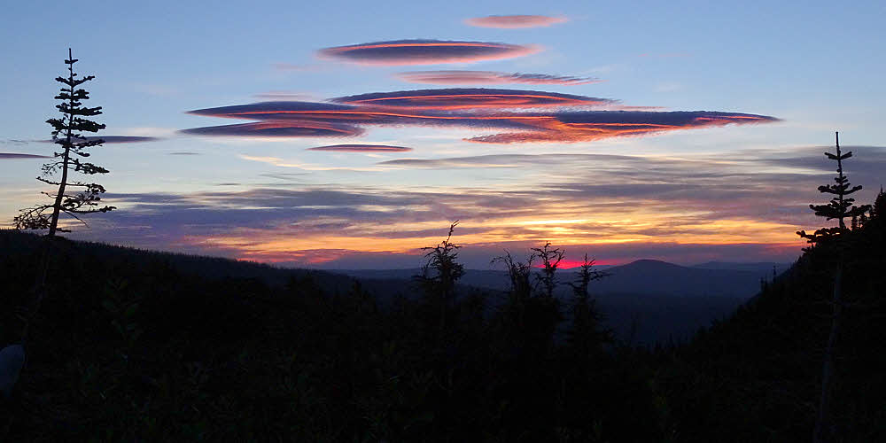
Well, regardless, the day is not done.
Its life continues.
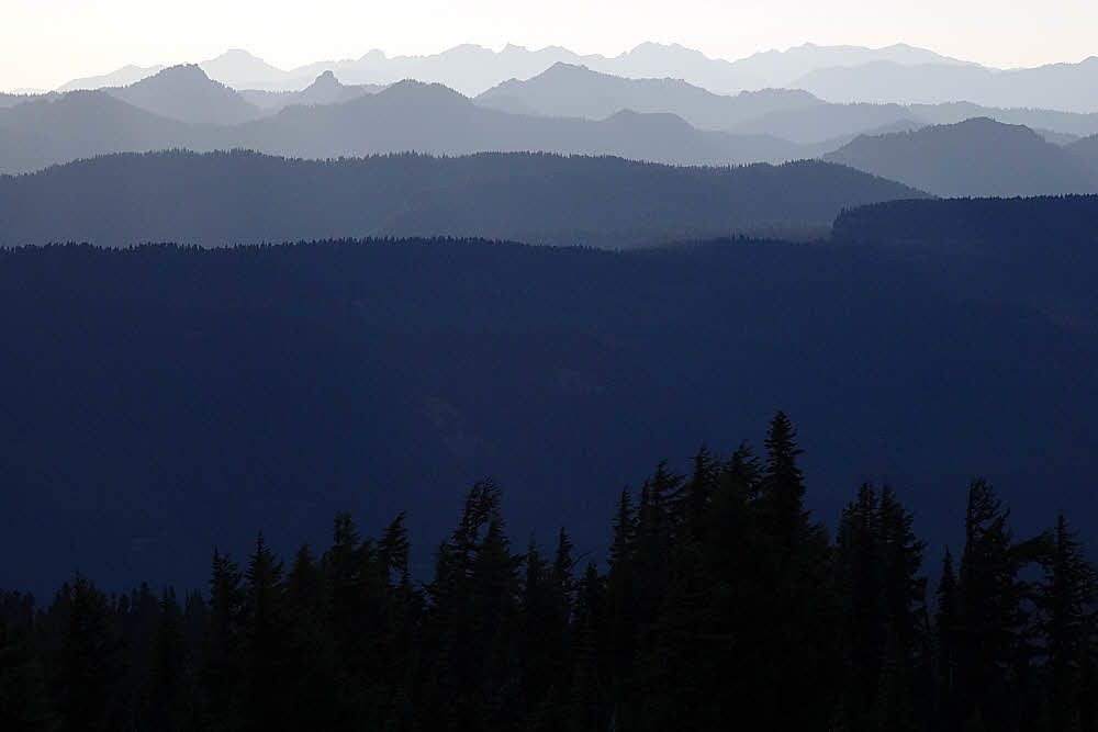
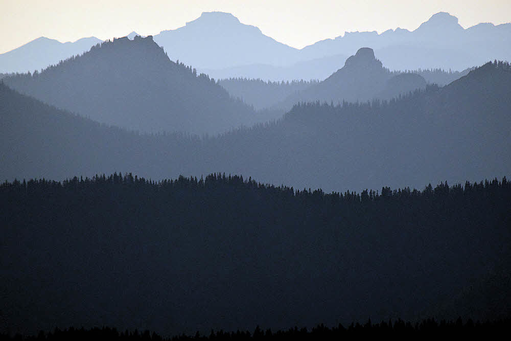
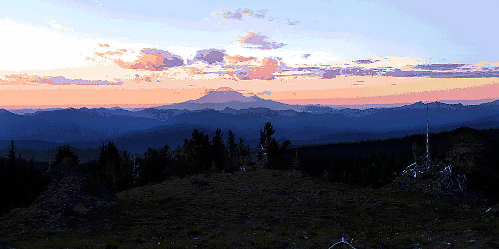
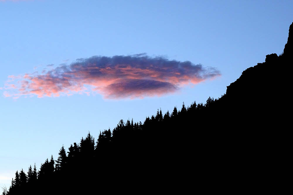
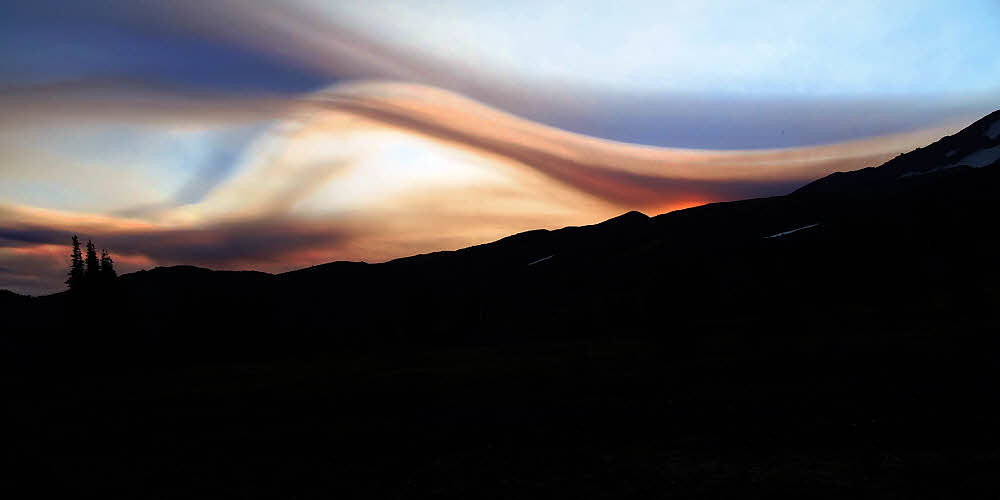
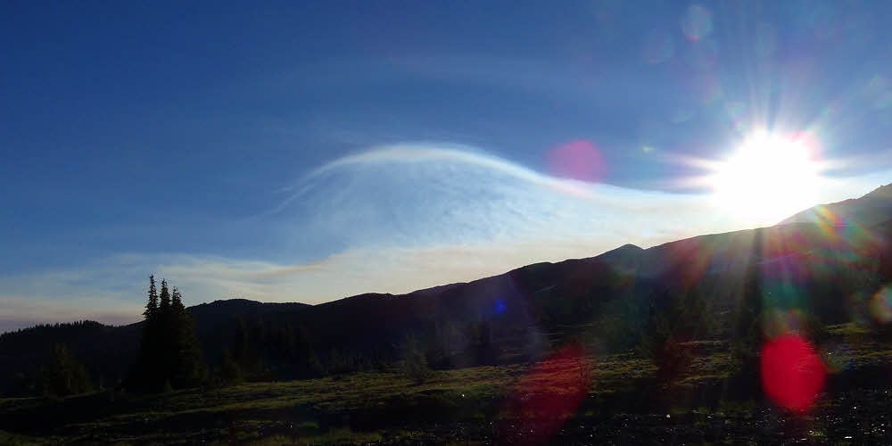
Clouds arrive to play with the sun,
Which reaches around them,
Touching far mountains.
Which glow happily. And sing.
In wave after wave.
Hello, hiker. We are here too. Hello.
I believe.
What can I say?
What is there to say?
I don't say.
Perhaps I hum along quietly.
Perhaps not.
No matter.
The mountains seem content.
Am I? To be here?
Yes. I guess I am.
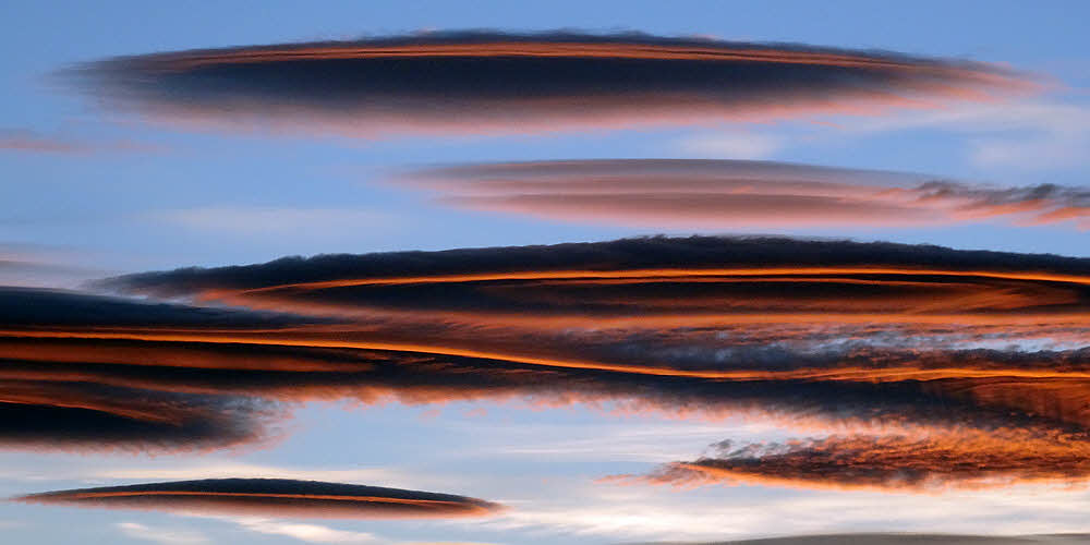
And still later, the sun again.
Lower.
Dimmer.
Redder.
Dancing on the glacier.
This happens a lot, does it?
Doesn't it?
Today it does.
I never get done with it, the looking.
Only darkness, when it comes, stops my admiring.
Luckily I know this place.
Found it my first time here, years ago.
Quiet.
Out of sight.
Private, but open.
With a good view.
Water.
And room to sleep.
Ah.
There you are, Old Rainy.
I thought you'd be here for sunset.
Way off, but impossible to miss, aren't you?
Always. As always.
I'll be back one of these days, to walk with you again.
But not quite yet, not today.
When the time comes.
When it comes.
Walking, walking. Around the mountain.
"Round-the-Mountain", "Trail 2000", "PCT".
All the same.
A collection of names for one trail.
But no matter.
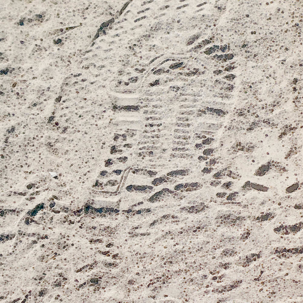
No matter what, the dust.
I leave my tracks too. With others.
A trace. My passing signature.
I endorse.
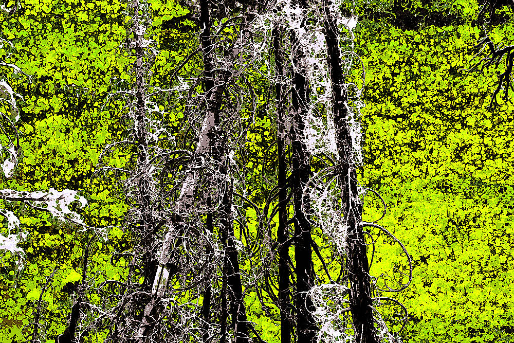
Different this year.
There was fire. A year ago.
Or two, or what? A while. A while ago.
A while ago there was fire.
No fire now, but fire sign.
Every where. See it?
But life is here. Always.
Life cannot be defeated. Fresh every spring.
All around. Near us. Surrounding us.
Fresh. Clean. Green. Moving gently when a breeze.
Scattering its shadow everywhere, without a care.
Step.
It reached from the south, north, way up.
Traveling.
Fire.
Is its own wonder.
Has effects.
Easy to see, years on.
But today is quiet.
All over. Quiet. Warm.
Another landmark. A marker. A hint.
Good to find.
Things are confusing this year.
Because of fire, and so
All a bit off.
With yesteryear's memory
Not quite matching today's mountain.
So good, then.
Good to find a marker.
Get a clue.
What clue is it? I wonder.
Past that then.
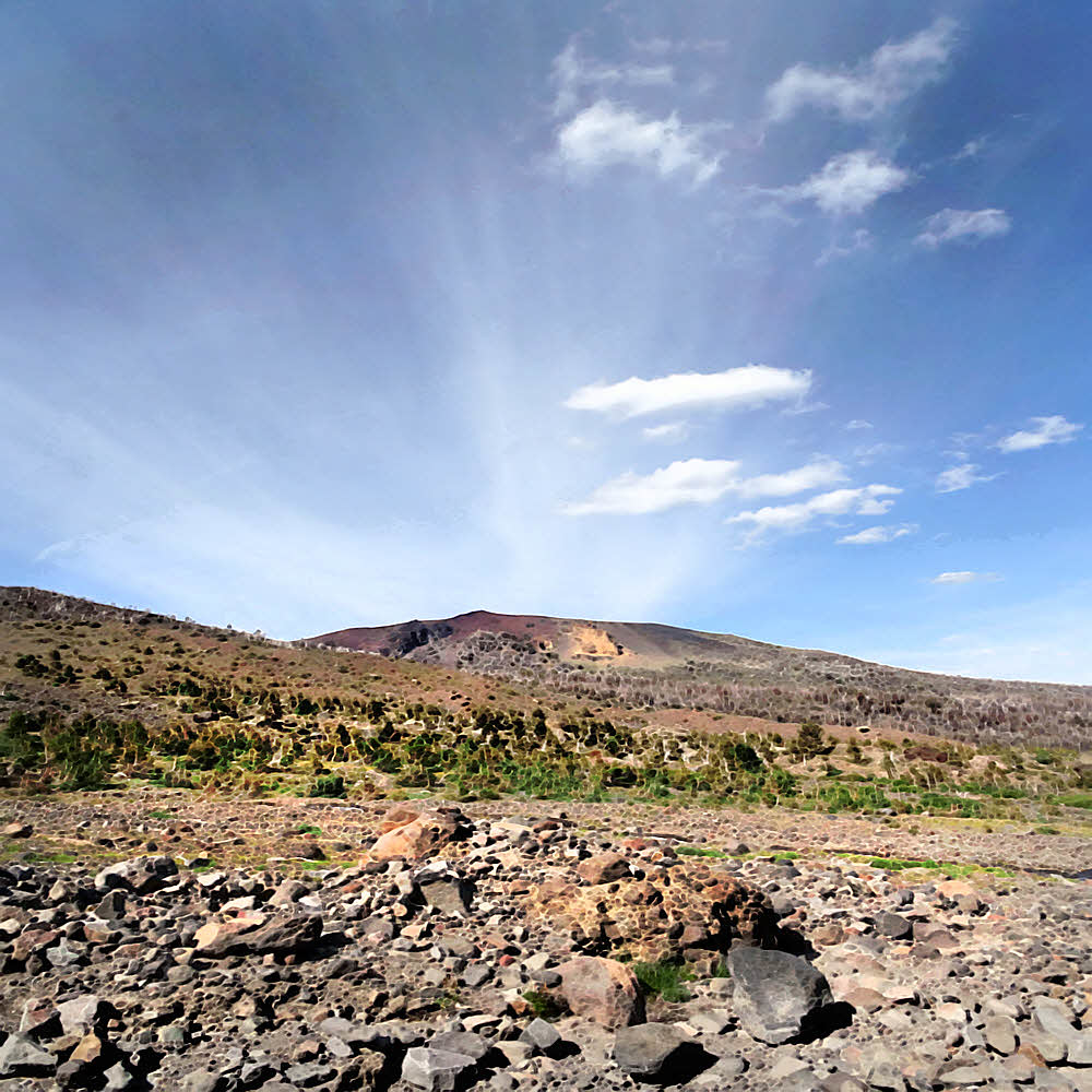
Into the open.
Beyond old fire.
Beyond forest.
Enough sky here for a world.
Good Adams, fine Adams.
You are my friend, I think.
Are you?
— Hellroaring Valley. —
And beyond.
Look up. See.
See that?
Ridge of Wonders behind.
And around left. It flanks.
Curves around, surrounds.
Embraces.
And from the front, once again confronts.
One day, I think, I will go there.
— Big Muddy Valley. —
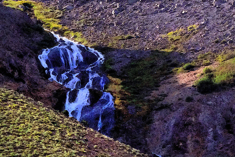
Splash.
Burble.
Bubble.
Spray.
It has no name.
Neither do I.
Being only a thing.
Here today.
See?
Yes. Up there. One day. Not now.
One day.
But tomorrow,
Tomorrow I meet them.
Two people.
Up there now.
Out of sight.
Taking another route.
I will meet them, crossing Big Muddy creek.
Will show them a place to cross in safety.
Which I found by accident.
Perfect sharing. My reason to be here?
Could be. My purpose.
And next morning, before all that,
This.
Coming alive with the sun.
For me. For us. For today. For now.
For ever and today.
Nothing to say.
Look.
You learn a lot that way.
By keeping still.
By waiting.
By looking.
By letting the world happen.
Not all extremes are bad.
But being extremes,
They have short lives.
Short lives lost quickly.
Which is why it is good to recall
These words:
Lightning flashes,
Sparks shower.
In one blink of your eyes
You have missed seeing.
So thank you again, crazy
Old Mumon, long dead. 1260.
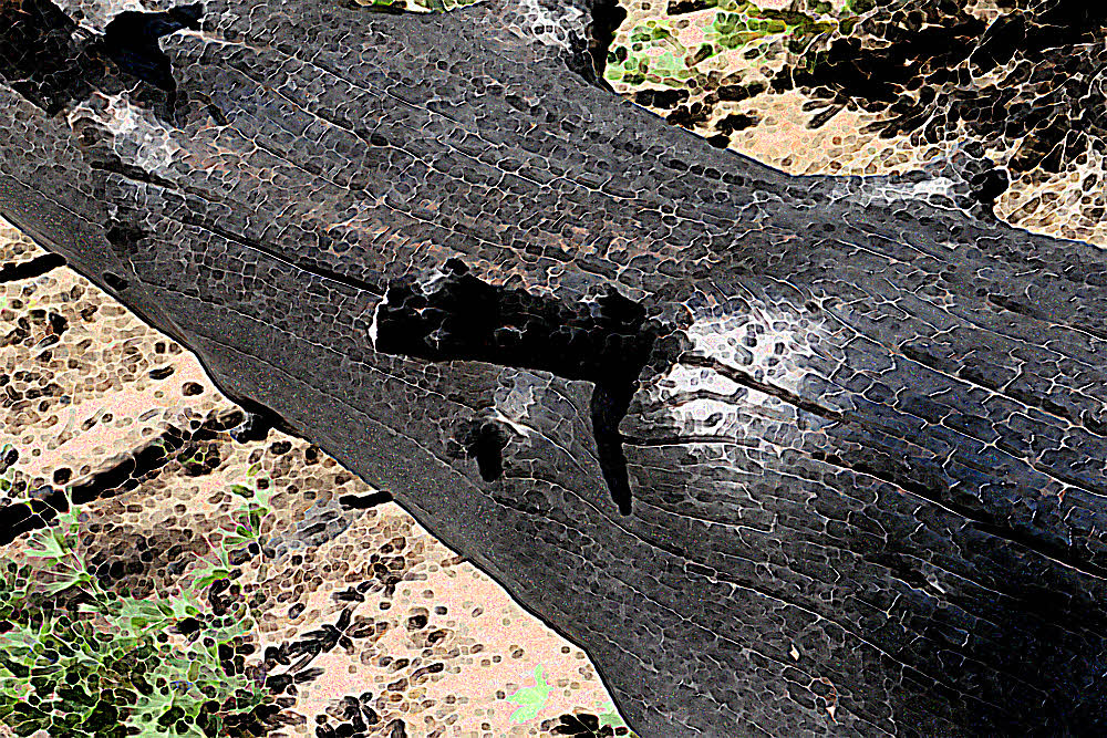
Crunch.
Step.
Crunch.
Third trip around,
This mountain.
Third time lost trail.
Third experience
Finding secrets.
Step.
Not all who wander are lost.
Only me.
Alone again.
On unique traverse,
So I think.
Take your time.
Use your head.
Check map.
Observe sun.
Find landmark.
Don't forget to look.
Panic only if it helps.
And don't forget to look.
There it is. Again.
Landmark.
Sky-scratcher, rain-catcher.
Wide of my trail but with me.
Trail? Close, near. Only look.
Friend Rainier will stand.
Good to navigate by.
Trail? From here, left.
Go left I think.
West.
Round the mountain's north.
Past Little Muddy creek.
Past Foggy Flats.
Past the PCT hikers up early, jogging,
Chasing Canada.
Past all of it, all of them.
Back.
To my secret campsite.
Under the glacier which sits
Singing its single silent deep note.
Which is an alarm,
A warning,
An alert.
A promise.
"Be up for it. Look east. Early."
I am. I do. It is.
There.
East. Early. Up. There.
Transient, another extreme.
Another secret unshareable, because.
No one else is there.
To share. Those moments.
Then.
All gone. Quickly. Quickly over.
Too quickly.
Brushed aside by Sun,
Which owns the sky.
Leaving another hiker to fumble off.
Toward home.
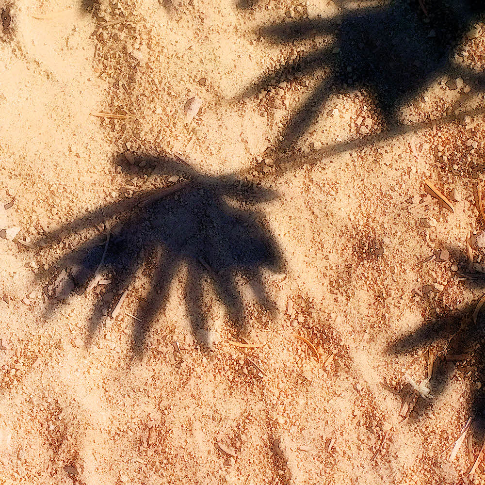
Dragging shadow.
Leaving a last batch of tracks.
Among dapples.
Previous Adams:
Adams West, April 11, 2012.
Adams South, April 26, 2012.
Adams East, May 24, 2012.
Adams North, August 29, 2012.
A worm rides my hat.
I have met you but forgotten.
Or never met you.
Or will some day.
Or won't.
Life is like that.
Going ahead without us.
Take another breath.
Just look.
It is enough.
You have lived.
One more day.