Wednesday, August 27, 2014

Even More Stomping Along The High Divide

Part 3 of 2: The Lost Doofus Panoramas.

Approach to Lunch Lake basin.

Yeah. M. Doofus strikes again. I had several unprocessed panoramas left over, and didn't remember them for about a week, so here they are. They should have been included in the previous posts.

The first (above) shows the rocky depression leading to Lunch Lake. See the previous posts for where that was. Anyway, you go to the right around this jumble of stuff, hang a left, and come back on the other side of it, then squeeze through a teeny-tiny pass and have a view of a couple of lakes. One of them is Lunch Lake.

That's about all I know.

Olympus from the High Divide.

Farther along, past the turnoff to Hoh Lake, past Bogachiel Peak, you get better and better views of Mt. Olympus. This one shows just a peek at the Hoh River way down there.

This is one of the few mountains likely to keep its glaciers for a reasonably long time yet — the amount of precipitation here is stupendous, and not all of it is going to melt away until the planet gets to be uninhabitable, which will be a while yet.

Seven Lakes Basin from High Divide.

This looks better in the photo than it seemed face-to-face. The surrounding landscape was crawling with people and the Basin itself seemed all too ordinary and plain.

I hope they all liked it. I guess they wouldn't keep cramming themselves in here if they didn't like it.

For me it was a good day hike. A really good, long, tiring day hike, and that was just right. I don't want to camp on top of anyone else so I'm not going back with a tent.

The far side of Seven Lakes Basin.

This looks more interesting. I'm betting that a person could kind of slither down to that lake and fade into the geography. Most people are likely to stay near the spur trail (which is off to the left from this view), and park out in the open near one of the smaller lakes in the flats.

But me, I'd try for one of the edges. You never know what you'll find off to the edge. Besides privacy.

I like privacy, so if I went there, at all, ever, for some reason, I'd check out the edges.

Mt. Olympus.

Just before leaving the High Divide and beginning the long descent, you get a few more views of Mt. Olympus and its glaciers.

Blue Glacier is on the left, and White Glacier is on top. Coupla gnarly ones, they are. No nonsense.

Nice grassy hillside too.

Heart Lake basin.

And one of the first things you get to on the trip back down, going counter-clockwise, is Heart Lake.

The two trails at upper left show the route coming down from High Divide.

The place is pretty well trampled, and everything is out in the open — little cover or privacy, though the views to the east are nice. (See previous posts.)

Judging from the way all the vegetation is beat down, the sign warning against stomping on a revegetation area, and the pit toilet, this area must get a huge amount of use.

About the only thing missing is a giant pickup truck parked six inches from the edge of the lake, gun rack in the back window, a huge tent, bonfire, and cooler of beer.

Just like on TV.

The end

Previously...

Stomping Along The High Divide

More Stomping Along The High Divide

Wednesday, August 20, 2014

More Stomping Along The High Divide

Part 2 of 2: Day-hiking the Sol Duc loop.
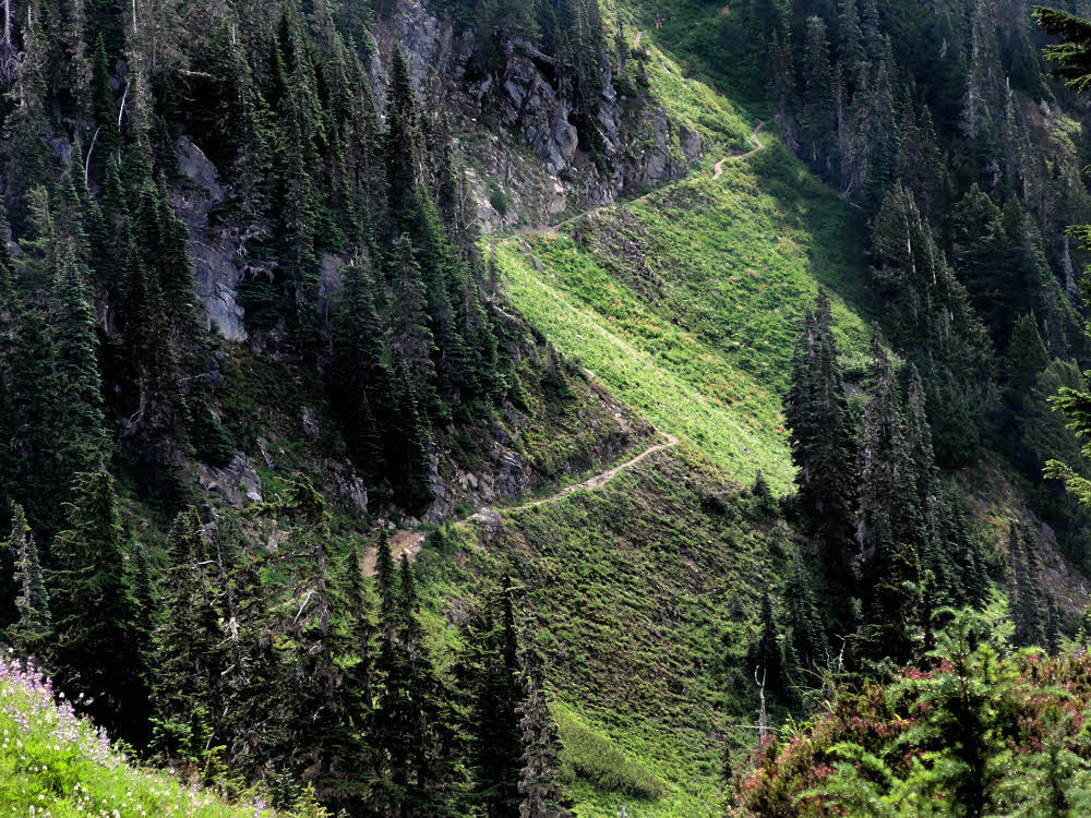
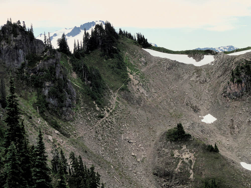
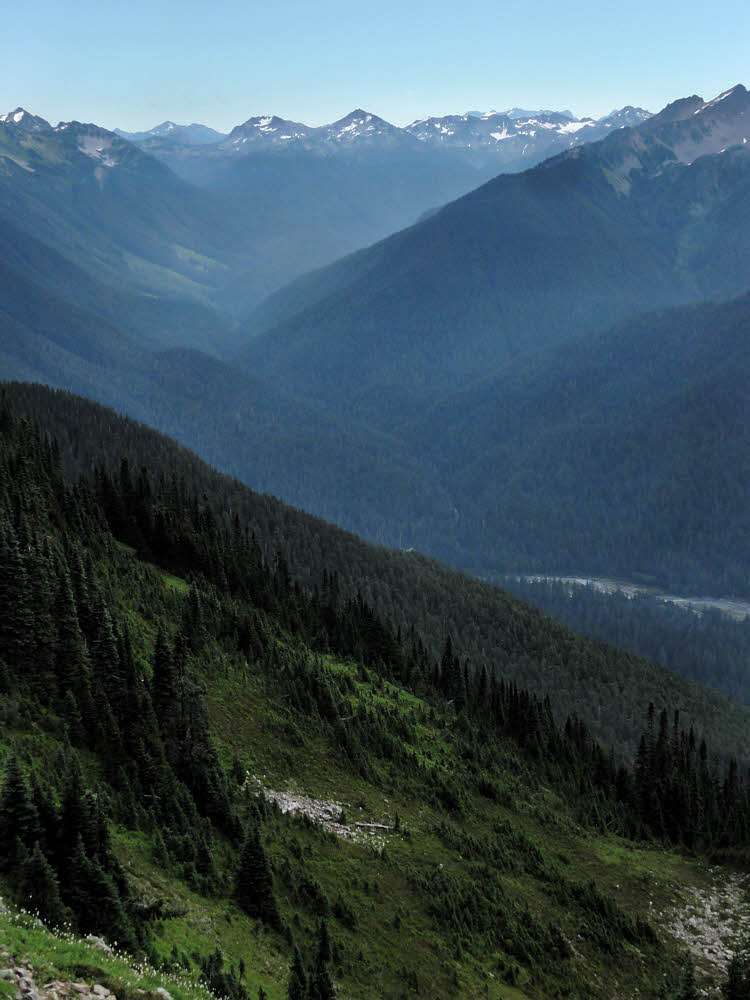
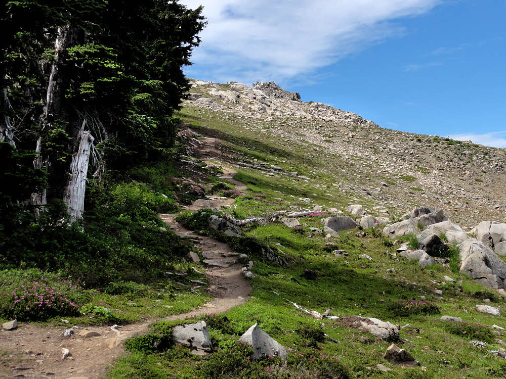
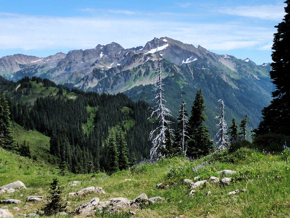
Seven Lakes Basin

Lunch can be a wonderful thing. Mostly, for me, food is fuel, but if it tastes good, so much the better, and on the trail, refueling time is resting time, made especially better if accompanied by a mug of tea.

So I had a leftover meal already packaged up from the previous week's backpacking trip, water, a teabag, and a cookset. And I was nearly halfway around the 19-mile (31 km) loop. And the clock said noonish. Good enough for me.

I sat, and cooked. I sat and ate, and after sitting and eating, I sat and chugged tea. More than good enough.

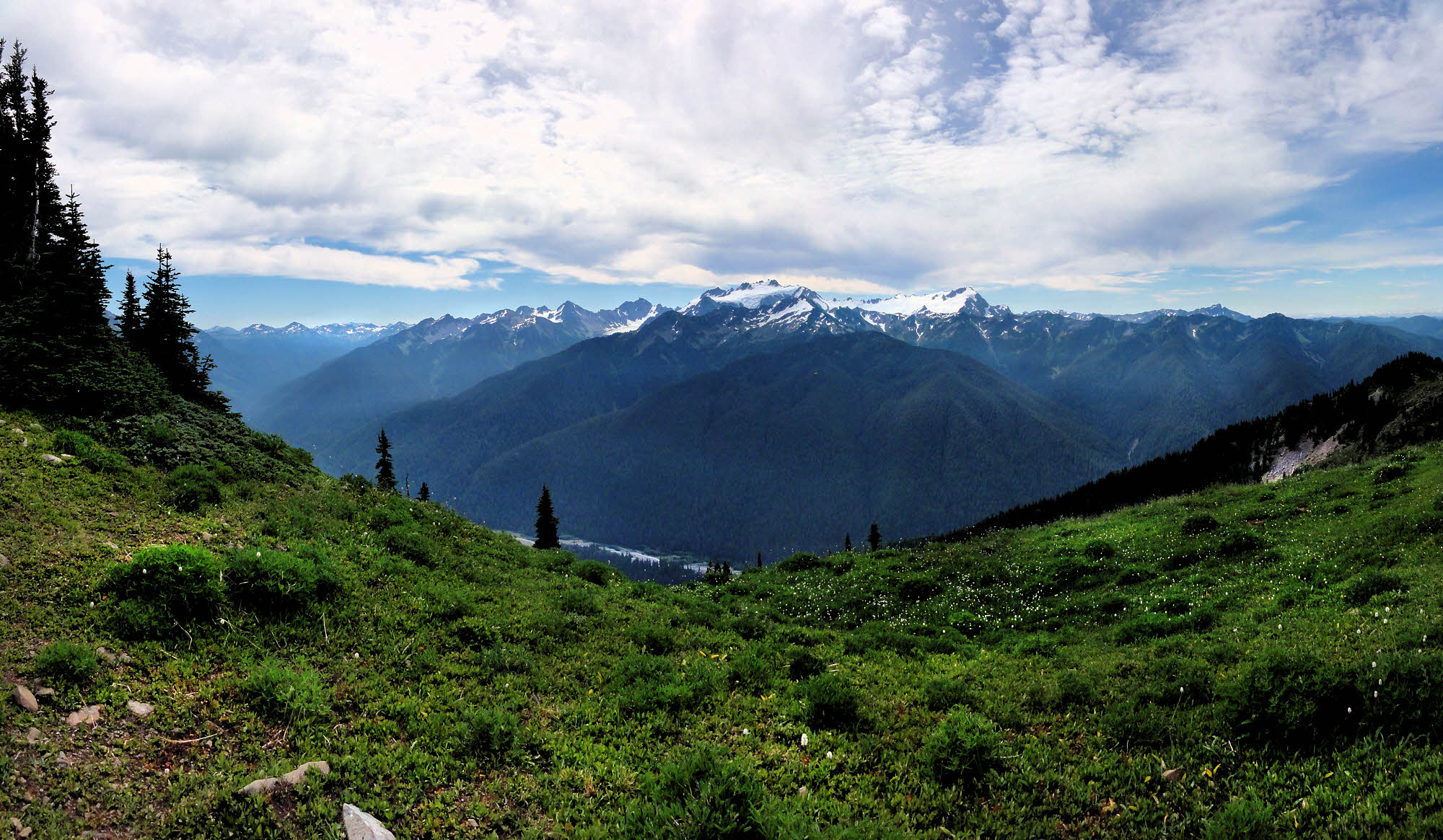
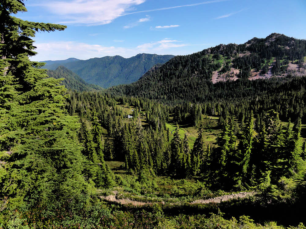
By then the day's haze had vanished and long shots into the Hoh River Valley and across it to Mt. Olympus were coming out less like fuzzy-blue blobs, and more like photographs.

It was time for more walking.

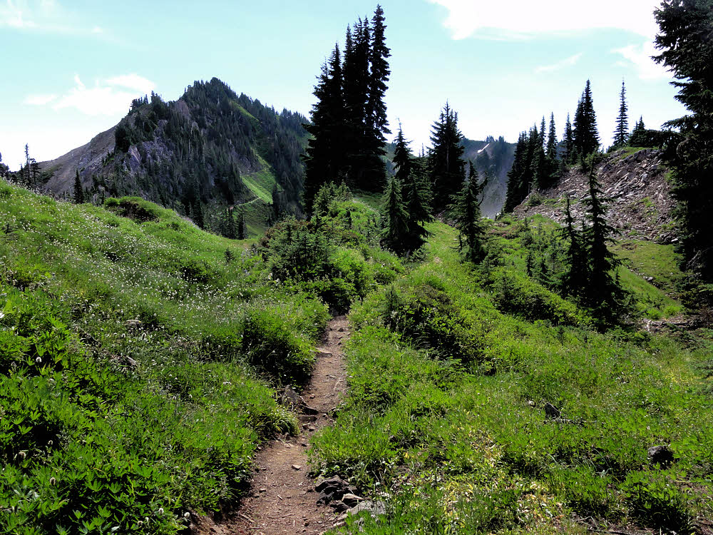
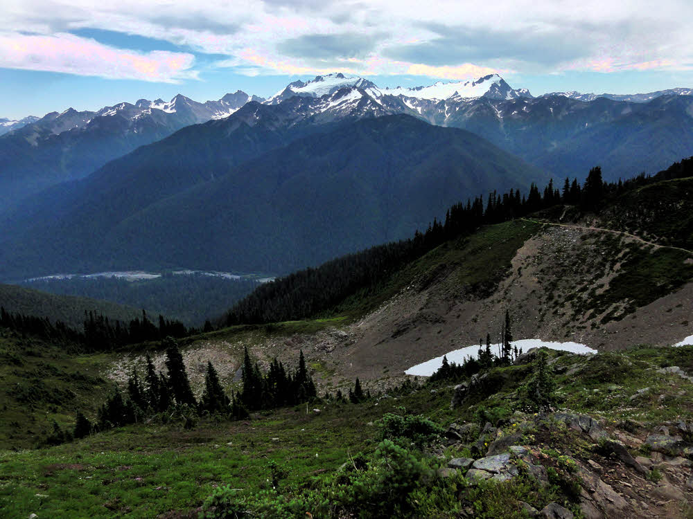
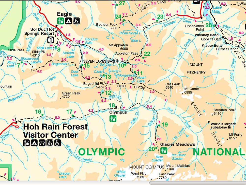
Along the High Divide.

I had estimated that in the worst case I would get back to the car by 7:30 p.m., which was on the late side of things, making this a 12-hour hike. Ordinarily, 19 miles in 12 hours is not good time, especially while traveling unloaded. It's different with a full backpack, even a light one, but the Olympics are also different.

In the Olympic Mountains, at least to my way of thinking, which matches my experience there, the going is tough. There are two kinds of tough going. Going up and going down. In other words, much changing of elevation.

Hiking in the river's direction along the Elwha, from Low Divide toward Whiskey Bend is not like that, nor is it typical of foot travel in Olympic National Park. Given the right conditioning, the right weather, the right load, and an early morning start, a person can cover almost the entire Elwha, a distance of about 25 miles (40 km).

But it's all downhill, and level. Nice. Foresty. Mossy. Quiet. But not typical of hiking in the Park.

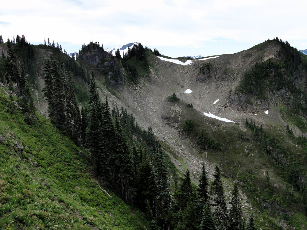
What is typical is shorter river valleys terminated at one end or the other by mountain passes. Steep ones. Steep ones with snow patches that linger into August, or even later.

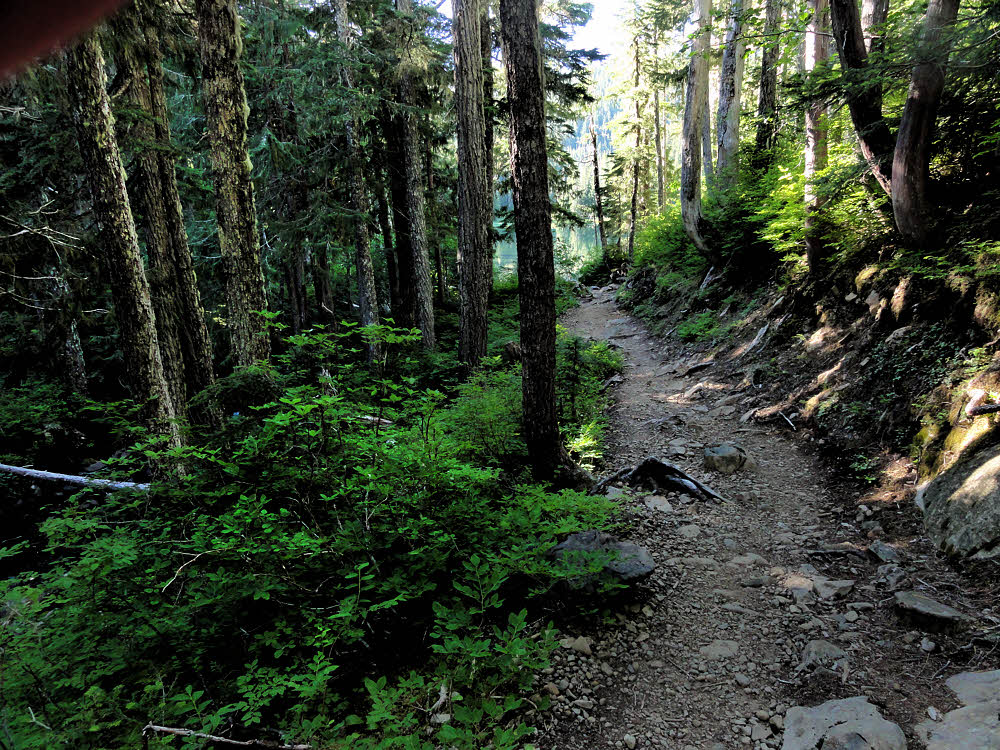
Such as the Sol Duc/High Divide/Seven Lakes Basin loop, so I had to keep moving. Going uphill is slow work, as is going downhill, given trails knotted with tree roots and cluttered with rocky outcroppings.

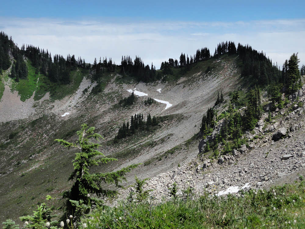
The shoulder of Bogachiel Peak.

But with calm air, sunshine, and a belly full of eats, I felt good. It was a good day.

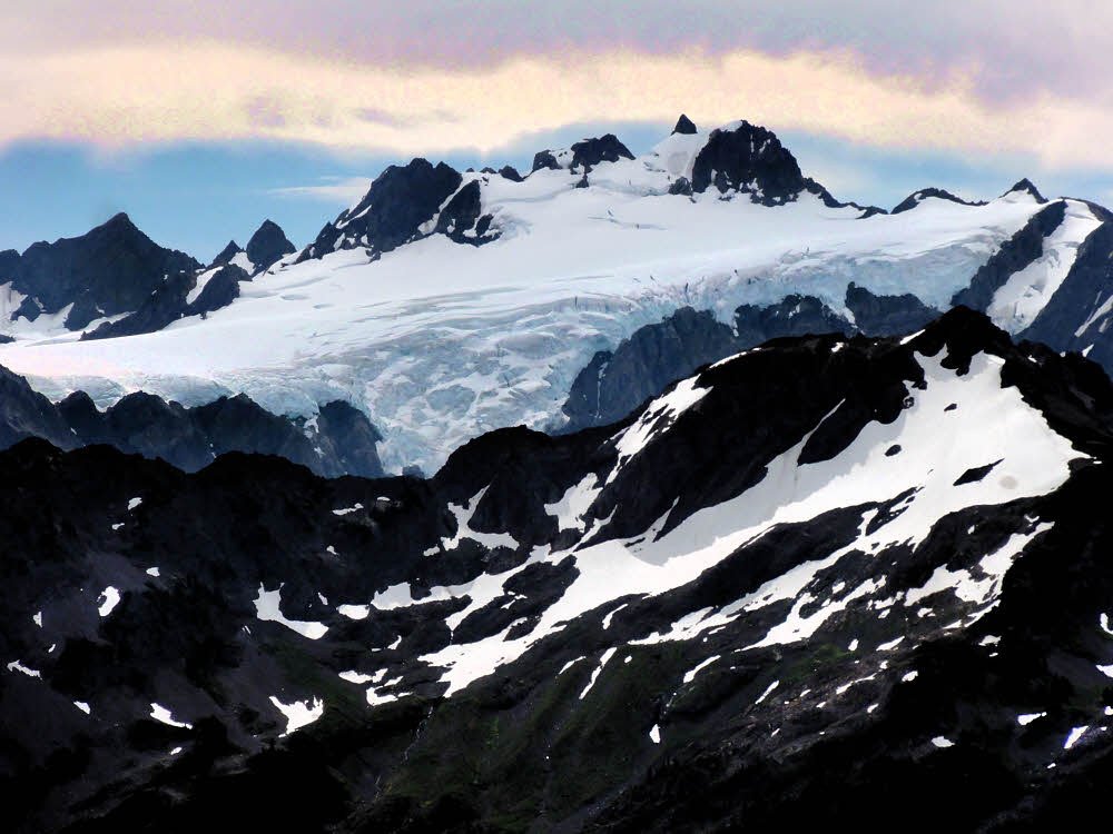
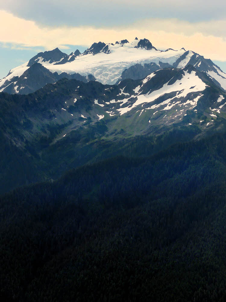
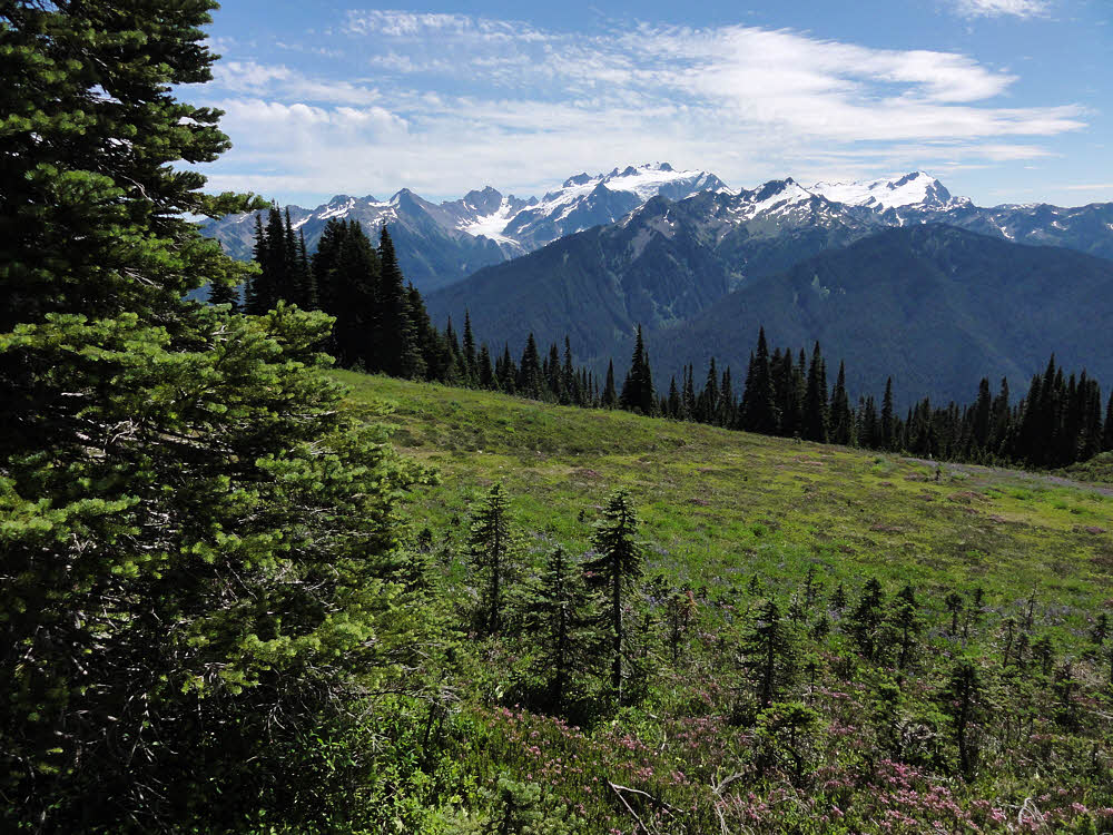
Mt. Olympus was obliging, hanging there in the open, showing off its glaciers. And there were glimpses of the Hoh Valley, which might be nice to hike again. I've seen it only in the wet of winter, not in the warmth of summer, but then again it's an in-and-out hike and I like loops, and once you're in a valley, you don't see much — cobbles, sand, flowing water, and moss.

At least up high, where the hiking is more deliberate and at times more desperate, you see farther. I did see all the way to Mt. Baker, over by Bellingham, and pointed my camera at it, but the haze outdid both me and the camera — there is no there there, only a vague whitened horizon, even though Baker was plainly visible.

Likewise, there were fog banks lying heavily within the Strait of Juan de Fuca, which separates the Olympic Peninsula from Canada's Vancouver Island, and what appeared to be more of it out west, toward the unbounded Pacific Ocean. Impressive to the eye but photographically elusive. I passed on them — there was no use trying — all you get from attempting to photograph things like that is a washed-out band of too-bright something cutting horizontally across the image.

So I pretended that I would be content with continually snapping Mt. Olympus, its White Glacier and its Blue Glacier. Those photos worked. Well enough.

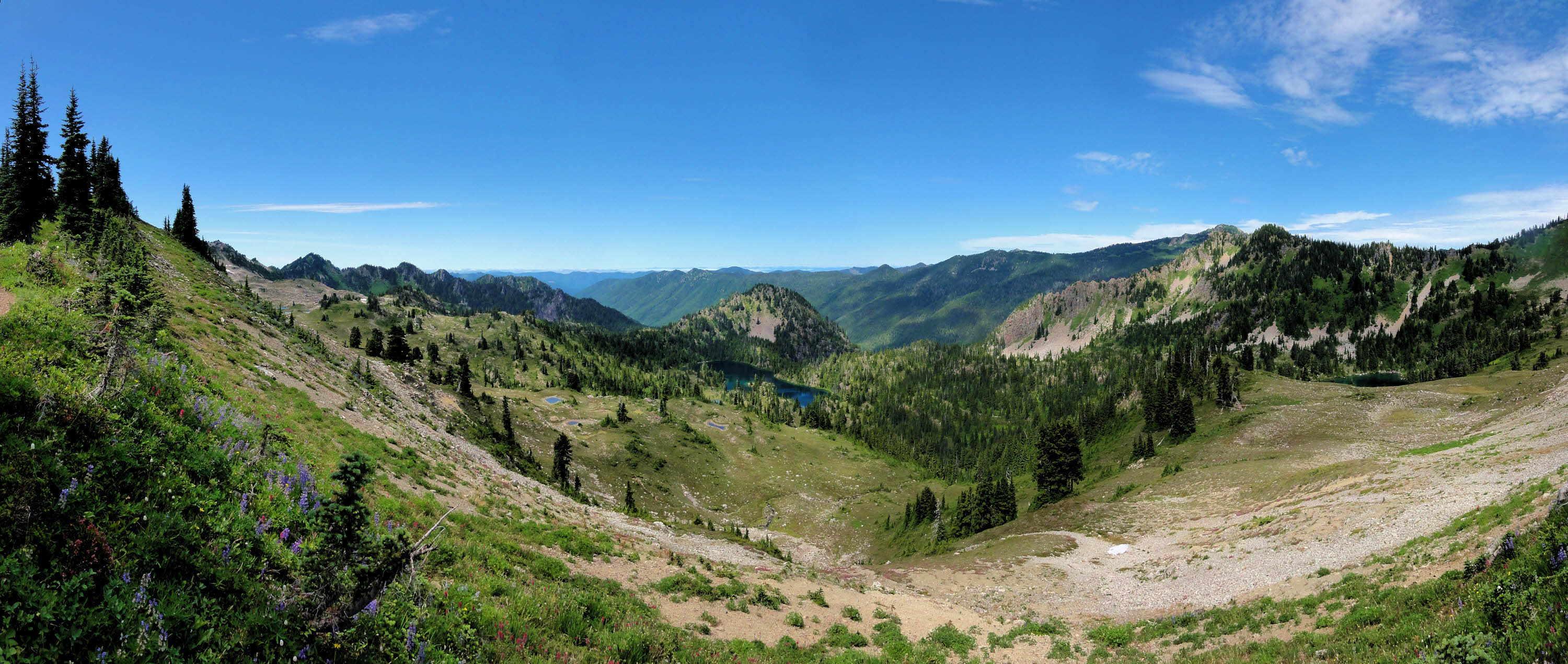
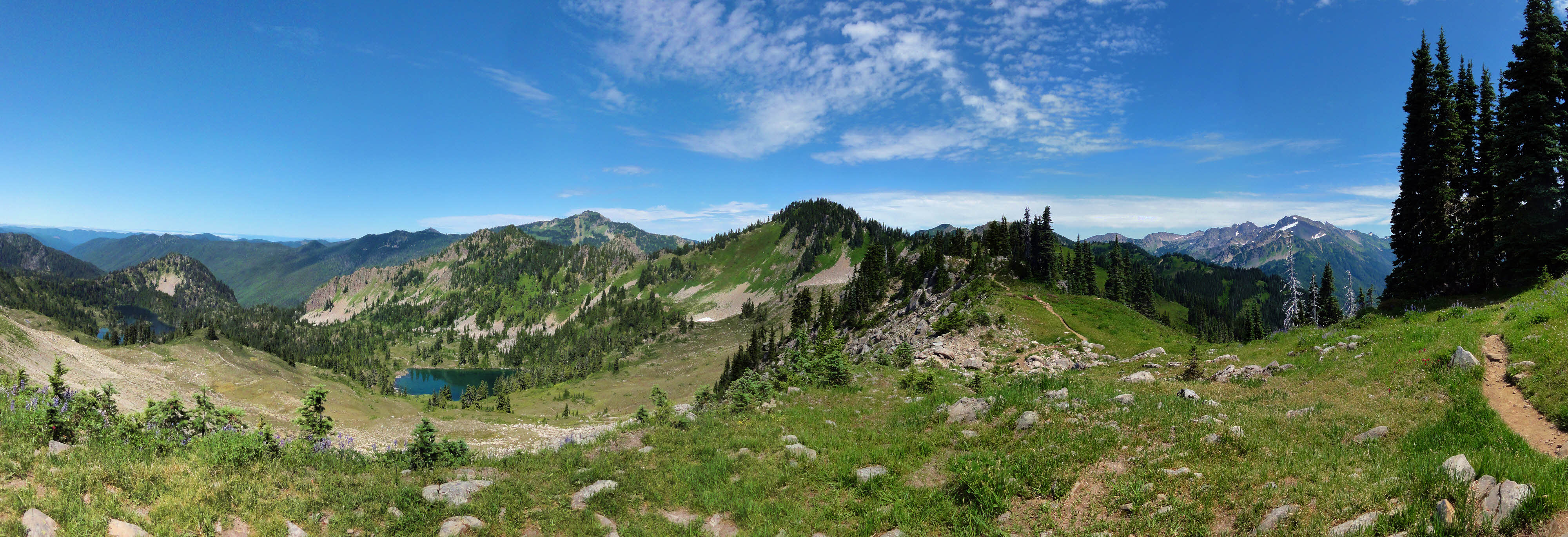
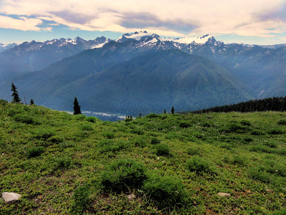
Seven Lakes Basin, looking northwest.

The trails there are good enough too. Accepting steepness, and tree roots and rocks, which are what you get in a live landscape.

Generally speaking, I can get lost anywhere, anytime, without thinking, but aside from temporarily heading up toward the top of Bogachiel Peak before I realized where the right trail was, I didn't have any trouble. Even I, which says a lot.

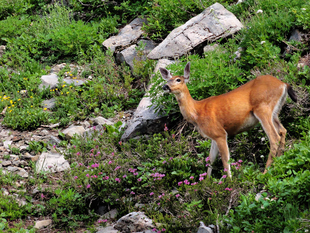
As mentioned earlier though, there were lots of people. Lots.

Lone backpacker at Seven Lakes Basin access trail.

I saw a bunch right before lunch, specifically a young woman and her young male companion. He was sitting, munching a snack, and she was standing, facing him. I gave a perfunctory greeting while passing by and couldn't help, once again, noticing their outfits and gear.

Both had enormous packs. They could have been the two pack animals for a party of six, but they were apparently alone. Wearing big leather boots, all decked out in Official HikerWear™, but not so much as other people I see at times.

Last September in the Goat Rocks I ended up feeling self-conscious. Everyone there was decked in full head-to-toe HikerWear. North Face shirts, Sierra Designs pants, Outdoor Research hats, Danner boots, ExOfficio gloves, Oakley sunglasses.

I didn't see much of their equipment, but I can guess. The same brands as above, plus packs (Arc'teryx, Black Diamond, Boreas, Deuter, Eureka, Exped, Granite Gear, Gregory, JanSport, Kelty, Mammut, Marmot, MHM, Mountain Hardwear, Mountainsmith, Osprey, Patagonia, REI), plus stoves (Bleuet, Coleman, Jetboil, MSR, Snow Peak), plus more of the same for the rest of their stuff.

More of Seven Lakes Basin.

Me, I'm a bum. I prefer to make what I can, and make do with what I can find, and buy what else I need when I have no other choice.

My stove is small enough to stuff inside my mouth and burns alcohol. Its accessories (pot stand, windscreen, ground protector/reflector, and so on are things I made. My cup is a a delightful 650 ml aluminum job made by Imusa out of Colombia. I was lucky enough to find it in Cuenca, Ecuador, and bought two, plus a full liter-sized larger sibling. Each of them cost around $2.

Some of my clothing I've made myself, and I used to have a pack that I designed and made, though I had to chuck it out when I moved to Ecuador. Which didn't work for me in the long run, so now I'm hoping to get settled enough again to sew up some goods, such as a new pack.

Things like that. I look and act like a bum. I'm out of place even in the woods. Maybe I'd fit in with thru-hikers, but doubt that I'll ever be one.

Apparently where Hiker News is usually posted, but there was none.

By and large though, people give you a pass. Not many people you meet on a busy trail want to share notes. They're mostly urbanites out for a day or two. You can tell.

People like that don't tend to be friendly. They're used to passing thousands of others like themselves on city streets, which is exactly the kind of place that you don't make eye contact or share pleasantries.

True people of the trail are different. They may not be yearning to make lifelong friends from the random assortment of those they meet, but they don't judge so much, or ignore so much. They're there, you're there, that's it.

Fellow travelers well met. No thousand-yard stare. No wordless passing. No smell of cologne or strawberry-scented body wash. Whatever that really is.

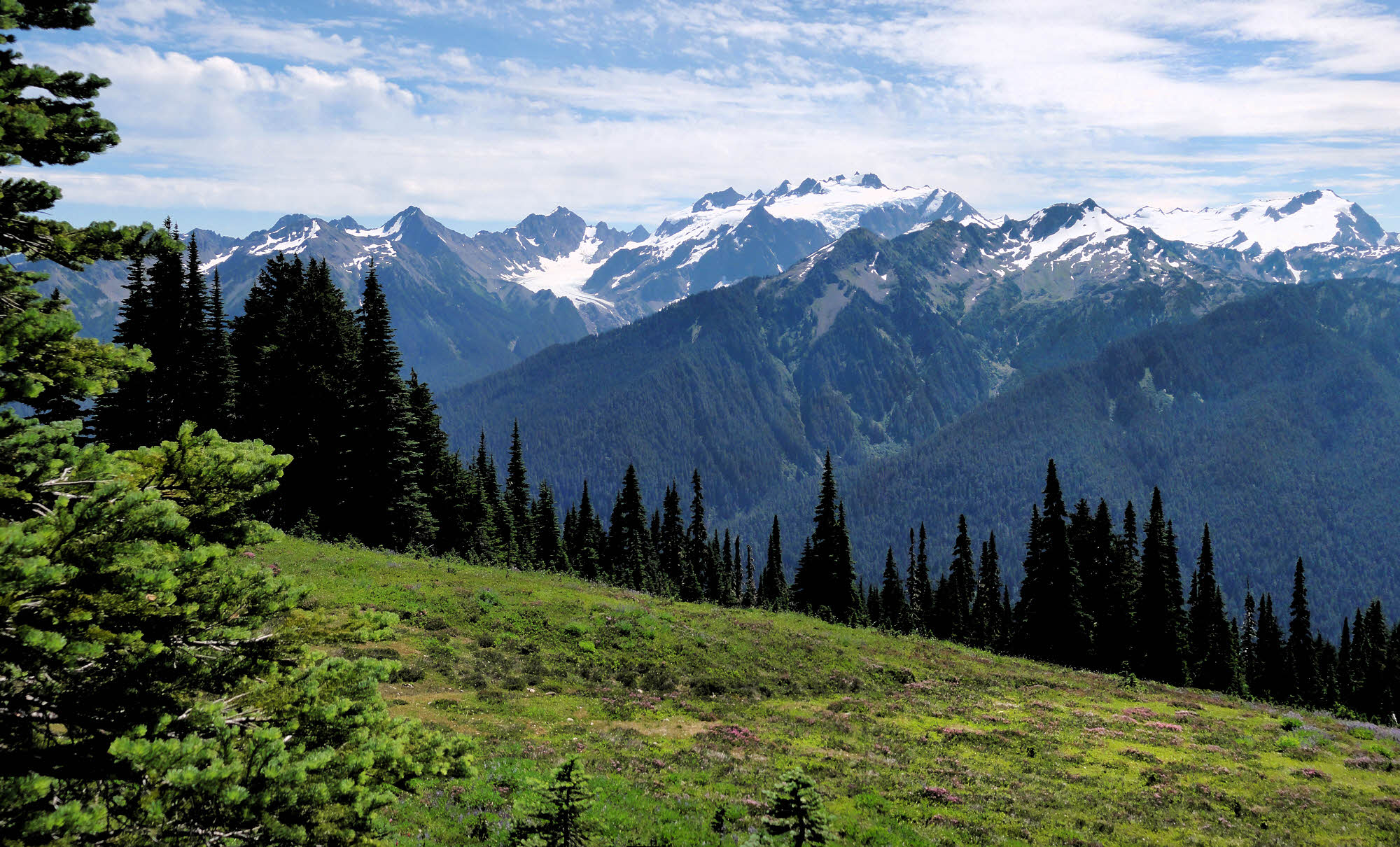
Mt. Olympus again, somewhat more clearly seen.

As I've sort of said earlier, this is a great area to pass through though I'd prefer not to camp there because of the heavy use that the area gets.

Surprisingly, I didn't see any tents, except a couple in the lower areas, on the way in and on the way out.

The foot traffic was almost like a shift change, everyone tromping this way and that, in long lines, although I didn't see any large parties leaving. Maybe because it was a Tuesday.

Maybe the weekenders had gone out Sunday evening, or Monday morning, and now the area was refilling. Can't say.
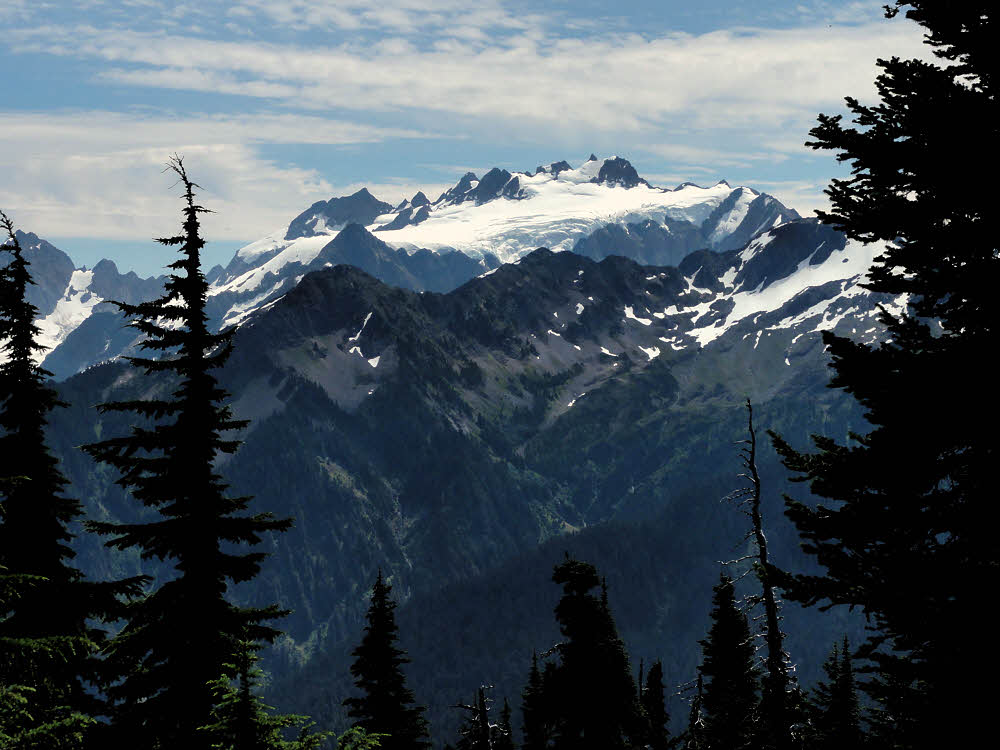
And White Glacier.

I did notice (and last year too) that there is almost no backcountry ranger presence.

Several of the other trails I passed over this year are the ones I saw last year, and last year most trails were choked by blowdowns. Some stretches of trail were nearly impassible because of the constant trunk-hopping needed. While not too difficult in itself for a person carrying a light pack, it is tedious, and dangerous in its own way.

But those choked trails of last year are clear trails this year, so crews have been out.

Not so with rangers.

Olympic National Park's backcountry is dotted with seasonal ranger warrens. They are all abandoned. Some are cabins but most are wooden tent platforms. All vacant.

Last year I did see a couple of volunteers — people wearing a semi-uniform with some kind of patch on the sleeves, but definitely not real rangers. The Park Service must be hurting.

It used to be that you could bet on seeing a ranger or two every other day. Not now. The money doesn't seem to be there any more.

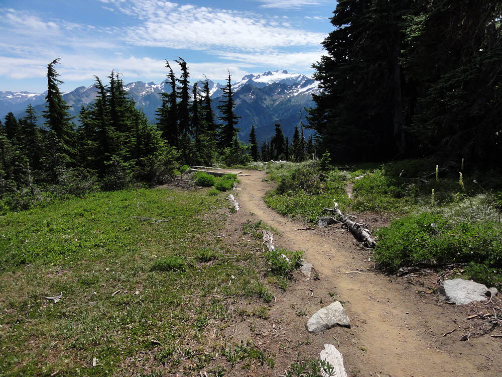
Lunch-spot trail, left, High Divide main trail, right.

So, I guess if I have to choose, I'll go with trail crews keeping the paths clear, and accept the lack of rangers as a sort of blessing.

Backcountry rangers are a nuisance for me more than anything else. I mind my own business, stay out of trouble, clean up after myself, and don't need lectures on how to hike or where to camp.

Most rangers are paper-pushers, even the ones who hike, and are mostly interested in whether every backpacker they meet is properly registered. It's easier to tell who is missing if you know who went in and didn't come out on time.

At times though, you do get into discussions about where you'll camp and when, and what kind of equipment you have, and the bureaucratic mind is a terrible thing to be examined by.

You can't reason with it.
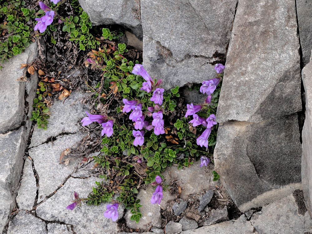
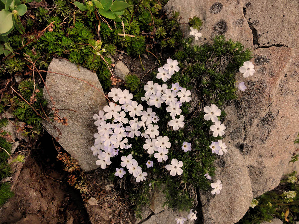
Bear grass.

For example, try explaining that you don't wear boots. That won't fly.

Everyone knows that you have to have boots if you go hiking, let alone backpacking. To a ranger's mind, if you're wearing anything other than heavy leather boots with lug soles, you'll be the inevitable target of a search party and the eventual recipient of a helicopter evacuation, dead or alive. End of discussion.

Or say you're trying to explain why you don't really need to be in or expect to be at a particular campsite. Because you use a backpacking hammock.

No. Can't get the idea across. Rangers, like most backpackers, when they think sleeping, think tent. On the ground. And if it's on the ground, it has to be in a place that's already been trampled to death, otherwise it's destroying a new area that hasn't already been trampled to death, but will be when you get done with it, which is what they don't want, because that means even more work back at the office.

No. That discussion doesn't work either, so you go along with it. Say you'll be at Location X on Day Y, and then melt into the forest and hang yourself. Comfortably. In your hammock. And don't bother talking about it.

Ditto, from above.

So the rangers are not out there any more. For now.

So you only have to get a backcountry permit if you're staying overnight, and deal with the office people, and don't have to worry so much about random trailside inspections and challenges from uniformed officials inspecting the legality of your status.

Now it's more like you and the backcountry — work it out on your own.

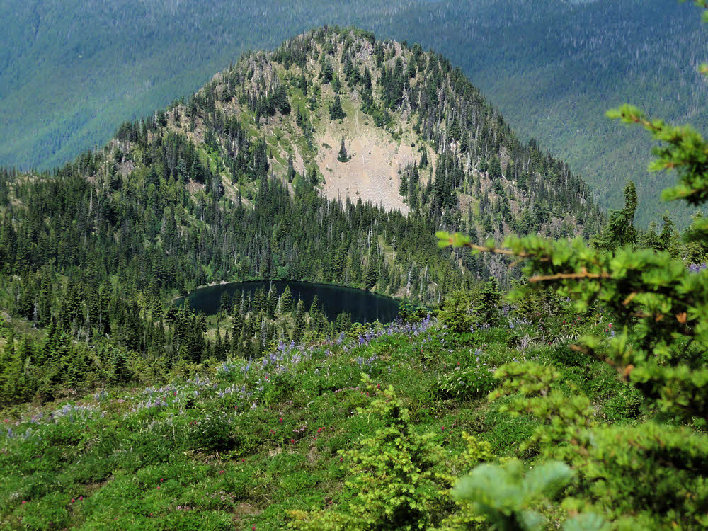
Another small lake, Sol Duc River Valley in background.

Which works for me.

Except for all the people out there.

The last ridge of Seven Lakes Basin.

But as noted, they're mostly city people and don't see you, especially if you look a little off.

Not dressed in new brand-name togs. Not carrying a pack the size of a compact car. Not pounding the ground with your kilogram boots.

Mt. Appleton, I'm thinking, to the north, more or less.

You get to drift along anonymously and as an oddity you're given a wide berth.

Especially so if you're doing a day hike. And this is a decent place for one.

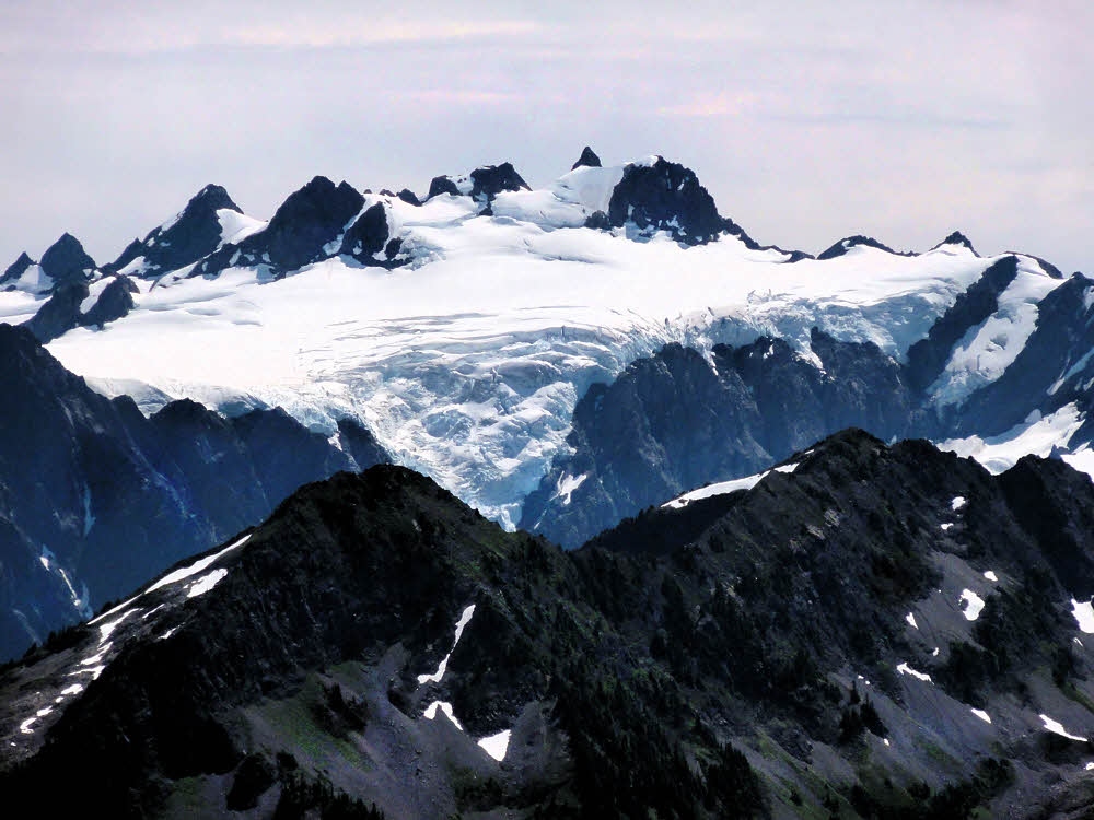
White Glacier again. Getting more impressive by the minute./p>

And, getting back to what might pass as a topic, this is what I had intended to do — hike a loop, grab some photos, see a new place, and retreat.

After lunch it was mostly downhill.

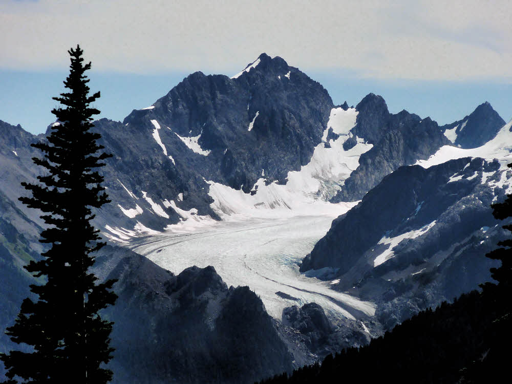
Blue Glacier, on the northeast side of Mt. Olympus.

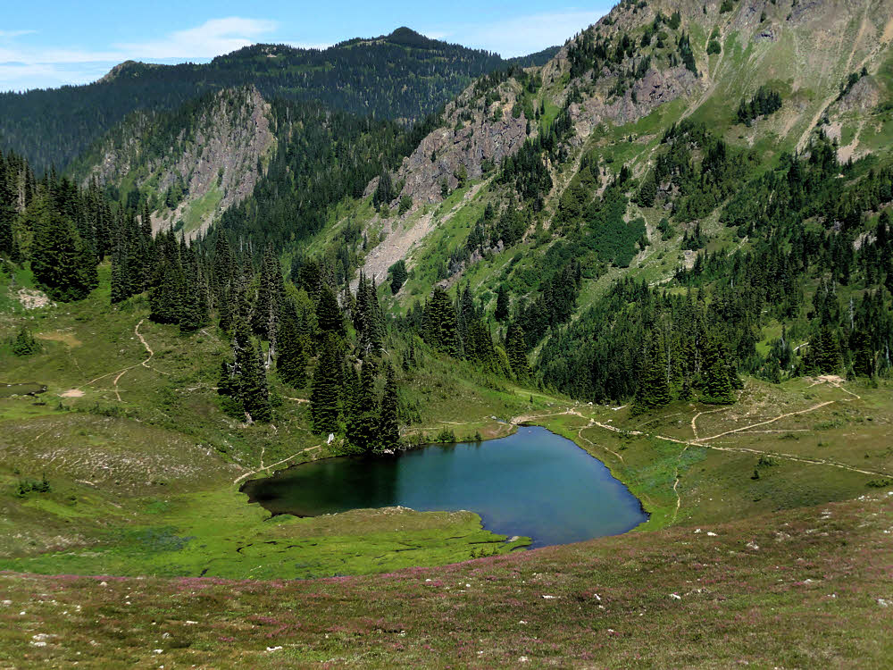
First, I passed the tail end of Seven Lakes Basin, which is sort of a wash.

A nice place to see but not particularly hospitable. Open and mildly rocky, with plenty of small lakes and few trees.

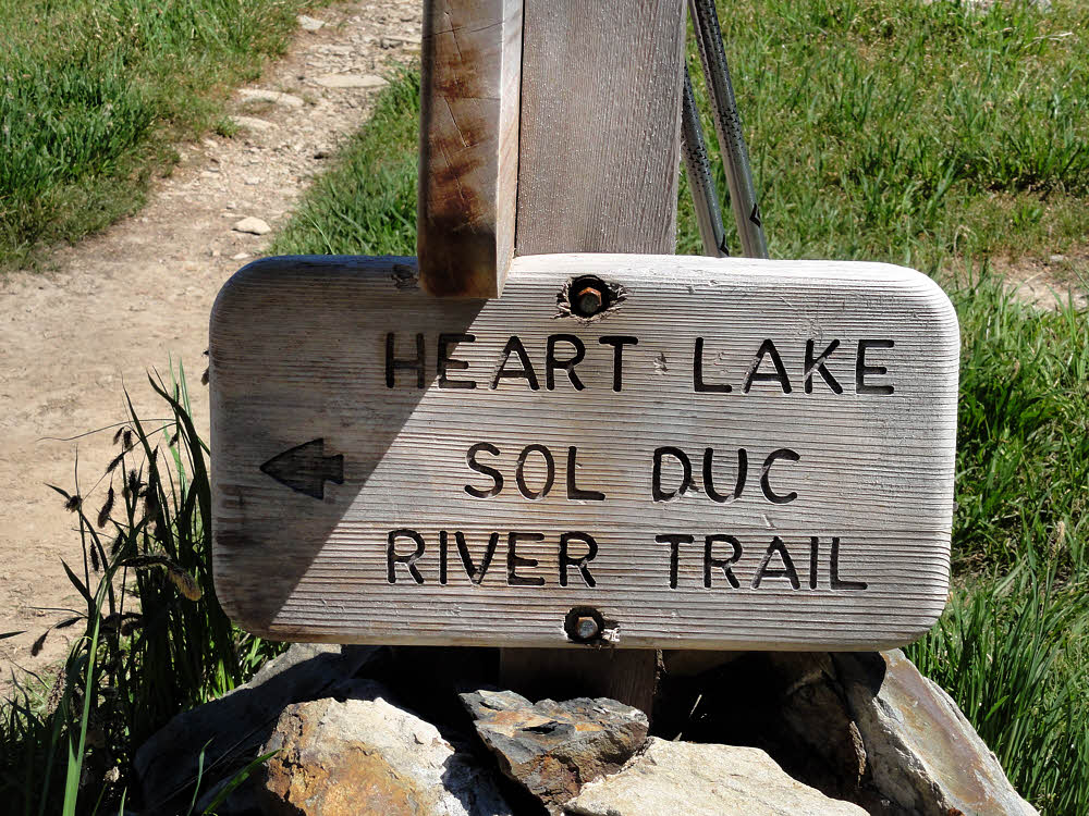
Then, a lot farther along, and down, there was Heart Lake. At this point I'd assumed that I had passed it, but it was unmistakable.

They could call it Cardioid Lake, which it was, geometrically-speaking. Pretty much a wet Valentine up there, boggy at one end and draining wetly from the other. Also well-trampled. No doubt it sees use.

And all of Mt. Olympus at once.

From there on down, the trail was less interesting, but still long.

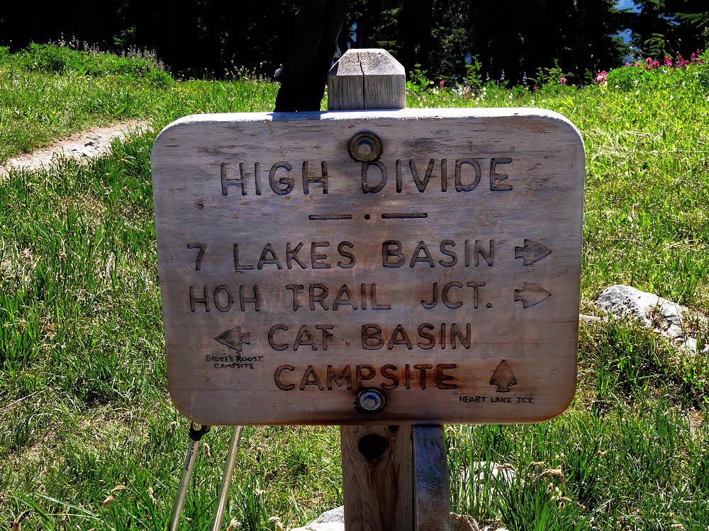
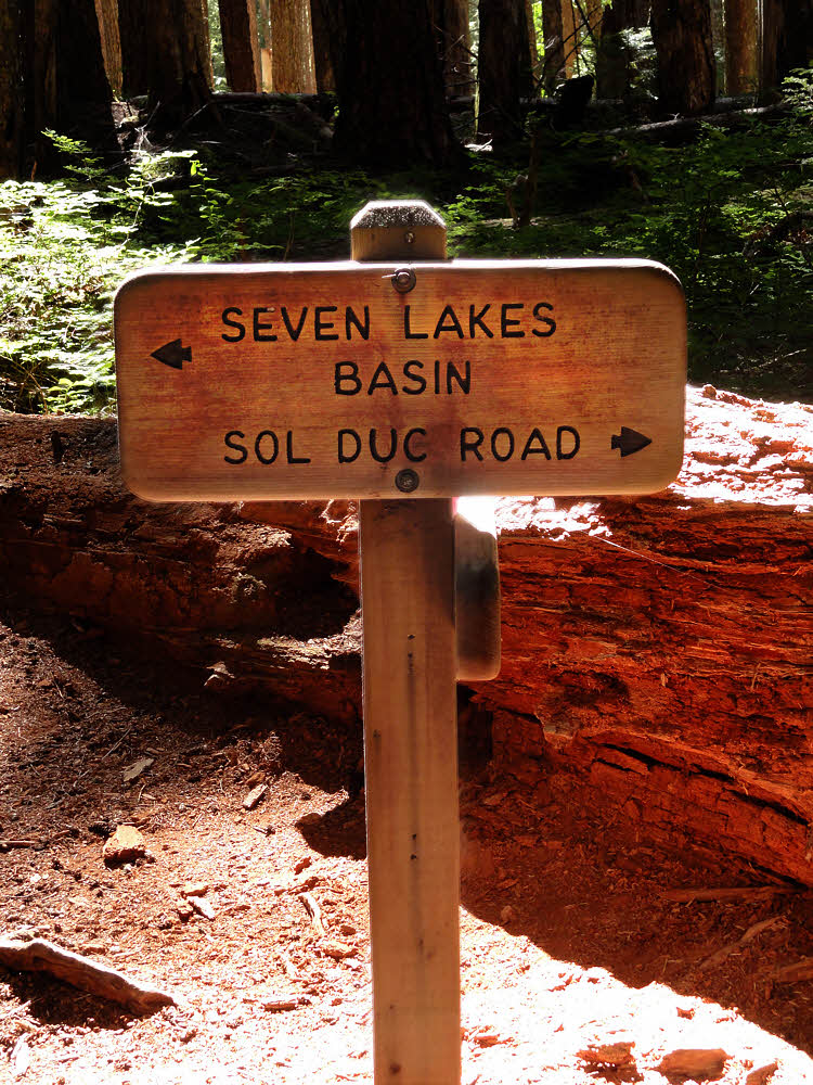
At least the signs were in good shape.

There is a spur up to Cat Basin, but I'd declare it uninteresting on priciple.

No doubt if the shape wasn't enough. We're at Heart Lake, guys.

Why hike another three miles to go there and look up at Cat Peak? After hiking all this way in?

Not for me.

Sol Duc and Heart Lake, left. Cat Peak straight. Camping to your right.

But if you like forest hiking, and want to go downhill, then the rest of this hike is pretty good.

There is water here and there, and lots of flies, and enough shade to diminish fears of sunburn.

And this is, as you might expect, Heart Lake.

Though it does get to feel endless after a while.

On the whole, I prefer a long river-side walk like descending the Elwha to a forest-bound, random downhill. Going along a river at least gives a person the feeling of getting somewhere. While it's true that I was headed for the end of my loop, the parking lot, and my ride back home, it was more like something to be endured than the end of a nice hike.

Heavy-duty stompers headed uphill.

There were still more people hiking in. I passed one particularly large party of mostly children. Everyone was dressed in flimsy shorts and more cotton T-shirts. They were all milling around at a shady spot, all right in the middle of the trail.

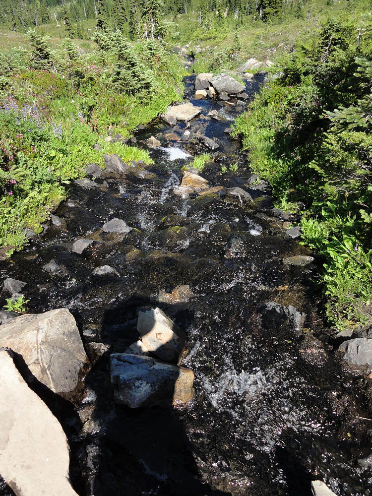
Outflow from Heart Lake. Cool and clear, with black "moss".

One guy said Excuse me for blocking the trail as I passed, but didn't move. I still don't understand that one.

I don't remember seeing any packs either. Maybe it was a one-way mass suicide party rather than a backpacking trip.

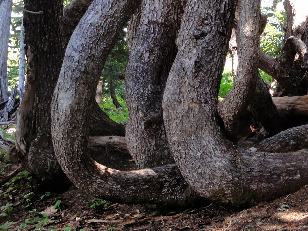
Another snow-bent tree.

The side trail to Appleton Pass came and went.

There was dust.

There were rocks.

Flies attacked every time I slowed for a photo.

The usual.

At the Appleton Pass trail junction. Not much else to see this far down.

And then it was over.

I had a snack in the parking lot, drank some water, changed shoes, and drove home.

The end.

More:

Elwha River Restoration story.

Elwha River Restoration photos.

Wednesday, August 13, 2014

Stomping Along The High Divide

Part 1 of 2: Day-hiking the Sol Duc loop.

Seven Lakes Basin

This is the sort of place that I never want to go to. Easily-accessible, popular, crowded.

It's also the last remaining piece of Olympic National Park that (a) I had wanted to see, and (b) hadn't gotten to. Because it's easily-accessible, popular, crowded, and requires a special permit because of the former qualities. Admission is limited, though, strictly speaking, you don't actually need a reservation nor are you required to camp in a designated site.

Typical stretch of Canyon Creek Trail leading to Deer Lake.

Though, in a sense, there is a reservation system, since only a limited number of overnighters are allowed, though a backcountry permit is needed inside the park for all hike-in overnight stays.

Meh.

I knew ahead of time that I wouldn't want to stay overnight anyway, and the Park Service is prickly on the matter of requiring bear canisters for food storage.

Looking back north, after passing Deer Lake and climbing way above it.

Something I like to avoid.

The whole idea of bear-resistant food containers is both smart and dumb.

Given the number of trailside buttwipe blossoms I've seen, I guess if you're going to allow city-apes to enter places like this, at least you should force them to comply with some rules. Just because, OK?

Snow-stressed trees, a fairly common sight here.

And poop isn't really the worst of it. Food actually is.

Piles of human turds don't attract anything worse than flies, and toilet paper bouquets, even less.

Food attracts anything at all with an appetite, and some of those things can be distressing campsite visitors.

South side of ridge, on the way to Bogachiel Peak.

I've never had a bear problem. So far, bears and I get along just fine.

If I see one, I wait, or back up. Whatever seems best — after all, I'm a visitor in the bear's living-room. I ought to show some respect.

And when it comes to eating, I'm fastidious, preferring to eat meals outside of camp, except for breakfast, since, if I'm on my way out anyway, it doesn't matter if I leave a bit of food-scent, or a couple hundredths-of-a-gram of spilled food.

Generally, I try very hard to eat the day's last meal before getting to a camp site, but if I can't, I eat well away from where I'm going to be snoring, and then hang my food in a third location.

Lunch Lake is around to the left of here.

I'm not the world's expert on any of this, but I am careful.

My watchword is stealth. All around.

Be silent, be invisible, leave no trace, and don't broadcast scent.

And then the trail continues, upward, toward the Hoh Lake junction.

I actually did have a problem once, in February, 1981.

That winter I hiked into the Hoh Rain Forest. It was a mild winter, and didn't even rain all that much. It rained pretty much all the time I was there (two nights/three days), but not all that much came down. It was one of those dry rains.

The first night was when my lesson arrived.

But first, some critters — black-tail deer.

I'd stopped at a horse shelter, a roofed, three-walled wooden structure with a dirt floor. It was dry inside. Good enough.

I set up my bivy sack and hung my pack from a wire running along the open side of the shelter. Then I went to bed. OK so far.

Sometime during the night I woke up. Maybe it was the scratching sounds of little feet. I can't say, but I definitely did hear those tiny claws skittering back and forth over my head once I was awake.

Mice. They had me right where they wanted me.

And two deerlings.

Which was zipped up, out of sight, and blind inside my sack.

Leaving my pack hanging out where they could get at it. Which they did.

Chewed a hole right through it, near the top, on one side.

Crazy little bastards. Demented. You can't reason with mice.

A bear can stand there, or run, or charge, and depending on who you are and where you are, and what else is going on, and what the bear is like, you can try something. It might not work, but there's a chance. Not so with mice.

I just backed up, out of their way, and everyone was happy.

I had some mice running up and down my tent on another occasion, and since there was enough light that night, I could see their small, dark shadows, which made dandy targets. I'd whack the inside of the tent with the back of my hand and send each mouse off in a grand trajectory to land several feet away, but though satisfying, it do good. They're nuts.

They can't help it. Within a few seconds they all came back again, skritching and scraping and scratching their way up the outside of my tent.

Eventually both sides got tired and then morning came and it was over.

Something like what happened in the rain forest that other night — it ended, somehow, and I got on with it, with only one hole in my pack, no bears, and a lesson learned.

To this day I'm extremely wary of bears, and meticulously cautious with food, but terrified of mice. Mice would eat you alive if they were just barely bright enough to find their way in.

I don't want to give them, or anything else, a fighting chance.

Lunch Lake, in case you were wondering. Someone pooped in the curve of dead wood to the left.

Which is one reason I like to avoid places where bear canisters are required. Because if they are required, you know two things.

One is that you're going into a place where a lot of others go, and that's no fun right there. A trip to Disneyland — hell, just thinking about it — would make me homicidal. On general principles.

The other is that you're going into a place where a lot of food is randomly scattered. Think about it. The Great Wall of China wasn't built by people who had nothing better to do. It was built to keep out the barbarians. Bear canisters are required because there's an existing problem. Already.

So, better to go elsewhere.

Anonymous lake and Lunch Lake. Actually nicer than the Seven Lakes area.

Although, if there's a place, and you want to see it, and you don't go, you don't see it, so I went.

But on a day hike.

It's a good day hike, about 19 miles.

That's a decent hike.

Off toward the Hoh River valley. Luckily not the real trail.

The road to the trailhead is paved all the way. So is the parking lot. You can even leave your vehicle in the shade most of the day, if there are enough slots open. I got there on a Tuesday, which gave me the choice of about 10 slots. Out of maybe a hundred or so. It's a busy place.

From the lot it's 0.8 mile (1.3 km) to Sol Duc Falls.

Meh again.

The falls are OK, but if you're a backpacker you've seen lots of falls. Sol Duc Falls is a narrow slot in a rocky canyon through which water sluices. No huge drops. No butterflies and rainbows. Just cold water foaming.

Not to be prissy and complaining, just, you know — it's a typical falls.

Still not the real trail, closeup.

After the falls, you turn right and begin climbing, if you're going counter-clockwise.

After just shy of three miles (2.9 miles / 4.7 km), there is Deer Lake. Lovely.

Boggy, grassy, buggy, calm. (Number 15 on the map up top.)

It's surrounded by trees and there are campsites on its east and west sides.

That three miles of trail is rocky and steep. Just like the trail that continues upward from the lake.

Obligatory colorful shot.

But it's all pretty nice — a good clean climb.

In morning air you stay cool enough. The trail is mostly shaded until you get way high, which you do eventually, and are able to catch views back the way you came, and off to the south, where be mountains.

Deer Lake is succeeded by a shallow basin full of lethargic trickles and bogs, supporting several small and shallow ponds.

Viewing them from above makes them look romantic, a feeling which is unencumbered by mosquitoes, which infest all boggy areas but which luckily for us hiking types, aren't able to do much once they lose our scent, especially if we end up standing in cooling breezes to wheeze and gasp and catch a few views.

Mt. Olympus and Hoh River Valley.

Well, anyway, once you get up high, you get views and breeze and more than enough excuses to drag out your camera and stop hiking for a few moments, and then you're mostly out of the trees.

Above, the trail curves eastward, along the south side of a ridge, and heads toward Bogachiel Peak. There's even a side trail that will take you right up there, if you want to go. I didn't, but took the side trail because I was dumb, until it became clear that the main trail went elsewhere.

So, after backing up a quarter mile or so (0.4 km) I got back on the trail and was tempted to go peek at Hoh Lake around to the right. But I didn't.

I'm lazy and/or bright enough, I guess. I decided that 19 miles (30.6 km) was a good enough day. No reason (no decently-good reason) to add two or three or four more miles just to see another lake.

White Glacier on Mt. Olympus. Still healthy-looking.

But I did see Lunch Lake. I did that. I ought to get points enough right there, I'm thinking. It was worth seeing. (Number 13 on the map.)

You reach an intersection with its side trail and have to double back around a small rock-strewn basin, and then chuff over a small ridge (really more of a large berm) and then there you are — another lake. Or two. Two in this case.

OK, fine. Chalk those up.

Hoh valley and the Bailey Range.

Then came the side trail to Bogachiel Peak, and the junction with the Hoh Lake trail, and the curve of the main trail back northish (actually, more like east-ish, again). I.e., more of the same, but slightly different.

By now, by this point on the trail, we are mostly out of the trees, and things are rocky. Rocky enough, and they are odd rocks.

Kind of granite-colored, but not. A sort of dense volcanic pumice, I think. Hard-packed tuff, or something. Light-colored, but heavy, not the usual dark basalt of this area. Anyway, there was lots of this stuff scattered all over.

And air. Lots of air. And sunshine. This is the High Divide. Finally.

And it was good. Or if not good, then OK. Pretty much OK, in a good way.

More of the Hoh River.

OK for a day hike, but I kept encountering people. At random intervals. Most were carrying packs. Large packs. Like small refrigerators. Like people carrying refrigerators and looking for apartments to put them in. People with giant backpacks full of every sort of thing, and mostly dressed in long pants and cotton T-shirts.

And some wore hats. Odd hats. That's a thing they do here, some of them.

I had a pair of long pants along, a pair I'd modified so I could unzip the lower legs upward, along the inseam, and then stuff the cuffs into my belt, and effectively be wearing shorts. Ten seconds of work and two quick zips converts these pants back to longies for chilly areas or for bug-repellency. But even worn as shorts they were insufferable so I stripped down to real shorts.

But almost everyone else wore long pants. And a few had odd hats.

More flowers, and the odd, lightly-colored rock in this area.

Odd as in stocking cap, or watch caps. Knitted hats, pulled low. Hot hats. Crazy hot hats. Some people wear them around town. OK — fashion statement. Grungy, stinky fashion statement.

But doodle-bug-insane sweaty-hot for hiking, and there they were, huffing along underneath packs big enough to house moderate-sized families, wearing long pants and heavy leather boots, and cotton T-shirts, with a few knit wool caps topping the cake. Nutso.

I, however, wore my flat hiking hat. (Flat Hat Jack is my alter trail ego.) And light synthetic shirt. And underwear. I like to hike in my underwear. These days.

But you can't tell.

I used to wear bicycling shorts, but needing a pair this year, I couldn't bring myself to spend $40 or $50 or $60 on a pair, so I'm hiking in my Wal-Mart, mid-thigh-length black undos. They look OK. If you think that bicycling shorts are OK too.

They even have a pee-pee flap, which is handy. I thought I was used to pulling down the front of my bicycling shorts, but it's so much easier to pull open the flap. And with a long-torso shirt hanging out, you can't even see that flap (while it's not in use, of course), and these guys are cheap, comparatively, at around $10 to $12.

Cool, form-fitting (no waving around in the breeze, no disconcerting drafts, no room for bugs to crawl in from below), synthetic (quick-drying), lightweight — a good deal.

Full frontal Olympus.

So all this walking and observing and cogitating eventually got to me. I stopped at a a place with a great view and made lunch.

It was a good day for a hot lunch, especially because I had a high-calorie supper left over from the previous-week's backpacking trip. Had to get rid of it anyway.

And while I fixed lunch the day got warmer and most of the clouds blew away, and took the day's haze with them, so after lunch I got better views of the surrounding mountains.

More White Glacier as the air clears of morning haze.

And then I began walking again, which we'll hear more of next week then, OK? OK.