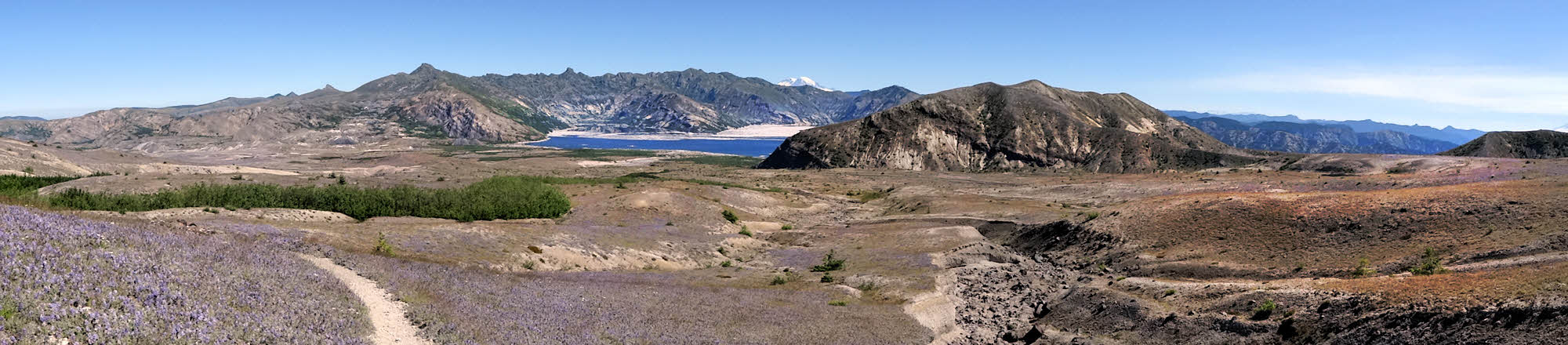
Looking north toward Spirit Lake with my back to the mountain.
So there I was, in the season of summer, with my shoes full of sand. Exactly as planned.
"Now what?" I thought, standing once again on the gritty soil of Mt St Helens.
There was nothing left to do but walk. After all, that's why I was there.

Mt Rainier peeking over the horizon.
One of my mottoes is "No Sniveling". (Sure, I stole it from Sgt Rock, aka Ernest Engman, but it's still something I try to live up to.) And it does fit with my other main motto, "Effort or Eff it", which sort of came to me on its own. Either way, I have a level of personal, to-mine-own-self-be-true obligation not to look completely confused and helpless in case anyone is watching.
Although I do have to give the applause to Groucho Marx, who said (although I can't remember in which movie), "Those are my principles, and if you don't like them, well, I have others." I can, in a pinch, probably come up with any principle I need, but that day the only option was to start walking in a big circle.
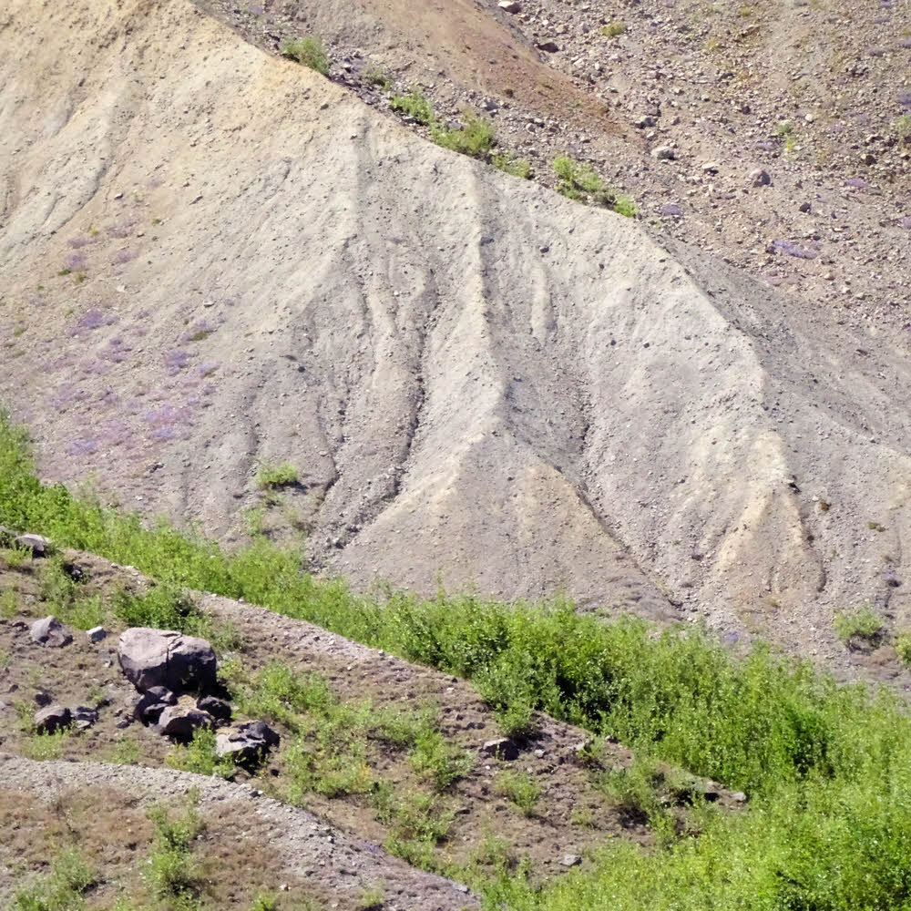
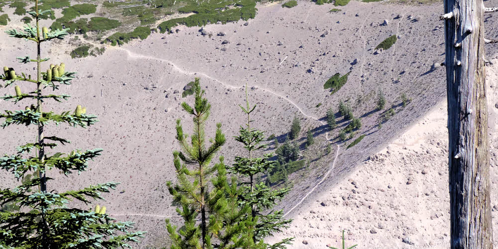
Near the west end of the Pumice Plain.
So that's what I did. On my first trip of a short summer.
I knew the area, having been around St Helens at least half a dozen times before, though the last time was in 2009. And it was messy way back then. The trails were degraded from successive winter storm damage and lack of maintenance, probably due to a never-ending cycle of budget cuts. I didn't know what in what shape they'd be in 2016, but I knew the mountain pretty well.

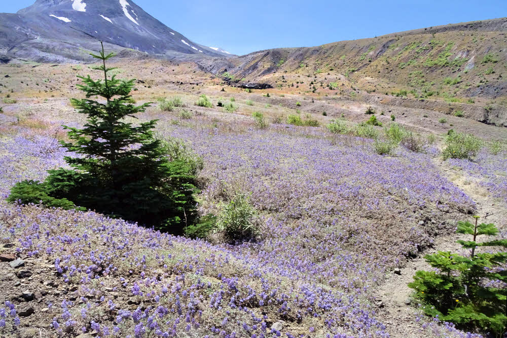
Fields of flowers in an impressionistic mood.
Mostly it's a game of taking it slowly, and then eventually you overcome anything that's in the way. So I had two and a half months to do something, and this was my start.
It wasn't bad. There had been a significant amount of trail work in the intervening years, and I didn't have any real problems, but it was a dry year after a dry winter, so water was non-existent. The large streams were flowing but none of the smaller ones. Willow Springs on the north. That was good. It's clean and clear.
Headed south along the west side.
Loowit Creek and one or two of its nameless companions, also on the north, but all have heavy loads of silt.
The south fork of the Toutle River on the northwest was also flowing, and a couple of its clear tributaries down in the forest, but then nothing for another 180 counter-clockwise degrees until June Lake on the mountain's southeast. There were a couple of unexpected weak trickles in the east-side canyons north of June Lake, but nothing after that until Willow Springs came around again.
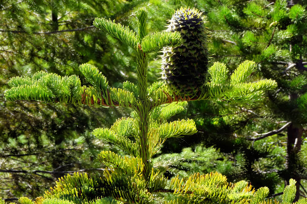
Fresh, happy new growth.
But the first really nasty obstacle was Toutle River. For several seasons it was nearly impossible to cross, not because it's big and ugly but because it couldn't be reached. Unless, of course, you felt like jumping off a cutbank and dropping 25 feet (8 m) or so. If you were going the the right direction. Because coming the other way, you had to figure out how to climb out of the dang river bed, which was even harder to do. But last summer, no — the trail had seen work, and it was just another part of the hike.
Somewhat tricky, a little dangerous, but somewhat and a little don't count. Only the big stuff counts, and this wasn't big stuff any more, so not bad. Just another part of the hike.
The long drop into the Toutle River valley.
After that, farther along, I knew that there might be trouble in a couple of the ravines. One ravine had the trail washed out of it during the 2001-2002 winter, and that had never been fixed. First, an informal detour got established, and then it was built up and marked, and got to be "The Trail". After that, farther south, I didn't know any more. More ravines, but I had no clue about the real, on-the-ground conditions.
And, you know? Things were good. There were tricky spots, but someone had done a bit of poking and gouging, and had placed ropes on either side of the ever-eroding ravines, and so getting down one side and up the other was no problem. So it was back to worrying about water but not broken legs, and as it happened, I didn't have any real water problems.

Rainier again, from across and above the Toutle River valley.
One thing that did get annoying was all the people out there.
When the trails were so beat up that hiking around the mountain was officially discouraged except for something like "extremely experienced hikers", well, you didn't see anybody else. But this weekend, July 29-31, the place was packed. Especially Saturday the 30th. Runners.

Looking east from high up the mountain's west side.
Runners, all coming at me. First a couple, then a couple more, then whole bunches of them, and after a long while, some of them came back from behind. I guess that a lot of them were going around the whole mountain, but some of the others weren't, or got a good look at the rough spots and decided to turn back, or something. So anyway, my first day was a lot like walking through an airport terminal — people coming and going and milling around and standing around, and you never knew who was going to do what, next, or why, or when, so it was a whole different experience.
But at least that came the second day. The first evening I had a quiet little spot near Toutle River.
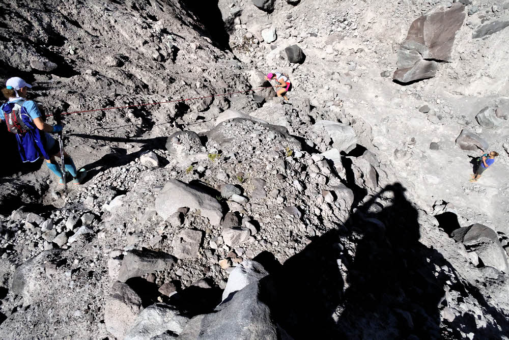
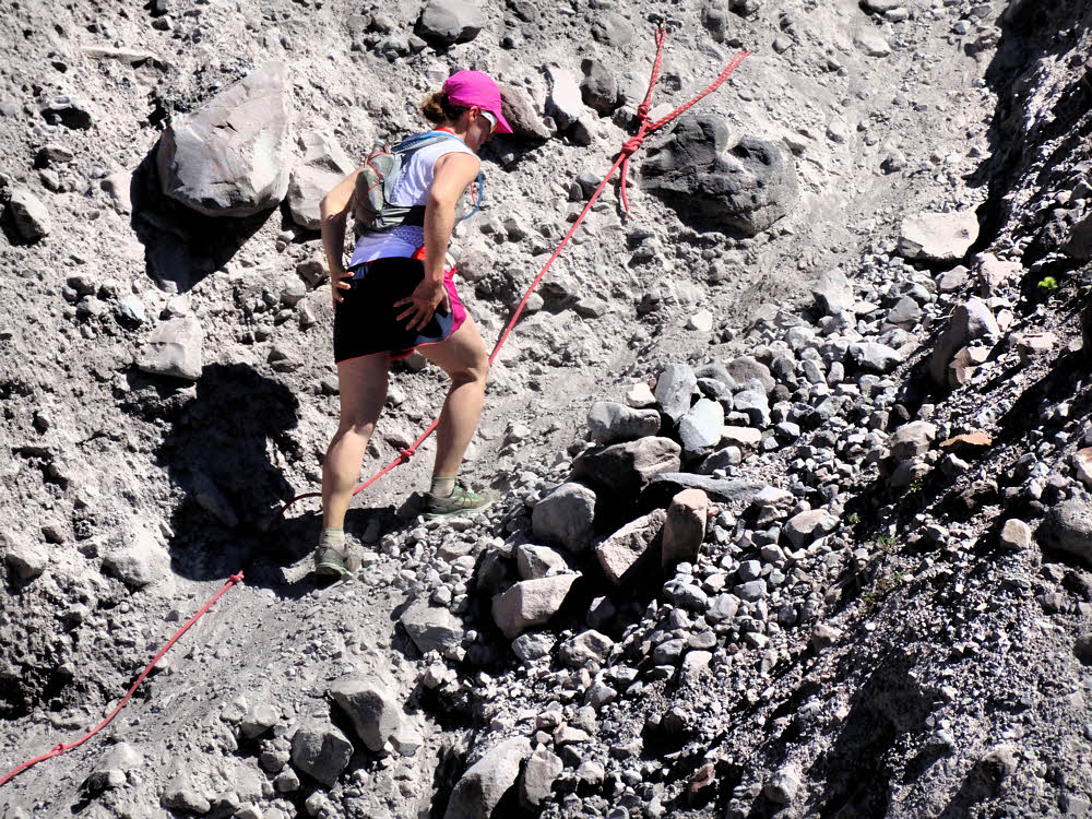
Three women going north, crossing a new, improved ravine.
First you get to the river, then you cross it, then you turn off the trail and head for the forest, and back in there somewhere there used to be a little sandy island right next to a little creek. And it was still there, but full of shrubs. Yes, things have changed since 2001. Because of that, and because of flooding. The whole area was messed up — creek beds rerouted, choked with blocky, fist-sized gravel, no good place to camp. I dithered, wandered, pondered, and finally figured out how to place my little tenty thing in between two logs in a sort of OK spot between and above two creek branches and there I slept.
That reminded me why I like hammocks so much. But it wasn't bad. It worked out.
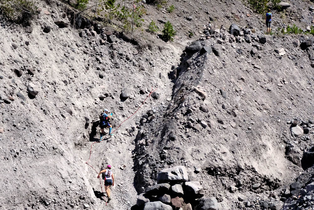
And them going up the far side.
So the next day, Saturday, came the ravines, and then the runners, and no water, and this took be around the south side of the mountain and through three fields of chunky broken boulders, which were not fun any more. By this time I started wondering if all this backpacking stuff was really something I'd aged out of. It was only tedious and uncomfortable. But I got through it.
By the time the trail down to June Lake came along it was late afternoon, and I'd seen no water anywhere, and was really seriously hoping that at least the lake was still there. Halfway down the steep spur trail to the lake I got a glimpse of it below, and there was no lake any more, only a round, dry, flat spot, but what to do? I kept descending.
Tough. Gnarly. Successful. (Compared to me.)
Something would work out. Maybe. That's how it usually goes.
And when I got to the bottom, the lake was still there. I'd seen something else from above. The waterfall feeding the lake was still there too, and grass and moss, and I crawled into the willows and washed up and then ate and pitched my shelter back away from the lake on sand and was OK.

Meanwhile, the outside world continues unabated. (But choosing to hide some secrets.)
The final day was uneventful, but still dry. The places I might have camped in a normal year were dry and dusty, so having June Lake was a lucky break. Anyway, the weather was great — sunny and calm, and the going was good.
The east-side ravines were significantly bigger than they had ever been before. They never get smaller no matter how often they get scoured out, do they? And there was a bit of water in two of them, and I think I picked up a bit. Having too much wager never hurts and the weight of it feels like a reliable insurance policy when you know for sure that you're in dry country.
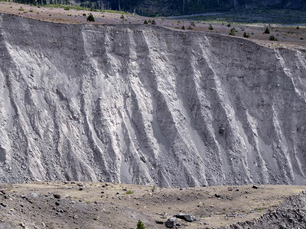
Jumping to Day Three, we see a ravine. (The trail does go through it.)
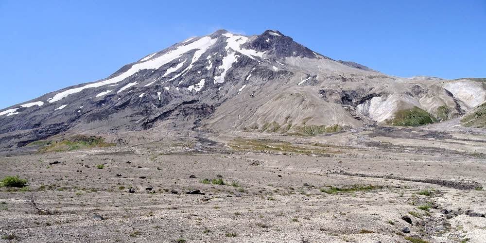
Mt Adams was out, comfortably sitting in its proper place out east, with Mt Rainier up north. Bicyclists were chugging up the Ape Canyon Trail. They didn't get out there in the old days, 15 and 20 years ago, but now they're all over. OK fine. I saw them at the head of Ape Canyon and from there out west across the Plains of Abraham, but there is lots of room for everybody there, so no big deal.
Once at the west side of the Plains, it's a walk downhill and then uphill and then it's over, which is what happened. Done.

And another view of another ravine. (Or maybe the same one — memory's fuzzing.)
I did fudge a little, and it was good. Since I'm no longer living in the area, and traveled and slept in a car all summer, I stayed the night before my hike and the night after at the Ryan Lake Interpretive Toilet, Picnic Table and Parking Lot to the north of the mountain, off Road 26. No one else came or went either night. I had the luxury of parking on smooth pavement, with a concrete walkway where I was able to sort out my things and pack up before the hike.
And there was radio reception, so I got to listen to the Democratic National Convention coverage and kind of sort of maybe almost aw shucks what the heck got to listen to Hillary Clinton and decide that if she was going to inevitably be the next President anyhow, she wasn't all that bad, probably. So I slept as well as anyone can in an odd and tricky world, and that was about that.
And...Then we have the Plains of Abraham and a short walk out from there. (Exit stage right.)