Wednesday, November 26, 2014

Definitions: Accident

Oopsie time.

Singular of accidense, an accident being one thing and accidense being a bunch of them, often noticeable as a swarm.

An accident is nature's way of demonstrating that you still have things to learn.

It is an occurrence, an incident, an event, and sometimes a good excuse for a party, though not often. Mostly it's something that happens or something that just falls out, like maybe an anvil falling out of a window and landing on your shadow (a good excuse for a party), or your head (not!).

Fortunately, on hiking trails, anvils are rare and second story windows even rarer. So on the trail your accident (if you are lucky enough to have one) is more likely to be setting your pants on fire, or having someone do it for you. Accidentally.

Which means you can't legally kill them. Neener, neener, neener.

Wednesday, November 19, 2014

Klomping Up Klahhane

First up — a critter.

Then some mountains.

Then some sky.

Looks nice, eh?

Well, it was nice.

Top shot. Port Angeles, WA down below.

And more sky.

Meanwhile, back to the southwest, some geology.

It gets pointy and craggy at the top.

But over the ridge it looks softer, but only down lower.

The wind up here was 35 mph (56 kmph)

Didn't we see this before? Anyway, less windy on this side.

My hat blew away, but few of the trees did.

Serious uplift.

I wanted to go over and touch it, but it was too windy — couldn't stand up on the slope.

It's all under snow by now. In fact, this was the very last day before the snow.

Pretty, though.

Looked inviting, but seriously — too steep, windy and cold to navigate.

The mountains do have strong bones, which is why wind blows few of them away.

See these rocks? Maybe the wind blew some of them here.

Very gnarly. A lot of this stuff formed under water (pillow basalt).

Oh-oh. Clouds coming.

Meanwhile, back in the trees, more bending going on.

And stuff was coming.

The void, in case you ever wondered where it hangs out.

Meanwhile, more stuff was coming.

Truly

But after I got back to my car, the first sprays of oncoming rain quit. Then things got sunny the rest of the day.

But by morning there was snow up high.

More

Klahhane Ridge

Visiting Hurricane Ridge

Wednesday, November 5, 2014

Wet Week, Day 5

We go left from here.

So then, Enchanted Valley is downslope, along the east fork of the Quinault River, and the rest is all the other way (back uphill). We take a left here.

Another lingering snow-pocket on the south-facing valley wall.

Even though the north side of the valley is obviously facing the sun, and is mostly bare rock, there are pockets there that hang onto their winter allotment of snow. Such as this.

See? Way up there.

Even though this trip was in mid-August, and the weather, after the rains, was getting seriously hot, the rocks kept their patches of white, all inaccessible save for the occasional passing superhuman. I.e., off-limits for me at least.

And this is the famous "chalet" in Enchanted Valley.

Finally, after three or so miles (4.8 km) of descending along the river, we get to the flattest and widest part of the valley, Enchanted Valley. Most backpackers hike in and don't go above this point, around 13.5 miles (22 km) in from the trailhead.

Looks kind of nice, doesn't it?

This is the location of the locally-famous "chalet". Which is a beat-up old log structure.

Go left some more...

(The signs around here could use some maintenance, eh?)

And get another view of the chalet...

Normally part of the chalet's main floor is accessible, with the upstairs and the south side remaining locked. I guess it's a refuge for campers and hikers, in case they need more shelter than tents provide.

...and then see the reality of the situation.

But this year it was locked up tight, for good reason. It seems that the river had gotten frisky over-winter, and had removed some of the surrounding real estate for its own use, leaving the chalet literally hanging on the edge of its seat.

It seems that the river has had some fun.

No, seriously. Right at the effin edge.

And has removed quite a bit of the local landscape.

I hear that they moved it a bit later, at the end of summer. Or were going to move it. (Yep, they did — just found some info — see links, below.)

But downstream, all is placid, complete with a cozy bridge.

Once past Enchanted Valley, and the chalet, we get into flat-valley forest for the rest of the trip out. The trail has changed a lot since 2003, when I hiked a bunch of it after dark — up until 11:30 p.m., without using a light.

Now we get into the realm of large trees.

It's not like that any more. Too rough, too unpredictable these days, but in its own way, still in great shape. Since it's so often used, the trail is maintained well, as you can see by the cut through the fallen tree, above. This sucker was a good six or seven feet thick. (1.8 to 2 m)

Like this cedar. Got one near where you live?

And if you don't believe that, take a look at the size of a still-standing tree. This one must be about 15 feet thick at ground level. That's 4.6 m, even without flexing any of its muscles.

A hot day. Plenty o' sun.

But there are lots of mostly-open park areas along the way too — alder, big-leaf maple, and other deciduous species. It's a world of sunny green.

Timber acne, before and after views.

Some of the trees are live and some aren't, but they all have their parts to play.

Looks like hemlock to me.

Like these young'uns. I think they're hemlock, but whatever they happen to actually be, well, it doesn't matter a whole lot. They're another fresh sight to behold.

Quinault River from Pony Bridge, near the end of the trail.

Most of the trip downriver from Enchanted Valley is either above or away from the river, but at Pony Bridge you get a good look at it again. This day, just around the bend, a group was in the water swimming. I hadn't known that there was an access point. Unfortunately, even though the day was hot, the fierceness of the heat didn't make it down to the river's level, so things would have been a tad bit chilly there. I kept walking.

The actual end of the trail.

Finally, back at the parking lot you can dig out your calculator and watch and see if you really make good time.

More...

Wet Week, Days 1 & 2

Wet Week, Day 3

Wet Week, Day 4

Watch the Enchanted Valley Chalet Slide to Safety

ONP's Enchanted Valley Chalet Moving, Temporarily

Enchanted Valley Chalet Relocation (Flickr)

Enchanted Valley Chalet moved out of harm's way

Saturday, November 1, 2014

Wet Week, Day 4

Tributary of the upper Duckabush River.

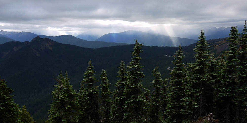
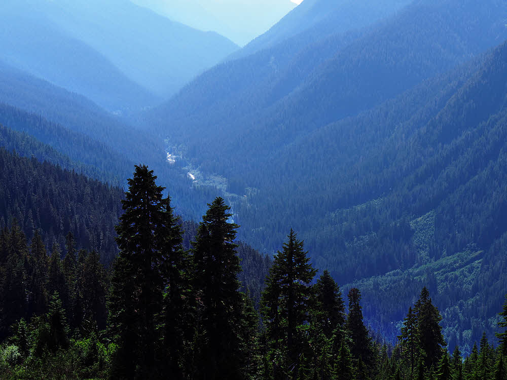
So Day 4 wasn't so bad — I finally got some good weather while climbing out of the Duckabush Valley.

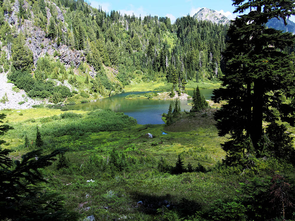
Marmot Lake, below and east of O'Neil Pass.

Once at the "top", there's a flat with a nice lake. Another lake is higher up, but not on this route.

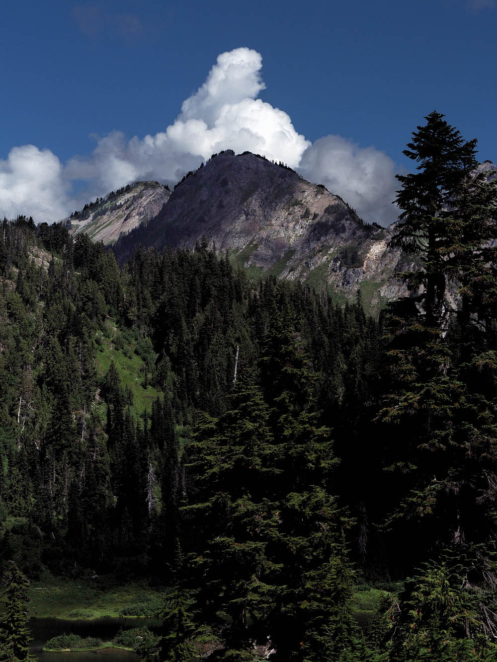
A few never-say-die clouds.

I started to get a little skittish again about weather. There was enough moisture in the ground to inspire a rip-roaring thunderstorm, as evidenced by the hard-edged clouds all over.

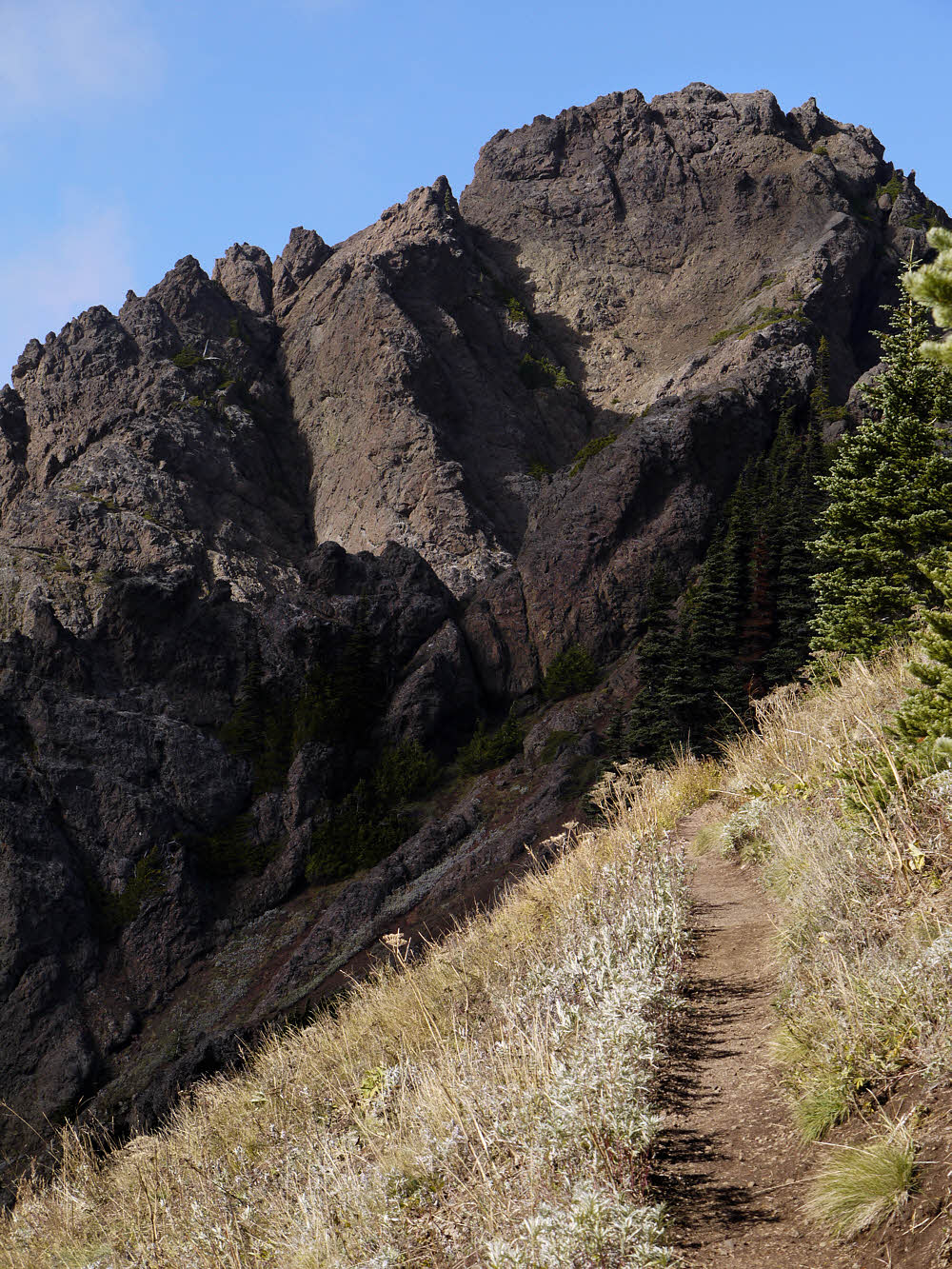
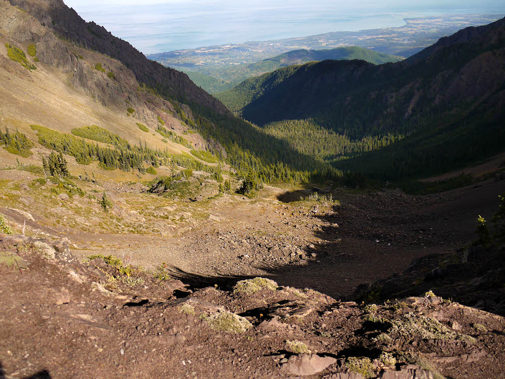
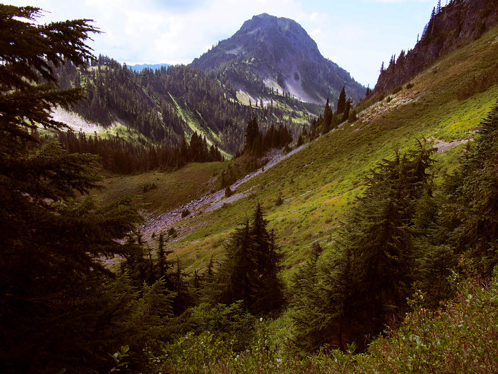
Looking up-valley toward O'Neil Pass.

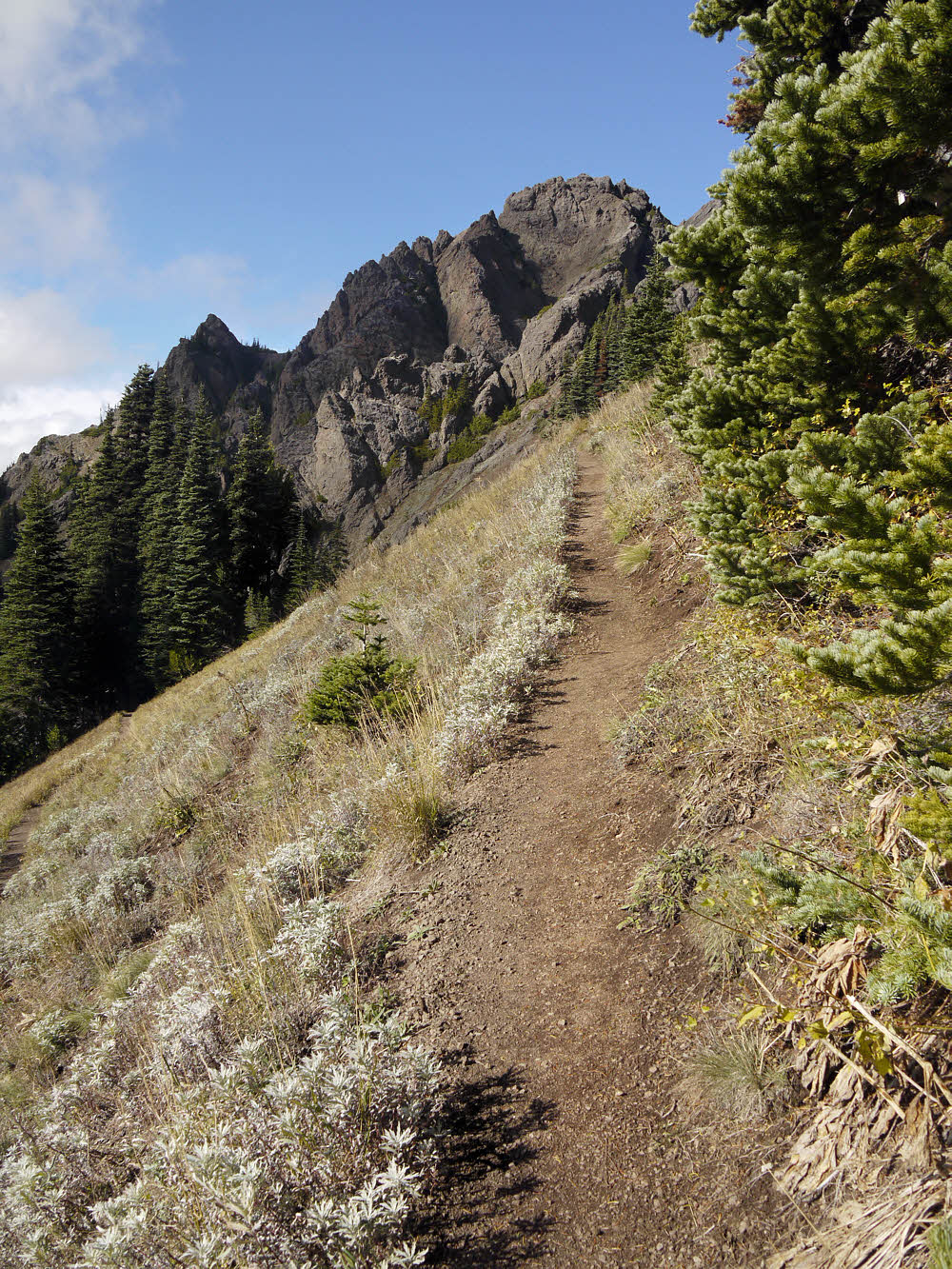
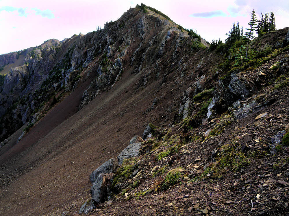
But the views up-valley were enticing, and the weather was warm without being hot.

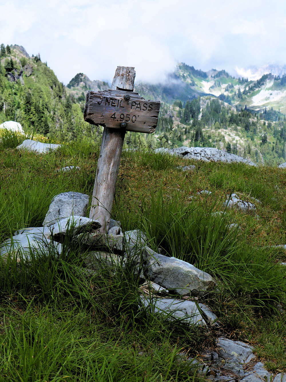
The last few feet of trail before the pass.

The trudge to O'Neil Pass was about the usual, though the snow was long gone. Usually I've had snow. Nice to do without it.

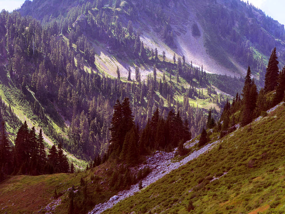
At the pass looking back east.

And the view back down-valley was nice too. After two days of rain and a third day inhabited by dripping shrubs, it was nice to be out in the sun with everything green.
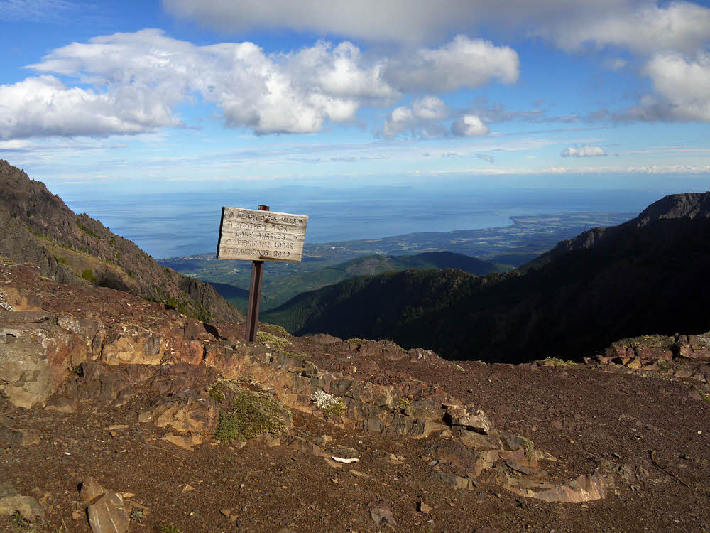
High point.

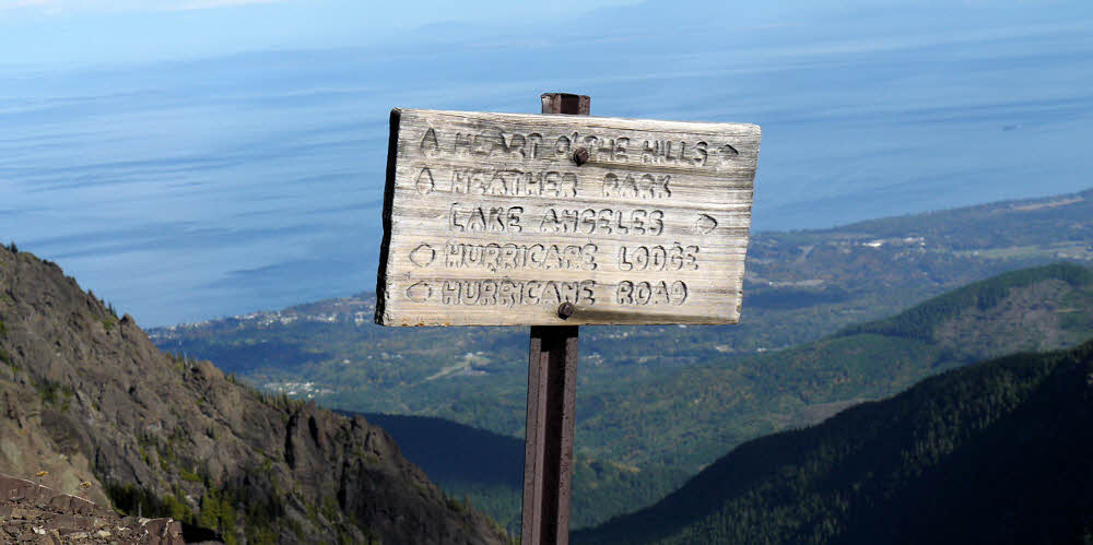
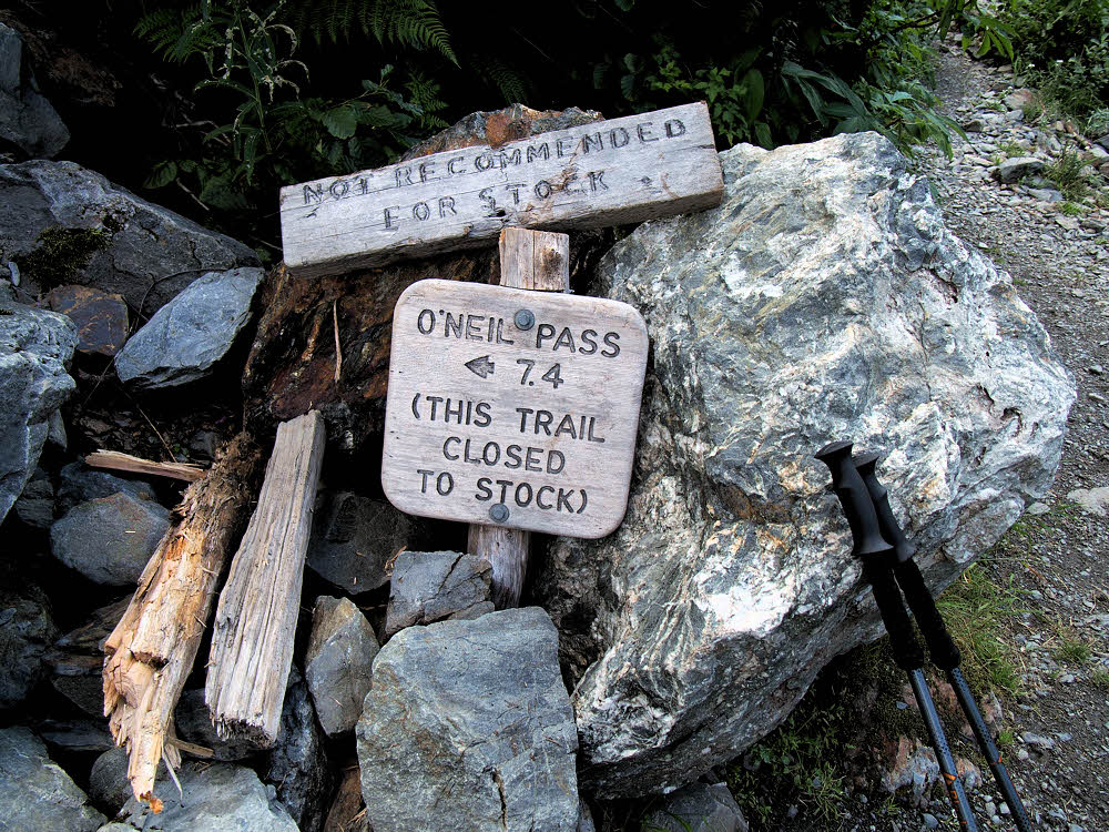
Even the clumsy old signpost seemed happy about things.

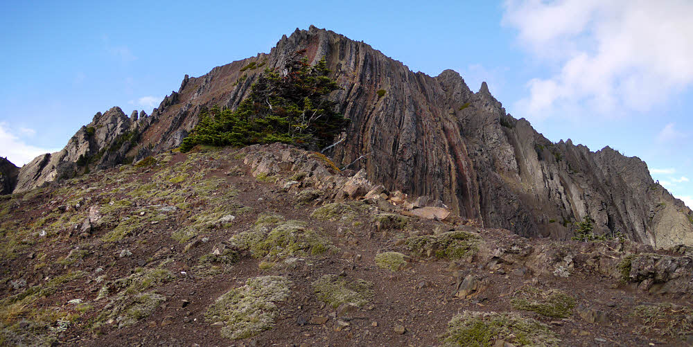
Just over the top, looking west-ish.

And looking ahead, well it seemed promising. And green there too.

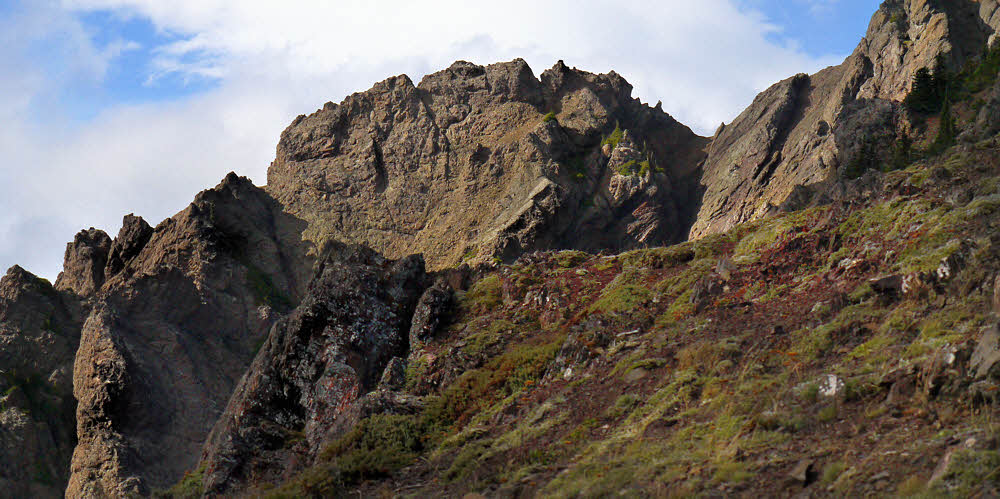
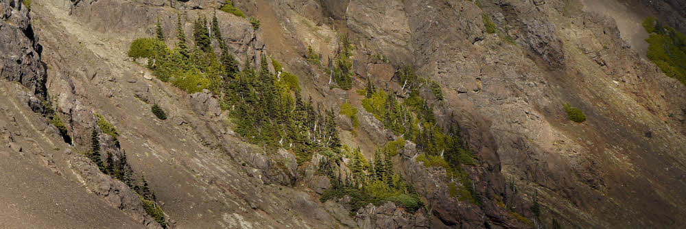
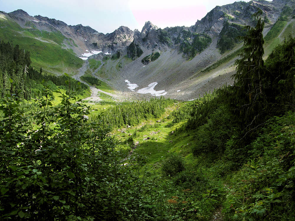
Appealing country for some off-trail exploration.

This is one area I've often wondered about dropping into for an off-trail excursion, though this whole area is heavily patrolled by bears.

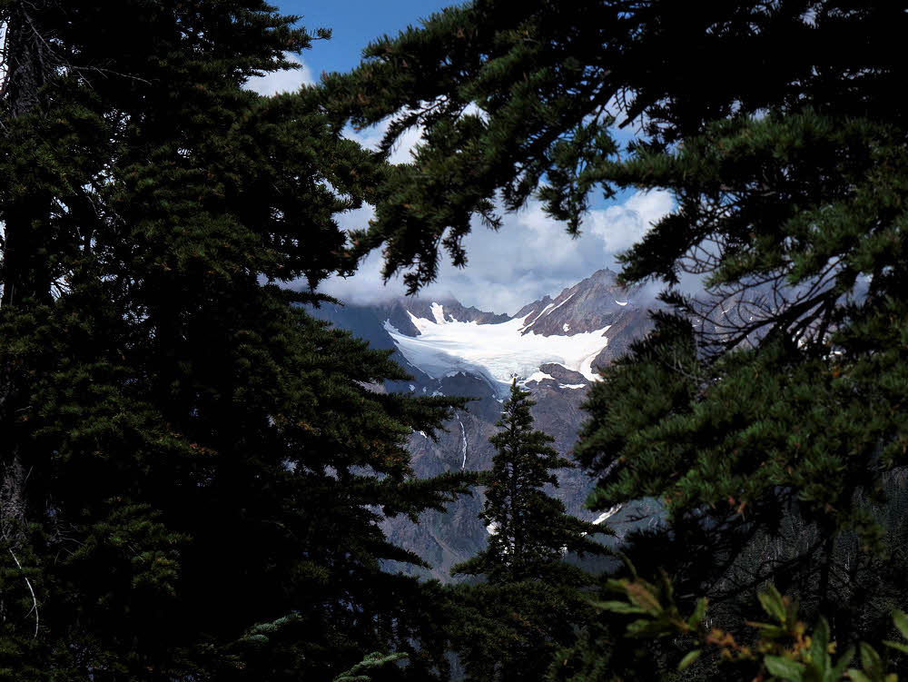
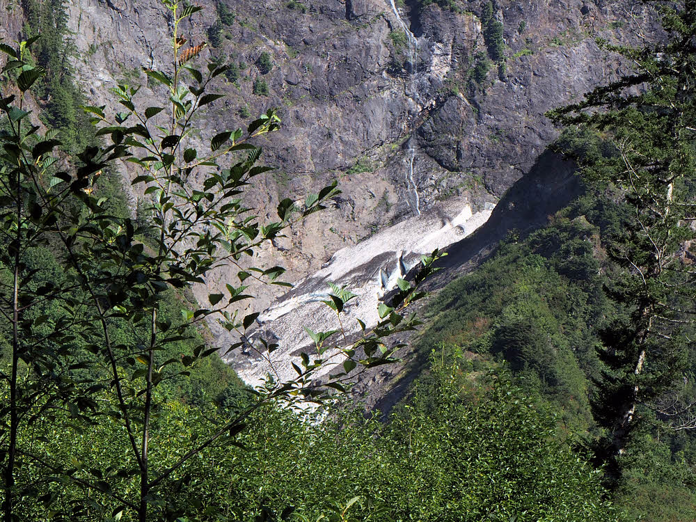
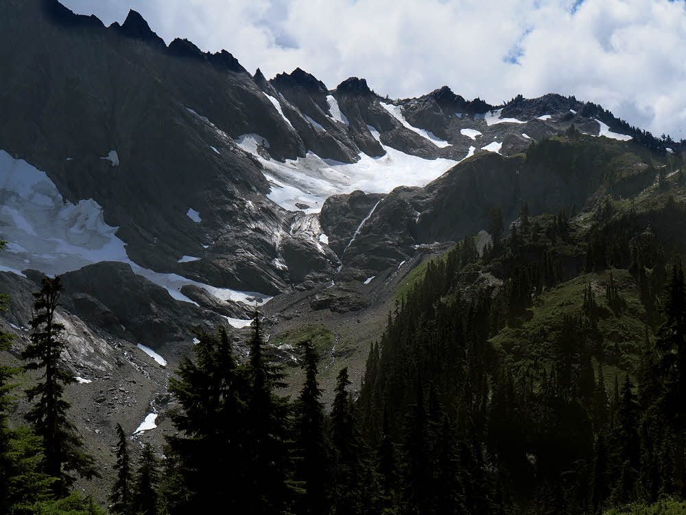
Anderson Glacier from much lower down.

You'd need to keep a sharp lookout for them, but likewise for scenery. It's easy to get glimpses of Anderson Glacier, but you have to be ready for them.

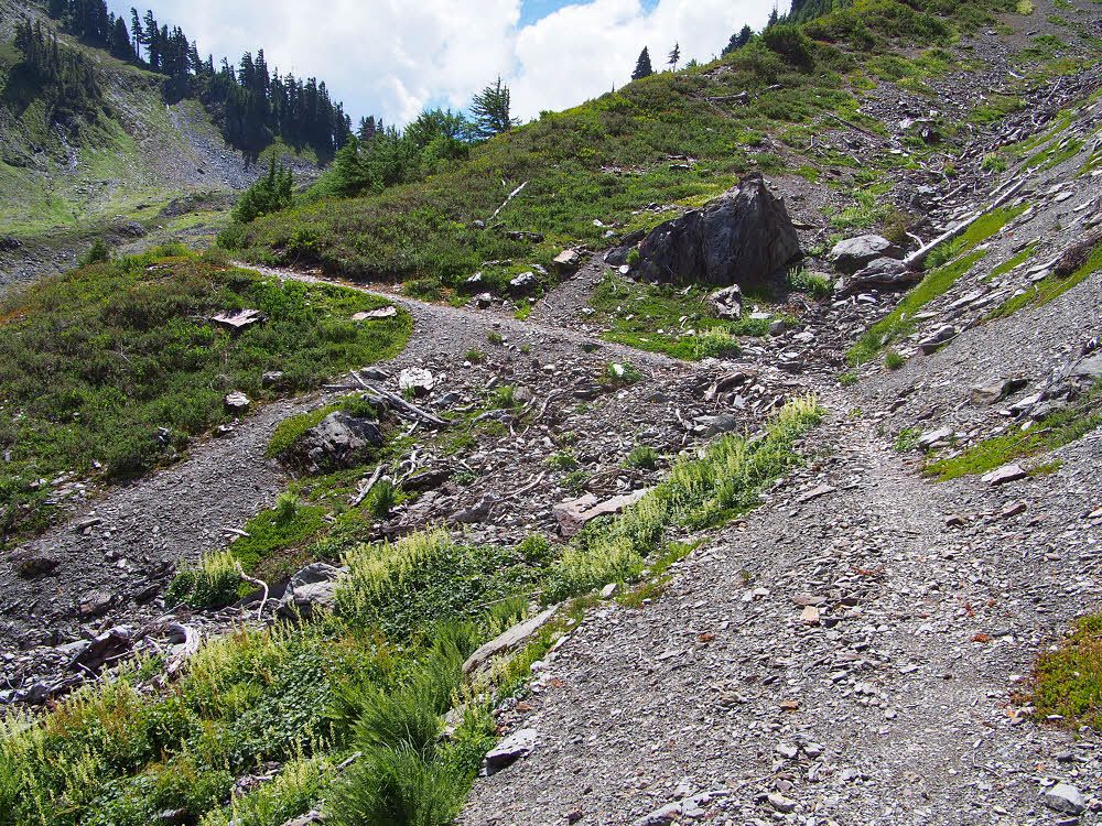
Typical section of trail on the way down.

And this trail seemed much longer than I'd remembered, maybe because it needs a good tuneup. Most of the tread was creeping toward senescence.

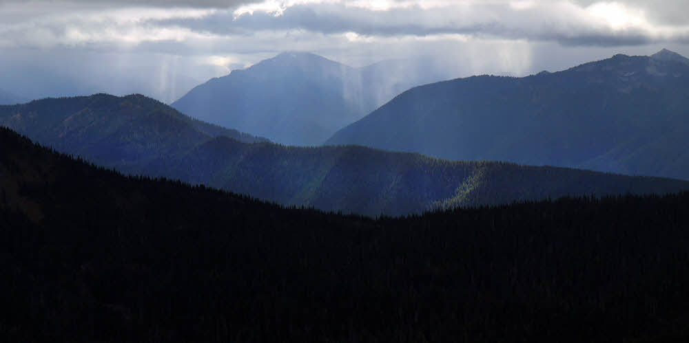
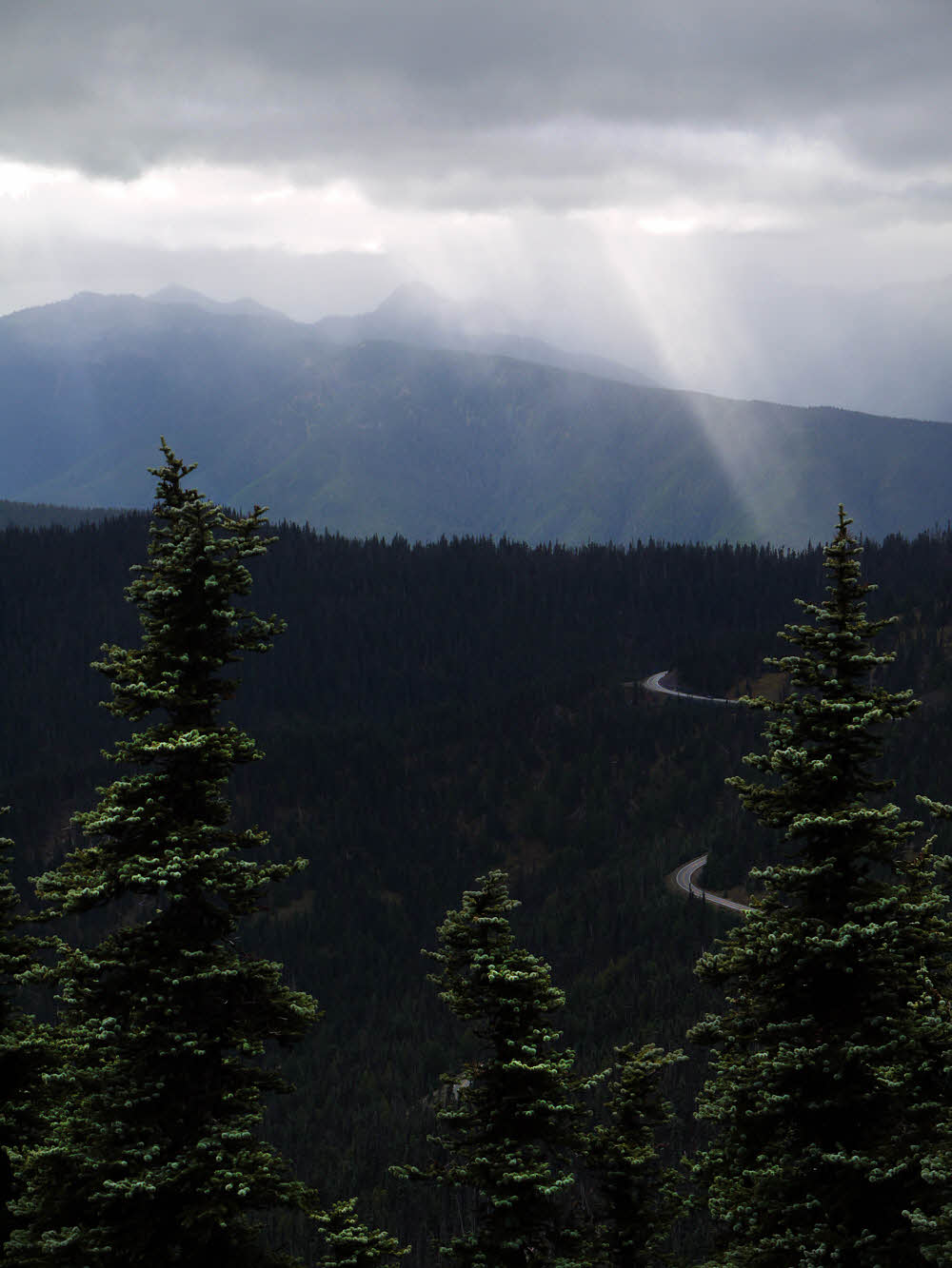
More clouds — couldn't get away from them.

Then there were more and more clouds popping up around the edges, making me wonder if I'd escaped the long rains to be hit with some short, sharp showers.

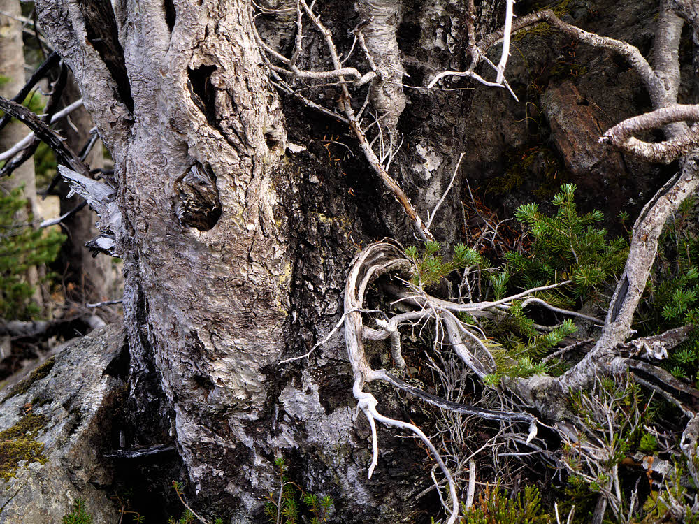
Big booger trailside spider.

And another thing to keep alert for is critters — they're not all bears, and some of them are much uglier.

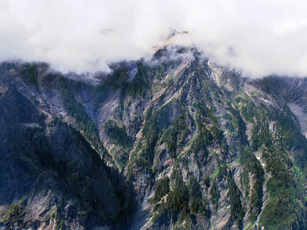
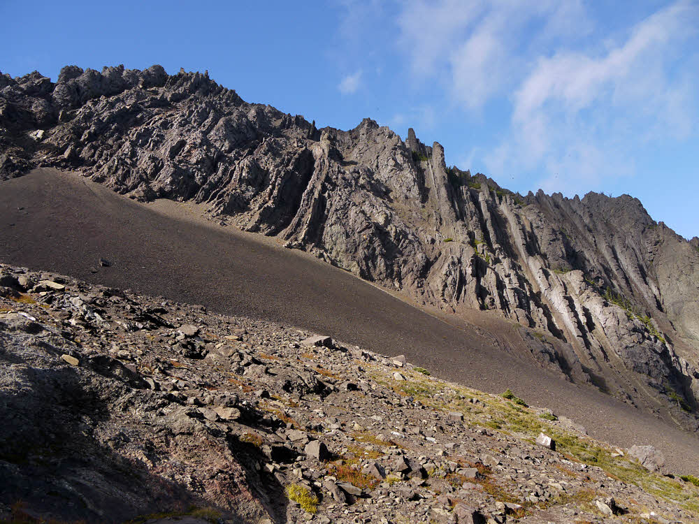
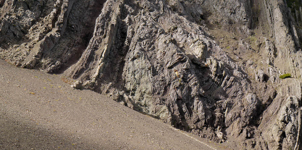
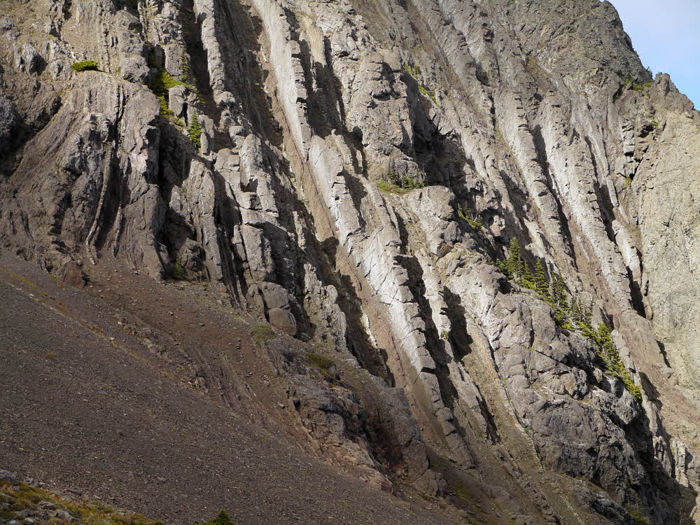
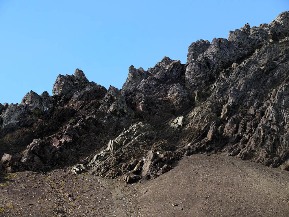
Opposite wall of Quinalult Valley.

Finally I got to a place where there were good views of the Quinaulat Valley, East Fork. The north wall of this valley is miles and miles of nearly-vertical rock.

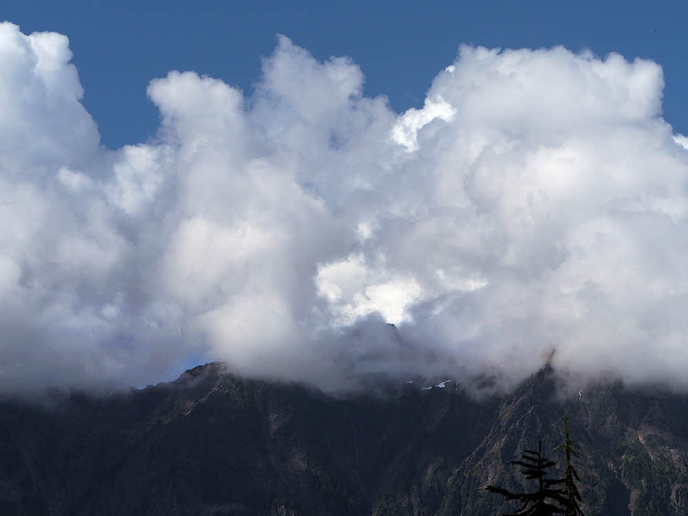
And on top — more clouds.

With, this day, clouds on top.

Isolated hanging snowfield.

And here and there, improbably for a south-facing wall, large old snow fields.

East Fork, Quinault River and its valley.

But the valley floor looked inviting. Actually, it was hot down there — really hot, which I regretted in turn.

Anderson Glacier again, hanging invitingly.

Peek!

Upper reaches of the Quinault.

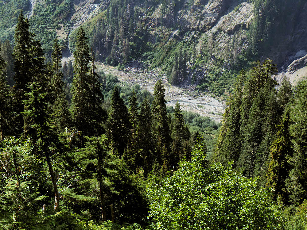
This view of the valley floor shows some of the debris from an avalanche of a few years back, still working its way downstream.

Even more clouds, and Anderson Glacier.

The clouds never ceased to bug me. They hung around the peaks on every side and seemed to be waiting for the right late-afternoon moment to dump a huge thunderstorm on me.

Nearing the bottom of the trail.

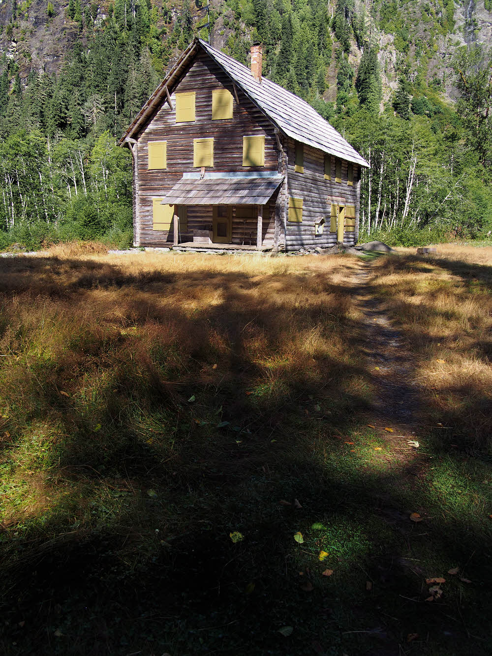
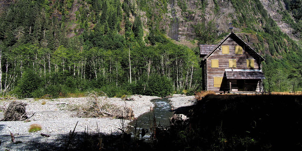
Finally — the last leg of the descent, and the possibility of a bath. In the afternoon it was nice enough there, though overnight this valley is scoured by a near-freezing downslope flow, even in the heart of summer.

At the junction with the Anderson Pass Trail.

I bathed, then continued down, looking for a campsite along the river, and passed this junction on the way. The signs have seen better days, but at least they were still around.

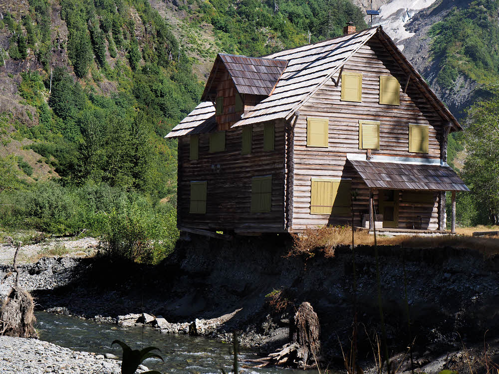
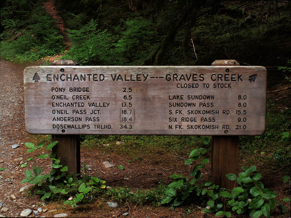
OK then. Next up, Enchanted Valley.

And someone added a pencilled version. This may date from about the time of the avalanch. The original signs may have been hidden by debris for a while — don't know, but it's better to have too many signs than too few.

Previously...

Wet Week, Days 1 & 2

Wet Week, Day 3