Ground Fire: A forest fire that stays on or near the ground, without leaping up tree trunks and getting into the tree crowns.
Ground Fire: When the ground burns. Caused by using nuclear devices as fire starters (also known as "overkill").
Ground Fire: Freeze-dried fire in powder form. Handy but expensive. To use, just rip open foil pouch, add hot water and wait five minutes. Comes in yellow, orange, red-orange, red, and three levels of hotness.
See tabs at the top for definitions and books.
Have extra info to add?
If the commenting system is out again, then email sosayseff@nullabigmail.com
Me? Recently nominated for this year's Doofus Awards. (Next year's too.)
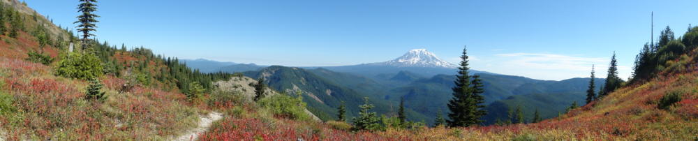
After deciding on the coziest, most level place to sleep, and the one with the least wind, I went looking for Jumbo's flat top.
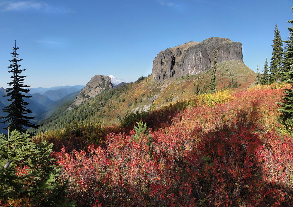
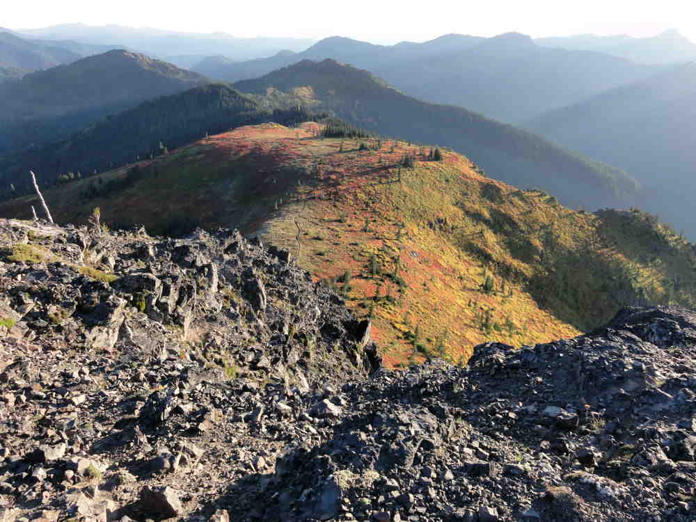
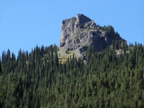
From the south Jumbo Peak resembles a monumental basaltic cork, frozen in place after the volcano it was once part of decided to give up on its reach for the stars, and died. Once you arrive at the top it's obvious that Jumbo isn't a big cork.
From my campsite.
As noted before, and as should be clear from the Google Earth images, what looks like a fat, clunky plug from one angle is really the intersection of two volcanic veins. These come in from the north-northeast and from the northwest. Only at that intersection is there any thickening, giving the illusion of a squat, flat-topped plug, like what you'd see if Devils Tower in Wyoming was sunk to its hairline in its landscape.
Jumbo ain't much like Devils Tower.
Google Earth. View from the south. Jumbo at center.
Jumbo is spooky, if you're up there, alone, at the edge of night, in the wind, and no one else on earth has any idea that you're even out of town.
Google Earth. From north-northwest. Jumbo top center.
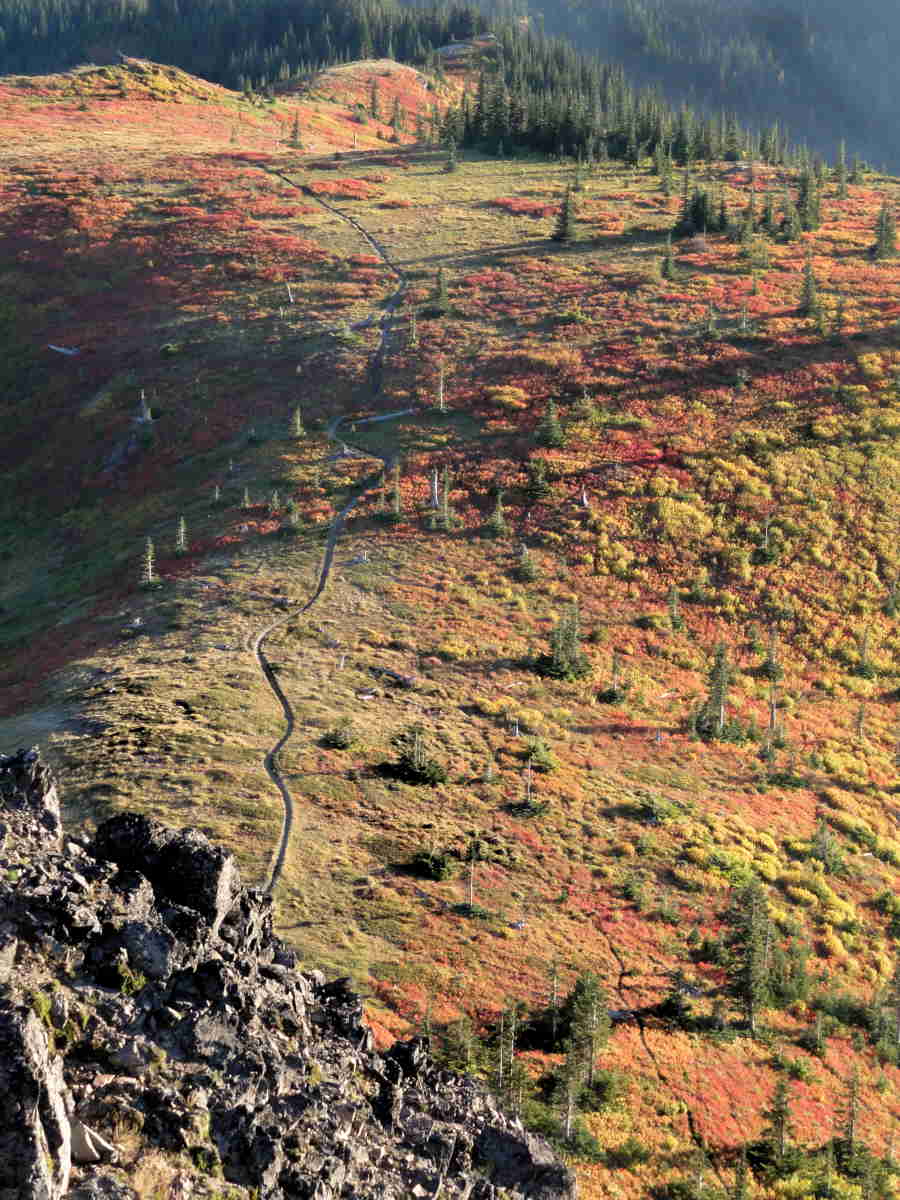
There is room to walk, especially in a north-south direction, but pay attention.
Google Earth. View from the south. Jumbo at center.
This is not a big, flat, rectangular floor, carefully swept, scrubbed, and waxed. It is lumpy. It is uneven. It is not like home. The slope is variable, and goes chasing off here and there, most notably at the east where everything ends and there is a deep void in the landscape. Here you find only sudden air and the suck of gravity.
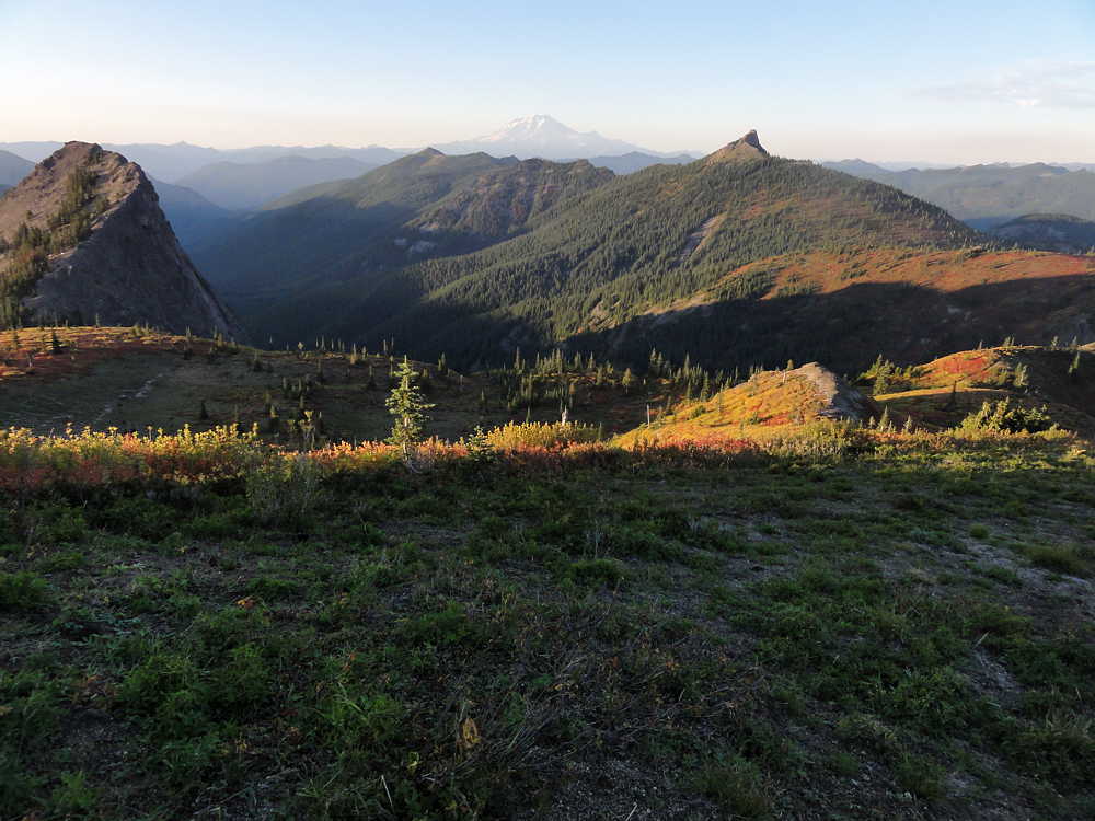
To north. Rainier top center. Sunrise Peak upper right.
Given that this place is big on a human scale, there is surprisingly little room, and too much unevenness, overlain by unkind debris that has collected over centuries.
So, big deal.
No unique adventure, except what you bring to it.
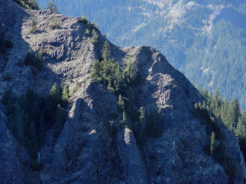
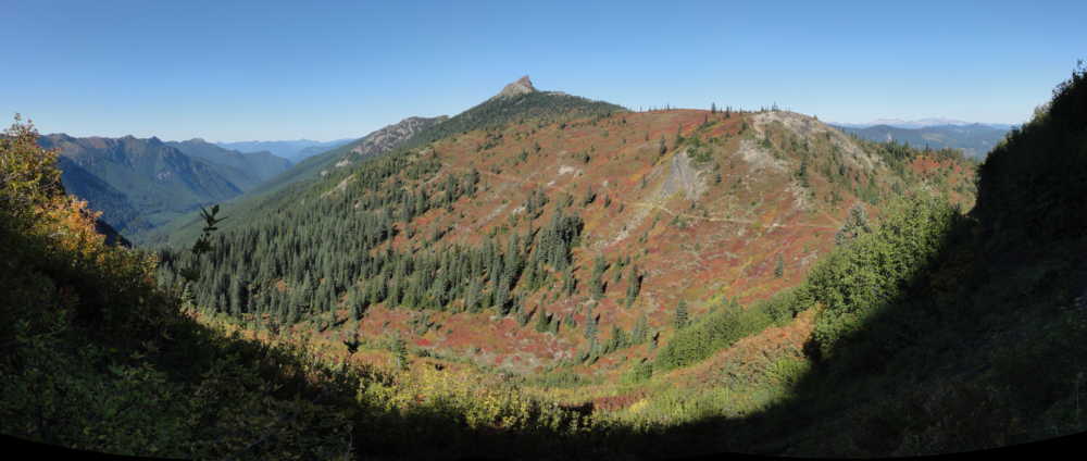
Volcanic fin or ridge northwest of Jumbo Peak.
I manged to pull myself up the wrong route using huckleberry bushes, wandered around until it was clear that the sun really was setting for the day, and came down an easier route. I was there, and can say that, but there wasn't enough drama to make a story out of, and no kinky spiritual revelation from getting high.
The trail around Jumbo skirts its western side. I camped to the south, in a small grove of trees. Tromping back north for a look from the top I took a side trail that looked to go there, but this only got me over the western (lower) ridge and dumped me inside the wide part of this mountain's V-shaped north side, where the trail then disappeared.
On top, to south. Campsite in grove near top center.
There were footprints going up from there, and generally that means someone with a clue has been by recently, so I followed them. This led me up and back toward the western ridge. But the footprints then faded out and I decided to keep climbing from there.
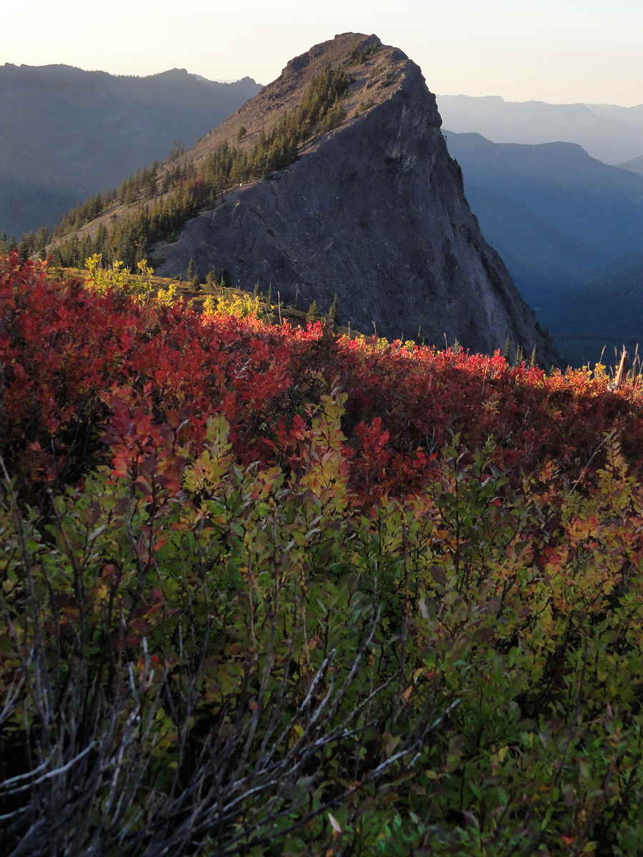
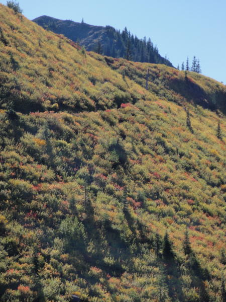
The place, wherever it isn't bare rock, is brushy with huckleberries.
Or if there are trees, and there are some, they are small and hug one another, and leave no space for
Tiny fossilized demon.
So at the altitude where the slope reaches toward vertical I had the choice to descend and try the other way (safer, slower, more of a sure thing) or to continue, by trusting in the shrubbery, that it would agree to I pull me up (not safe here, not a sure route, probably slower than it looked, but closer to hand).
So guess.
Trail to south. Campsite in grove at top right.
I chose the dumb way, to continue, hoping not to lose footing and go bouncing down several hundred feet (ever so many meters) to die alone in the dark.
It worked. (Still no story material. Sorry.)
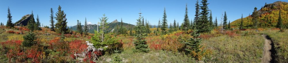
Looking north atop Jumbo. It's really a narrow ridge.
The other ridge, the other leg of the big V, to the east, is much longer but has a few trail-like stretches. Getting down, there, was easier, so getting up would have been too. Too bad for me.
On the south side of Jumbo, in the bare rock, there is what looks like a steep stairway, and there are those who ascend or descend this route. From the bottom it appears almost convenient, at first, if you think that a 75-angle is convenient.
But seeing it from the top is a whole notherness.
Spooky backpacker-type critter.
From up top you'd have to scramble down a long way over rock with a thin layer of treacherous scree to reach the top of this notch, and then, and then, if you were still up for it, to navigate down that route. Backward, of course. My little hairs still tingle at this thought. I'll never be a climber.
Meanwhile, back on top, the view isn't that great, especially for photography. There's nothing there to stick in the foreground for scale. You have the spot where your feet are, and a little space between you and the death edge, and a horizon miles out there in the haze. Kind of boring really.
But worth the effort. Cool place. Accessible. Near where I live. Little known.
Could have been worse.
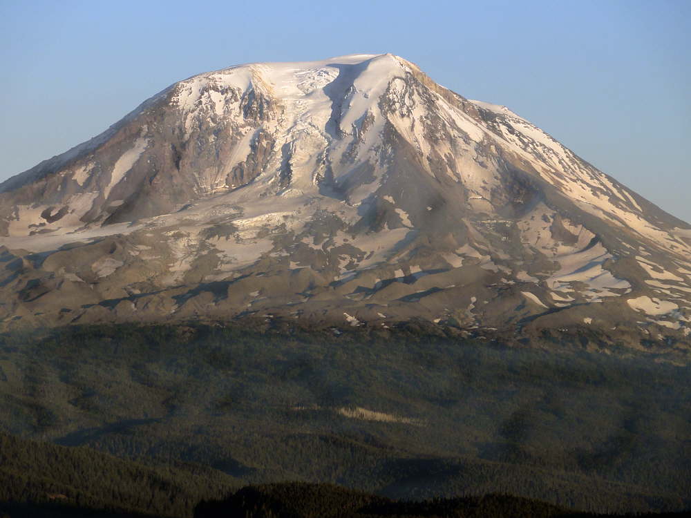
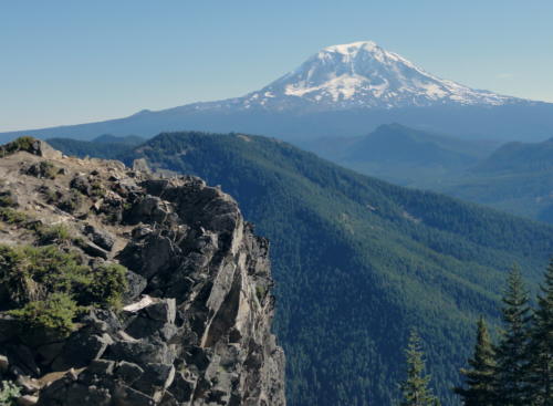
Mt. Adams to east. Haze, etc.
Footnote on the weather.
The high country here was socked in by snow until sometime in August. After August came the rains, for almost all of September, which is usually dry, clear, pleasantly not hot or cold, and bug free.
Then there was a sudden window, meteorologically speaking, enabled by Washington's geography.
Going from west to east there is the Pacific Ocean, the Coast Ranges, the lowlands, the Cascades, and central Washington. Central Washington is high desert. Given high enough atmospheric pressure, the already dry air of the Inland Northwest is pushed to rise and dry more as it is kicked west across the Cascade Mountains, opposite to the normal flow here. This brings warm clear skies into humid lowland areas between the coastal mountains and the Cascades, and a steady easterly wind.
Mt. Adams.
When this happens in summer the temperature pegs at "bake", and things start to melt, or turn dark and smoky around the edges. In fall, as happened this year, what heat there was, and the accompanying wind, shoved September's gray drippiness aside and created a few days of pleasant clarity within its protective bubble. This September still harbored a few bugs. Even though mosquitoes were down, mostly, flies are hardier, and lingered, but the wind dealt with them well enough.
After three or four days of this the high pressure weakened. Warm and dry air out east sank back behind the fortress walls of the Cascades, and Western Washington once again vanished into its customary moist gray cloak.
But for a while, a few days, a brief spell, a moment, it was glorious. It really was.
See tabs at the top for definitions and books.
Have extra info to add?
If the commenting system is out again, then email sosayseff@nullabigmail.com
Me? Recently nominated for this year's Doofus Awards. (Next year's too.)
Last summer I backpacked along Juniper Ridge in the Dark Divide of southern Washington State. The days were hot. Not killer heat, but.
The real problem was that -- well there were two.
The first: August, and a trail along a ridge meant lack of water. One source (and I was glad to find it at the end of a dry first day) was a 10 by 20 feet (3m by 7 m) pond. Shallow, green, and wiggling with life.
Aqua Mira took care of the living things, or if not then they only passed through quietly, the way I'd visit an amusement park. No fighting, no throwing things, no trying to destroy the equipment.
So that was good.
Sunrise Peak from the parking lot.
Farther on, day two, I found the wonderful clear Dark Creek in Dark Meadow under Dark Mountain. (All named after John Dark, who meant well but lent his name freely to what now sounds like an ominous area.)
The second: problem, that is. The trail.
The whole region is billed as one huge blanket of roadlessness. It's even called the "Dark Divide Roadless Area".
No. Not like that.
Afternoon Adams.
See, there's the trail. The trail is itself a road, used by off-road motorcyclists, who, by using it, have made it a road. An evil road. Often a deep and treacherous trench that separates features rather than joining them.
This trail, especially north-south along Juniper Ridge, was not designed the way it would be today. When the land rises or falls the trail does too, at severe angles. Switchbacks? No, not many. And little level going.
Walking, you feel lucky when you can take to the lip of the trench. In the rut, often three feet deep and five feet wide (1 by 1.5 m), are loose stones and dust.
Step into just the right dust, in just the right place, churned up just the right way by passing wheels, and an entire foot disappears. Not fun.
The dust is soft and fine as talc, and if you hike in shoes and you go into it ankle deep, well.
Too bad. Swear a little if you want, but there is no do-over.
So, given the motorcycles, I don't know how this can be a roadless area. Especially since, if you look at a map you see roads all over. They come and poke in from every angle. And then there is that spur road between Tongue Mountain and Juniper Peak where you could, if you wanted to, park on the trail. If you wanted to. You could.
See? Road. Number 2904.
I don't mind the roads. I stay away during hunting season. The rest of the year a hiker would see only other hikers if it weren't for the motorcyclists. The roads make day hikes possible, and although I wouldn't build roads there now, if it was my choice, they are there and that is only the way it is. But this is not a roadless area.
Just to be clear.
In case anyone is interested.
And maybe you should be, because this is a fun place.
For example. As mentioned already, most of the trails are high on ridges. You get views. No water, but views.
Jumbo on right, extra pokey thing on left with trail.
Now a lot of high places have no views, because besides elevation you need openings. The Dark Divide has them. There were fires in 1902, and again in 1929, and the forest has not come back yet, as though it took the hint.
I got a lot of views last year, on my first trip, and planned to get more. I had planned to hike in, and then out again along the same route, but due to trail evilosity I went back out another way. Not really the trail so much as the slopes.
Combine rut-walking with rocks and dust. Go up or down at crazy angles. Rig the payoff for a misstep to be broken bones or torn ligaments. Add thick, impenetrable tangles of brush along the trail, just so. So you have to stay in that rut.
So.
Last year I missed a good look at Jumbo Peak, the cold stony plug of a long-extinct volcano. Went right by Sunrise Peak, with its steel railing guiding the bold right to the very rocky point on top. Skipped Tongue Mountain because I was in a hurry.
Unnamed volcanic fin during its blue period.
"Why worry," I thought "I'll just stop and explore on the way out."
Only on the way out I took the gravel road down in the valley, where the walking was easy and water was everywhere. Where the flat, conveniently well-graded road was handy, in this supposedly roadless area.
So last year. I missed a lot of fun.
Coming around pokey thing to the "back" of Jumbo.
This year I hiked as much of the Boundary Trail (a little to the south) as seemed reasonable, but from it saw Tongue Mountain, and Juniper Peak, and Sunrise Peak, and, most intriguing of all, Jumbo Peak. And wanted to take another shot up there.
So, at the end of the Boundary trip, at the end of August, after I got home, I began planning a short one to Jumbo. To go say hello up close and climb its back.
And then rain, and rain, and rain. "Olympia has accumulated 4.1 inches of rain in just the past 4 days and 5.3 inches over the past 31 days. September normal at Olympia is 2.0 inches for the entire month." -- Cliff Mass, University of Washington atmospheric scientist on Sunday, September 19, 2010.
Pano toward Adams.
And I got sick. Not bad, but just enough. Aching joints, aching skin, slight fever, slight headache, slight dry cough. Those were the fun parts. The rest was exhaustion. Get up, wash, eat, lie down for a long nap. Repeat daily.
This went away after two weeks, and then it took another week to recover. So that was September.
And then we had three warm, sunny days. I packed and went back to Jumbo, pronto.
Warm and sunny but cool and dewy in the shade.
Drove almost up to the trail, only 3.1 miles from Jumbo (5 km), and hiked in. Yay for roads. Carried in two gallons (7.5 L) of water. Cuz there wasn't none up there. OK.
Four scant meals, some tea, a bivy sack, two cameras, and enough water for a day and a half. Try it. It's fun.
The weather: good. Sunny, warm, clear. A strong east wind kept the wet Pacific stuff out of the mountains. With most of the trail on the west slope, it was calm there. Even the one night I spent there was, though clear, warm, with bright moonbeams.
To the north, Sunrise Peak over the valley of Jumbo Creek.
I'd planned to hike up Jumbo for sunset pictures, sleep, pack up early and hit the mountain again for early morning pictures, and then see what happened. And it sort of but not exactly worked that way.
Although people have said that there's a trail "up the back side" of Jumbo Peak I didn't find one. Pulled self up the wrong side by use of shrubs. Not recommended. Was the hard way. Spooky too.
Again, to the north and Sunrise Peak. Trail on right.
Came down another way and found elk trails. They might have followed what might have once been a sort of trail, but you'd have to change your definition of trail to qualify it as one. But it worked. Scared a bunch less snot out of me than the up-route.
That really wasn't the bad part though.
Well, there was no really bad part, but up topside was different. Than what you'd expect. From seeing the mountain.
Especially from the south, Jumbo Peak looks solid and square, but it's really more of another ridge on top of a ridge.
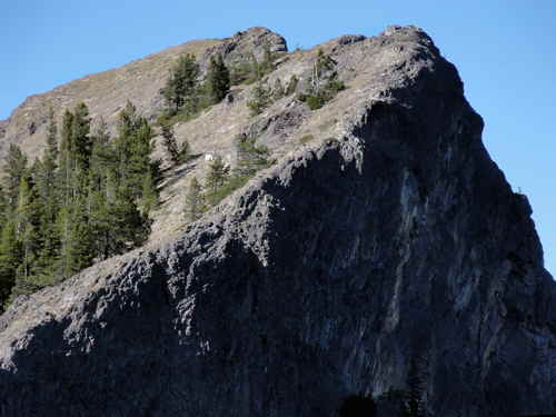
Volcanic fin. Note the white spot...
It's V-shaped. Two volcanic dikes come in from the north. They are northish. They meet and fuse at a blunt, southish point. The trail up, such as it is, follows the eastern dike. That's the route you will take if you are smart. Smarter than I was.
The western dike dips and disappears for a while, then reappears to the northwest as a sort of bare volcanic spire or fin to the northwest. This isn't named on my map but is impressive when you stop and look at it, and finally understand. How massively big and stony it is.
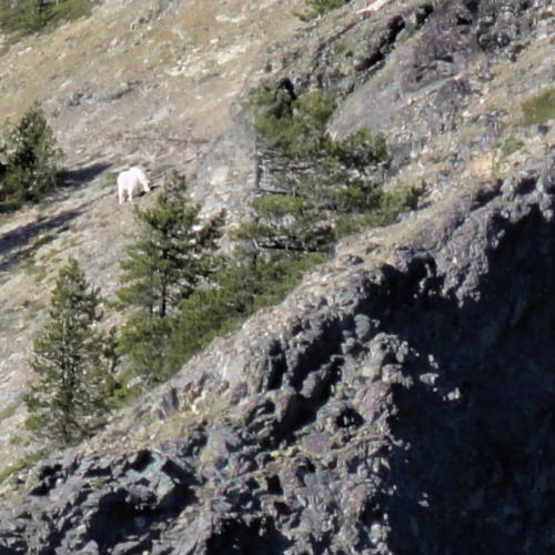
...which is a goat. Too bad I didn't notice when I was there.
But Jumbo.
On top is level ground but not what you'd expect, looking up from below. Narrow and uneven level ground.
East, toward Mt Adams, Jumbo shoulders off. The stone is loose and crumbly, a deceptive segue to a 2300 foot (700 m) fall, the contemplation of which makes all your body hairs stand up and scream in unison.
If you are there alone.
In the wind, as the sun is diving into cold darkness, and know that any one misstep will at best leave you dead. At worst leave you in blinding pain hoping to die, until you finally do. Later, in the dark.
Dirt. In case you have none of your own to play in.
So you move slowly, and retreat carefully toward camp in the weak orange light.
That was when I crossed sunrise photos off my list.
Anyway, the views are better below the peak. Where it is safe to stand. And so on.
I slept with my food as a pillow and all was quiet except for the wind.
Later we'll look at Day Two's photos and see more of Sunrise Peak. And I guess since I've run out of room, then before that, I'll have to post the rest of Day One's images.
See tabs at the top for definitions and books.
Have extra info to add?
If the commenting system is out again, then email sosayseff@nullabigmail.com
Me? Recently nominated for this year's Doofus Awards. (Next year's too.)
For several years I've seen someone who gets to work by inline skates. I see him mostly in winter, when I'm out early-walking on a local "greenway" (which mostly looks black in the dark, at least to me).
This guy makes me seem sane.
I have to thank him for that. His skill in that department is rare to non-existent. Except for him, I guess. He has either natural talent (reasonable) or has been secretly watching me and practicing (even I am not crazy enough to think this -- how about you?). When I see him he has a light on top of his helmet. I like this part.
He wears a helmet to skate to work. With a light on top.
He has elbow pads and knee pads, and two poles. And some blinkers, blinking LED-ishly. He leans and pushes in a skaterly way, the way skaters skate, and then also shoves with his poles.
He has poles. Two.
He's a good shover. Muscular. Manly. Energetic. I marvel.
At times he passes me on his bike. He also rides a bike, one of those things with knobby tires. Buzzzz.
I used to have one of those, too.
He always says hello. Nice guy, probably, for someone who is nuts.
I have to admire him. He gets his exercise.
I used to ride bikes. I don't really miss it, though it used to be my whole life.
My entire, whole life.
There was a time when I thought of 60 miles (100 km) as a short ride, and 30 miles as hardly worth the bother. One day I especially remember, and am still proud of. At least I remember the beginning and the end of it.
I pushed off from my doorstep one morning and 90 miles later (145 km) I touched ground again, at home, and not in between. Not once. In the vague middle I obeyed all traffic laws, except for doing a few cautious "rolling stops", though this worked because there was no traffic at any stop sign.
Life turns over, and over again, and with every phase of it you leave some things and take up others, and so I have left bicycling to return to walking. And so it goes.
But for those who are loonier than I am, and have money to spend, there are options.
Me, I quit my last job over five years ago, after deciding that I'd rather die than keep working there. It's like a sort of psychotic integrity. I'm not proud of it or anything -- that's just the way it is. I stand by that decision. Maybe you don't work that way but I do.
I had plans then, but never got around to them.
One of the problems with being good at living within your means, and with saving money, is that when you find out that you can get by if you are very, very careful, you do.
So now I'm an old and useless fart, and no longer any good for anything to anyone, even in theory, and planning on rolling over again soon by moving out of North America to the second poorest country in this hemisphere and seeing what happens next, because although I don't have a bunch of money I have enough to live there for a long time and what the hell I'm going to die anyway, soon enough, so go screw yourself.
And for some other reasons.
But there is still a lot of craziness in the air, and you can be part of it, yes. You. You still have options, and ambitions, so.
You, too, can become a Footbike aficionado.
Nurk.
Gary Schmitt says, "I have used this scooter for three years. I use it to commute to work, about eight miles each way, and it takes about 35 to 45 minutes. It gives an all-around workout much like cross-country skiing. It works the core, glutes, quads, hamstrings, calves, shoulders, and arms..."
Go forth and scoot, Bub, or Gary. I'm busy walking, but good on ya.
Footbike Training (Jean-Charles à l'entraînement, sur une kickbike race-max modifiée, etc., via YouTube.)
In case you were wondering about my chops, I haven't got any, though in 1987 I did RAMROD (154 miles and so on) and the following year did STP (196 miles) in one day. Thirteen hours and 21 minutes, against headwinds, with at least four hours of rain, wearing a short-sleeved jersey, bicycling shorts, and only knee warmers as extra protection. Seeing lots of people drop out with hypothermia, being able to shift only by banging my whole hand against the shift levers (fingers being out of commission). Had I gotten a flat I might have died but I made it anyway, so poop on you.