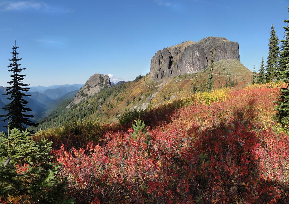
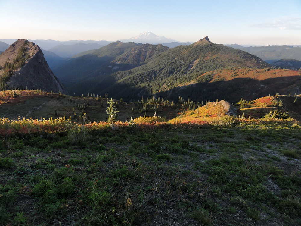
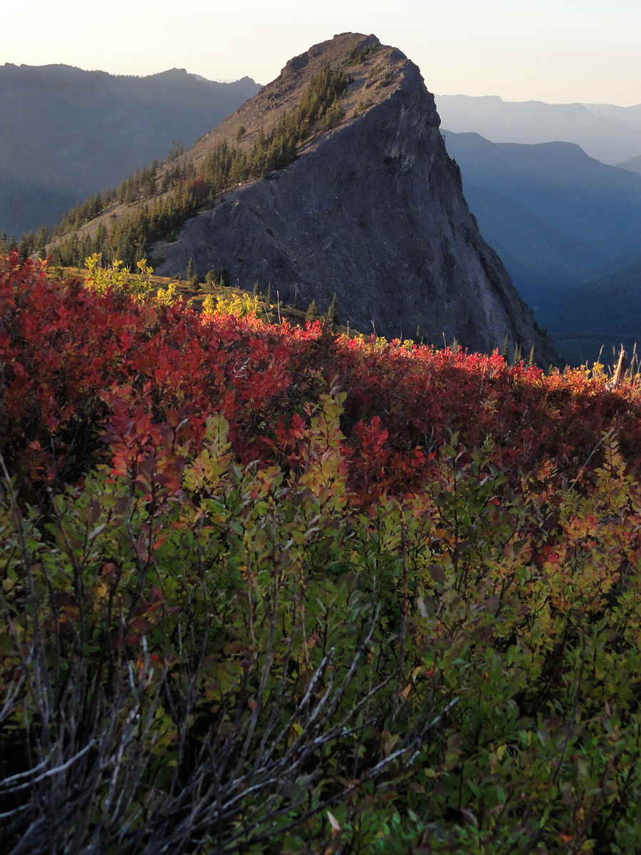
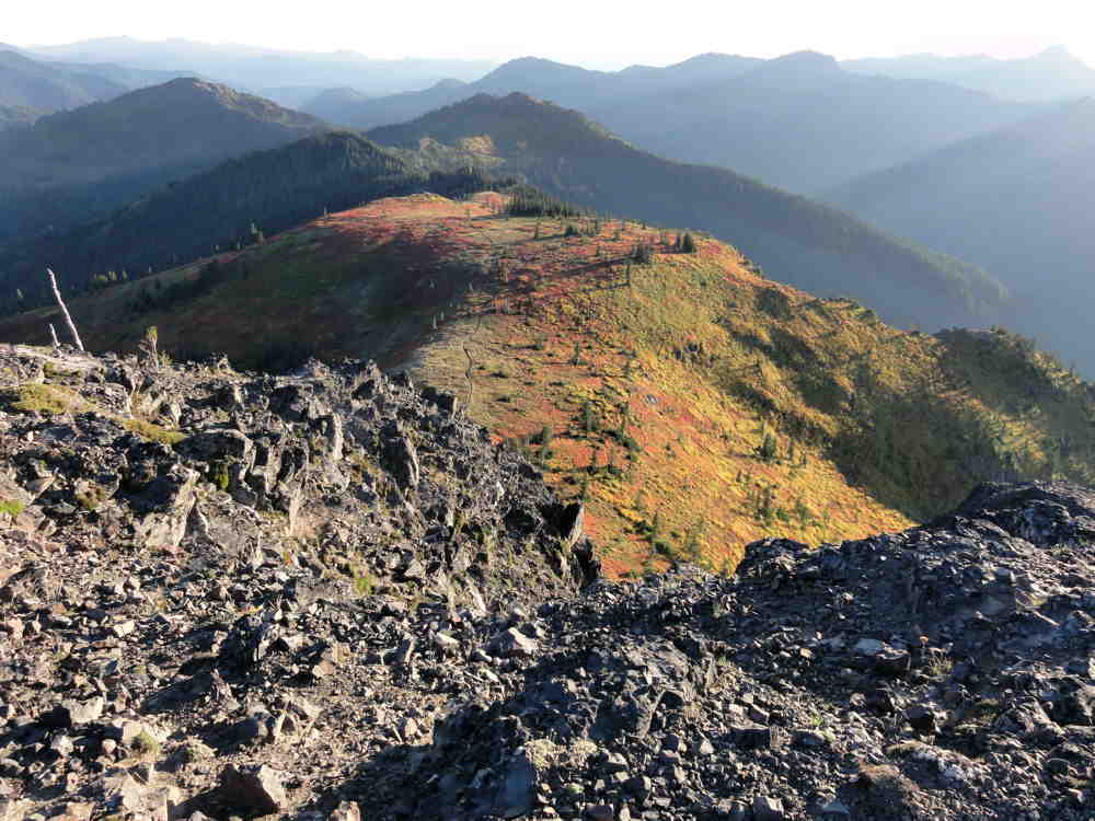
A walk in the cool warm light of evening.
After deciding on the coziest, most level place to sleep, and the one with the least wind, I went looking for Jumbo's flat top.
From the south Jumbo Peak resembles a monumental basaltic cork, frozen in place after the volcano it was once part of decided to give up on its reach for the stars, and died. Once you arrive at the top it's obvious that Jumbo isn't a big cork.
From my campsite.
As noted before, and as should be clear from the Google Earth images, what looks like a fat, clunky plug from one angle is really the intersection of two volcanic veins. These come in from the north-northeast and from the northwest. Only at that intersection is there any thickening, giving the illusion of a squat, flat-topped plug, like what you'd see if Devils Tower in Wyoming was sunk to its hairline in its landscape.
Jumbo ain't much like Devils Tower.
Google Earth. View from the south. Jumbo at center.
Jumbo is spooky, if you're up there, alone, at the edge of night, in the wind, and no one else on earth has any idea that you're even out of town.
Google Earth. From north-northwest. Jumbo top center.
There is room to walk, especially in a north-south direction, but pay attention.
Google Earth. View from the south. Jumbo at center.
This is not a big, flat, rectangular floor, carefully swept, scrubbed, and waxed. It is lumpy. It is uneven. It is not like home. The slope is variable, and goes chasing off here and there, most notably at the east where everything ends and there is a deep void in the landscape. Here you find only sudden air and the suck of gravity.
To north. Rainier top center. Sunrise Peak upper right.
Given that this place is big on a human scale, there is surprisingly little room, and too much unevenness, overlain by unkind debris that has collected over centuries.
So, big deal.
No unique adventure, except what you bring to it.
Volcanic fin or ridge northwest of Jumbo Peak.
I manged to pull myself up the wrong route using huckleberry bushes, wandered around until it was clear that the sun really was setting for the day, and came down an easier route. I was there, and can say that, but there wasn't enough drama to make a story out of, and no kinky spiritual revelation from getting high.
The trail around Jumbo skirts its western side. I camped to the south, in a small grove of trees. Tromping back north for a look from the top I took a side trail that looked to go there, but this only got me over the western (lower) ridge and dumped me inside the wide part of this mountain's V-shaped north side, where the trail then disappeared.
On top, to south. Campsite in grove near top center.
There were footprints going up from there, and generally that means someone with a clue has been by recently, so I followed them. This led me up and back toward the western ridge. But the footprints then faded out and I decided to keep climbing from there.
The place, wherever it isn't bare rock, is brushy with huckleberries.
Or if there are trees, and there are some, they are small and hug one another, and leave no space for
Tiny fossilized demon.
So at the altitude where the slope reaches toward vertical I had the choice to descend and try the other way (safer, slower, more of a sure thing) or to continue, by trusting in the shrubbery, that it would agree to I pull me up (not safe here, not a sure route, probably slower than it looked, but closer to hand).
So guess.
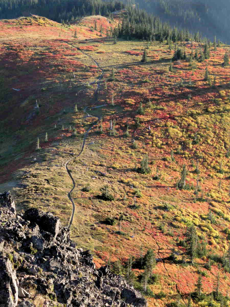
Trail to south. Campsite in grove at top right.
I chose the dumb way, to continue, hoping not to lose footing and go bouncing down several hundred feet (ever so many meters) to die alone in the dark.
It worked. (Still no story material. Sorry.)
Looking north atop Jumbo. It's really a narrow ridge.
The other ridge, the other leg of the big V, to the east, is much longer but has a few trail-like stretches. Getting down, there, was easier, so getting up would have been too. Too bad for me.
On the south side of Jumbo, in the bare rock, there is what looks like a steep stairway, and there are those who ascend or descend this route. From the bottom it appears almost convenient, at first, if you think that a 75-angle is convenient.
But seeing it from the top is a whole notherness.
Spooky backpacker-type critter.
From up top you'd have to scramble down a long way over rock with a thin layer of treacherous scree to reach the top of this notch, and then, and then, if you were still up for it, to navigate down that route. Backward, of course. My little hairs still tingle at this thought. I'll never be a climber.
Meanwhile, back on top, the view isn't that great, especially for photography. There's nothing there to stick in the foreground for scale. You have the spot where your feet are, and a little space between you and the death edge, and a horizon miles out there in the haze. Kind of boring really.
But worth the effort. Cool place. Accessible. Near where I live. Little known.
Could have been worse.
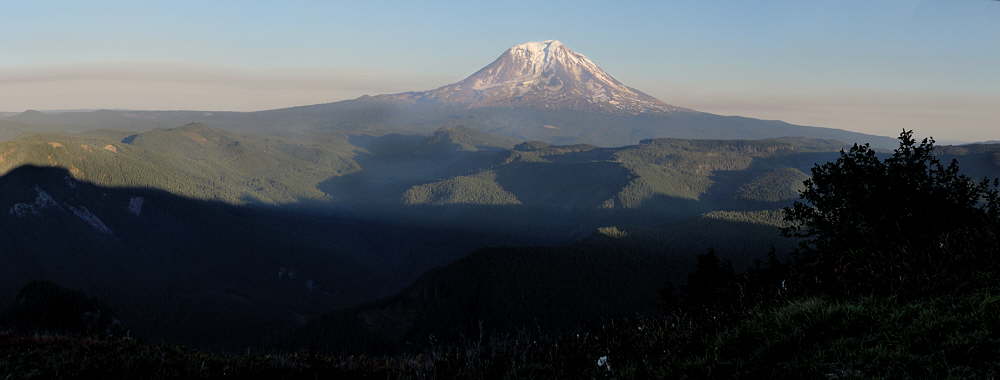
Mt. Adams to east. Haze, etc.
Footnote on the weather.
The high country here was socked in by snow until sometime in August. After August came the rains, for almost all of September, which is usually dry, clear, pleasantly not hot or cold, and bug free.
Then there was a sudden window, meteorologically speaking, enabled by Washington's geography.
Going from west to east there is the Pacific Ocean, the Coast Ranges, the lowlands, the Cascades, and central Washington. Central Washington is high desert. Given high enough atmospheric pressure, the already dry air of the Inland Northwest is pushed to rise and dry more as it is kicked west across the Cascade Mountains, opposite to the normal flow here. This brings warm clear skies into humid lowland areas between the coastal mountains and the Cascades, and a steady easterly wind.
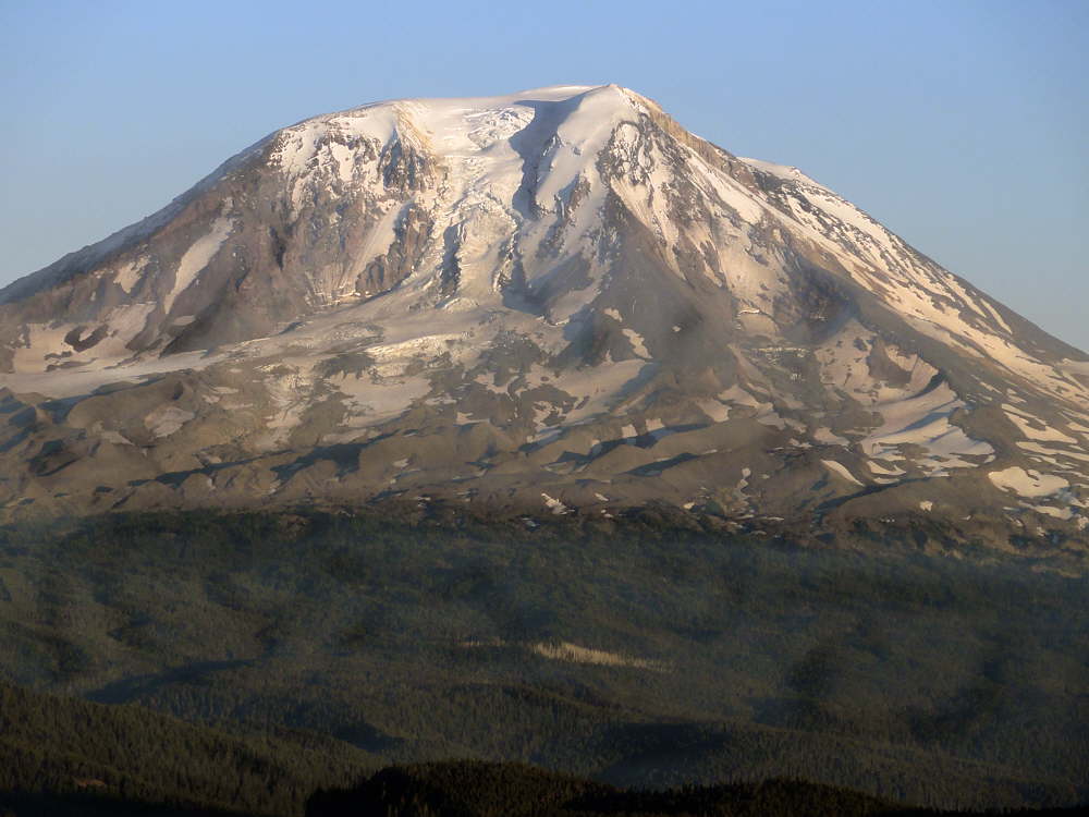
Mt. Adams.
When this happens in summer the temperature pegs at "bake", and things start to melt, or turn dark and smoky around the edges. In fall, as happened this year, what heat there was, and the accompanying wind, shoved September's gray drippiness aside and created a few days of pleasant clarity within its protective bubble. This September still harbored a few bugs. Even though mosquitoes were down, mostly, flies are hardier, and lingered, but the wind dealt with them well enough.
After three or four days of this the high pressure weakened. Warm and dry air out east sank back behind the fortress walls of the Cascades, and Western Washington once again vanished into its customary moist gray cloak.
But for a while, a few days, a brief spell, a moment, it was glorious. It really was.
See tabs at the top for definitions and books.
Have extra info to add?
If the commenting system is out again, then email sosayseff@gmail.com
Me? Recently nominated for this year's Doofus Awards. (Next year's too.)
