A short trip in a short time.
The way out.
This post wasn't working. I was a day late and disappointed. Pretty much as the trip itself went.
The photos weren't coming together. They're mostly crap, but they have some value, so I decided to stretch this out over several weeks and see if I could think of something to say.
I mostly just wanted to go to bed and forget it all, but I do a lot of that anyway, and that's wearing thin, so time make it or fake it is what I decided, and try something new — do a post backward and see what happens.
Day Four — It's over.
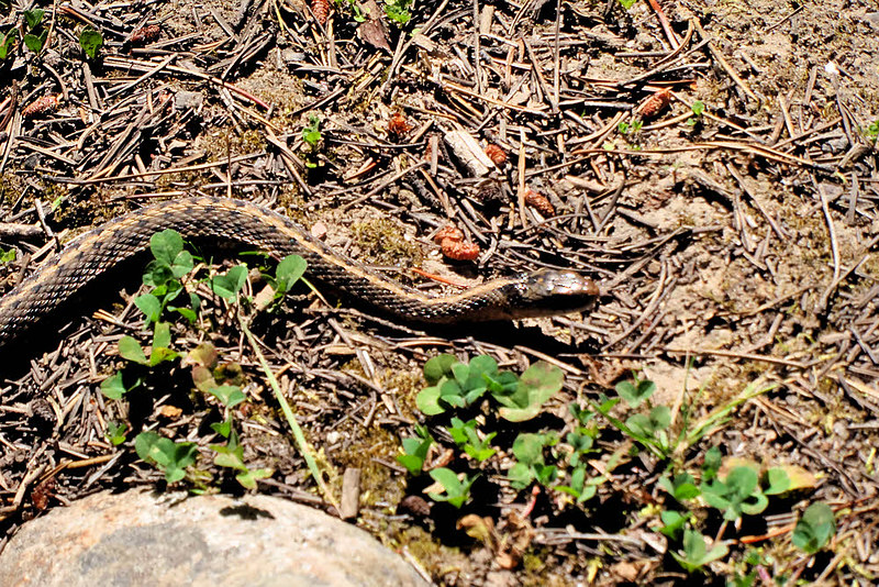
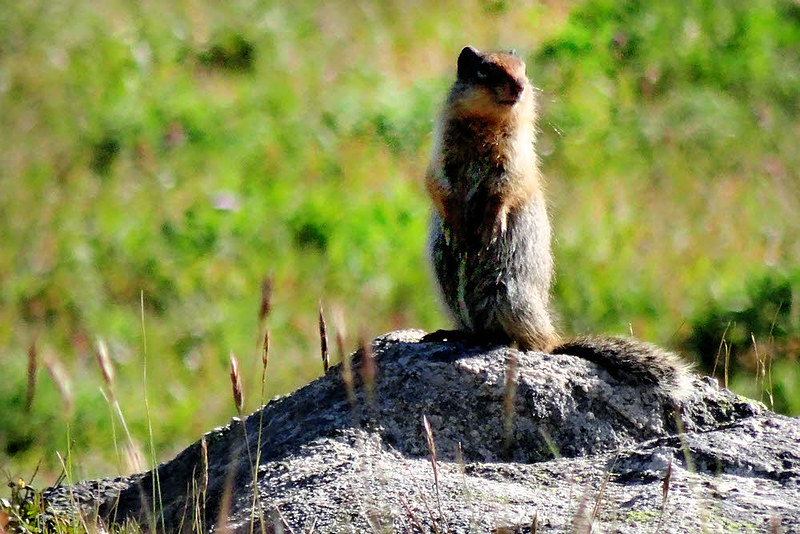
Fellow stroller.
Glad to be done, sorta, and anyhow I have an excuse — the rain is coming. I don't do well in rain. I keep thinking it's no big deal, until I see it headed my way. Then I panic and run for home. I'll have to grow up one of these years. Maybe.
The two guys I passed earlier today were about my age. I'm not particularly light this year — had to throw together what I could on short notice, and it wasn't the best selection of equipment, but these guys...I don't know. They're in for a helluva time. They're going uphill. I'm going downhill. They have a couple of those big, armor-plated packs. I think one is an Osprey but I'm not sure any more. You know the kind. Full-bore commercial pack. Probably weighs five pounds empty. Maybe it's what you use. Hard fabric so stiff you need a tire iron to fold it. Designed to last a thousand years. Impervious to everything this side of the slow, inevitable death of the universe.
They were sweating, moving slowly. They wanted to know if there was much to see up at the tungsten mine. No, but it's a place. It's a high point. It's a turnaround. Make it there and you can go home and not have to say you gave up on anything. Especially if you're sweating as much as they were. I'd guess they were carrying 35 to 40 pounds apiece (16 - 18 kg). That's a lot for a two-day trip, three-day trip. I used to do that. Not now. I have improved slightly. Anyhow, I'm headed out. This is the last half of my last day. I had to come here, visit Cathedral Peak, pass by. Now I'm nearly done.
Ever wonder what it's like to walk without legs? Inquire here.
It's been tough. Tougher than I thought. Different. The first time through on this loop was fine and dandy. I'm beat now. Had enough, and it's been only four days. Not quite four days at this point and I've had it. Don't care. Dropping into a quick summer of backpacking without a slow lead-in is turning out hard so far. St Helens a couple of weeks ago wasn't fun at all. Only annoying. Too hard, too dusty, too hot.
Pretty much like the Pasayten Wilderness now. Maybe I've been expecting too much. It was nice the first time I came here, years back, about a month later in the season, but that was right at the beginning of "high buck" hunting season, whatever that is. Men with guns were trickling in. I don't need that again.
Now, this time around, there are no guns, but some of the trails are goofed up. Things don't seem to be where they were before, and it's tedious with the fun parts missing.
Yep — too rushed. I have only a little time this summer to do a bunch of things. Cramming and ramming things together is the opposite of a good backpacking trip, which is another reason I'm not enjoying it.
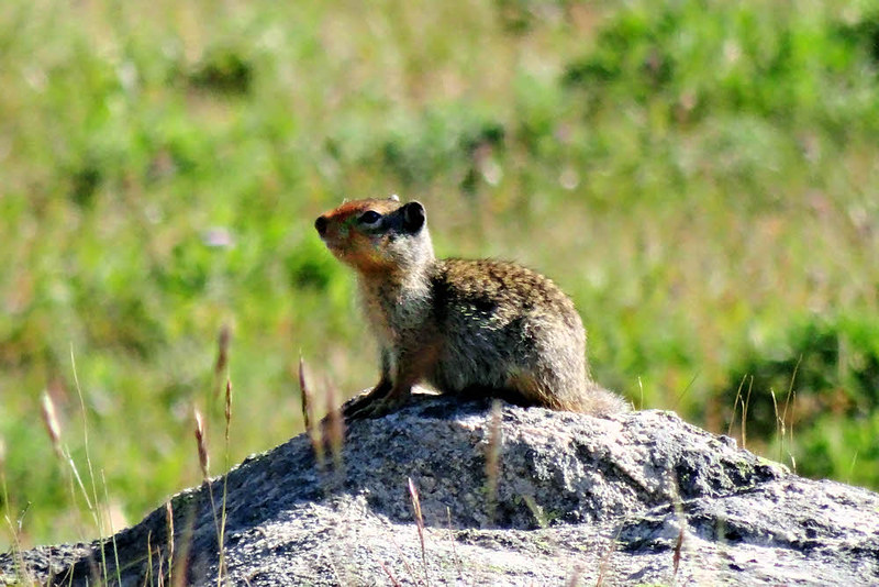
Local color.
Last night was nice though, after I passed Cathedral Peak, the lake, and made it down the rocky trail from the tungsten mine, though those three long stretches of muddy trail were not pleasant in any way. It's good that I didn't take that route last time. I don't know where all the water came from. This is a dry year. Very dry, and here is this whole wide trail, formerly an access road (that's plain, though it's been long out of use), thoroughly wet, flowing in parts, with almost but not quite enough stones in it to keep a person's feet dry. Slow going.
At least I made it most of the way down before plutching a foot deep into it. Not too bad, really. The camp site I found almost made up for it.
Emptiness.
I came to a clear stream and crossed it, then thought about it and went back, and off to one side. It was quiet there. Quiet and lonely. There was no one behind, and with it being Sunday evening and all, there was no one coming in. Just me and the stream and a silent forest. That was good. I don't need much. I washed and ate and went to bed in my makeshift hammock. I know just enough to make a hammock that works, though it's awkward and goofy and thrown-together and too heavy, but it works.
This morning I continued heading out, the last two or three miles, trying to beat the rain.
Ah — some fellow hikers. Maybe they'd like to share notes...
I beat the rain. I did, but I made another mistake.
I should have stopped at Wenatchee but instead I drove past it and took Highway 2 west, as though I have a home to go back to. I connected to I-5 at about 3:30 this Monday afternoon, and had — What was it? — 85 miles of rush-hour traffic? — almost all the way back to Olympia. And once there, once here, I have no place to go. Except my choice of staying in the state park for $25 or driving out into Capitol State Forest and parking in the trees for the night.
Why didn't I at least stop at one of the parks in Wenatchee? I don't know. I need to get smart.
The rain is over, but it would have been over in Wenatchee too. I like Wenatchee and I'm not there. Now I'm tired and disgusted and not sure what to do next.
No, no time to talk — just going randomly in all directions.
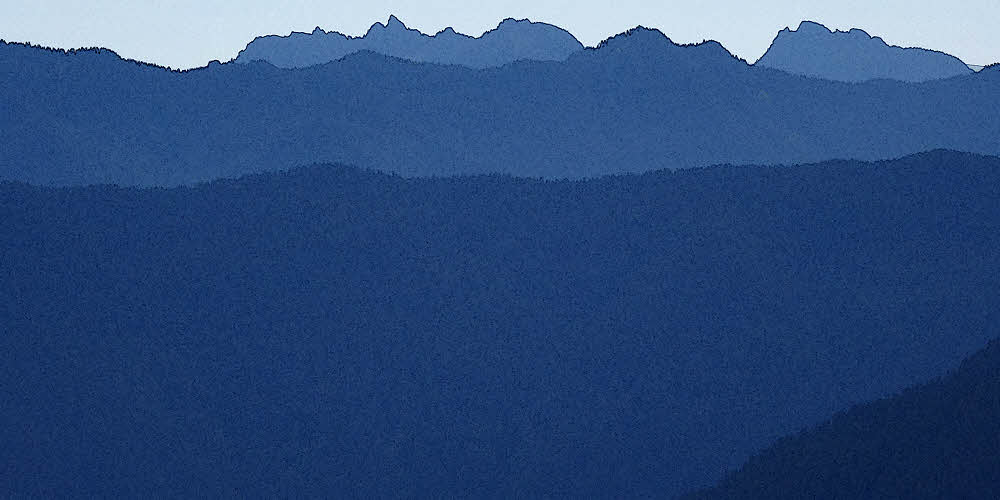
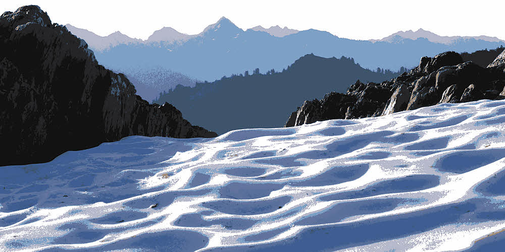
Day Three — Past the cathedral.
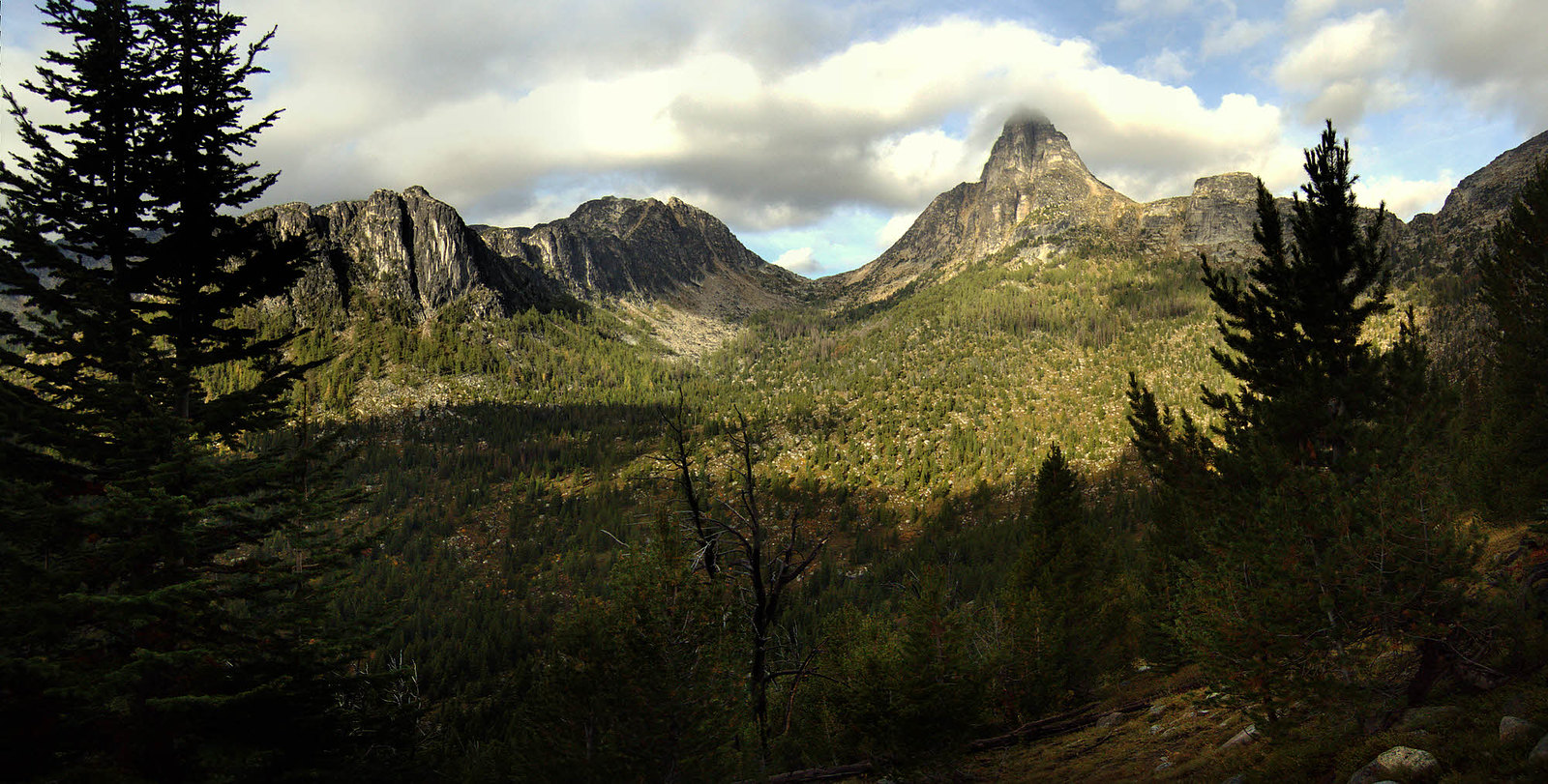
Amphitheater Mountain, Cathedral Pass, Cathedral Peak. (Image from 2009.)
Man, I wish I'd shot some images of my campsite last night. I'm playing it cool, trying a new approach, only shooting what I think is the odd stuff. Not pointing the camera at everything that comes along. Reaching for a new technique. Maybe it will work.
As if. Maybe I don't care right now. Maybe no matter how boldly I post what little I end up with, maybe I'm the only one who will see any of this anyway. Little excitement, no recognition. Such is life as a single electron.
But the campsite was fine. I wish I knew where it was. Couldn't find it on the map when I was actually there, can't exactly figure it out now.
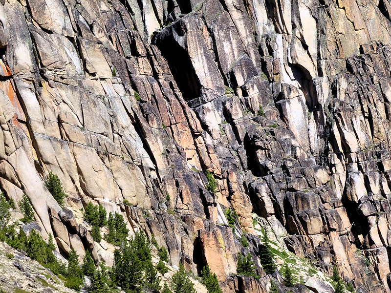
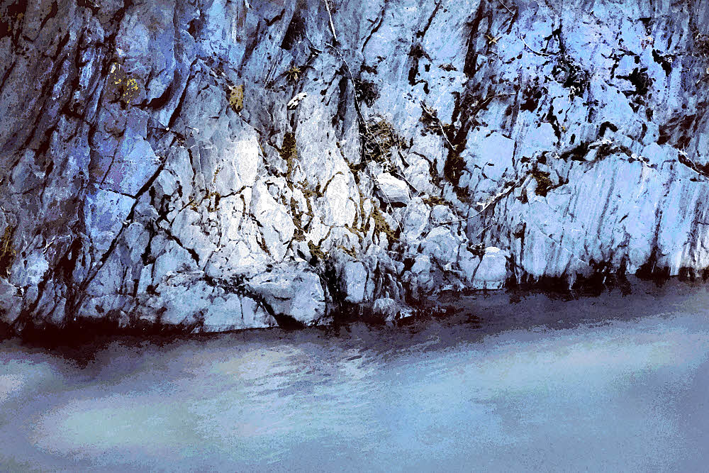
Valley wall at Cathedral Lake.
Night-before-last (Day One) I was at Four Point Lake under the brow of Remmel Mountain. It's hard to remember where exactly I was or what the names are because I discarded my maps before returning to Ecuador for the winter. And didn't take any notes.
Anyhow, that was then. Back to today.
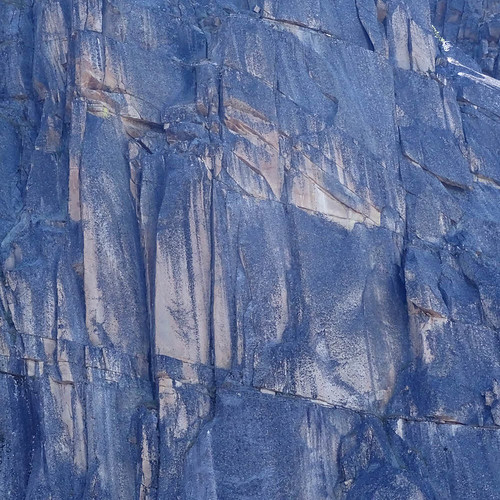
Valley wall at Cathedral Lake.
Last night I deliberately overshot the turnoff toward Cathedral Peak, looking for a campsite. Then I went farther, and farther, and it didn't look good. I saw a sort of nice-ish place but not great, so I kept going and things got less nice. Then I turned back because the place I had passed over had water. At least.
I wandered around in circles and found a sort of flat a couple hundred yards off the trail, with nicely-spaced trees, sort of a woodhenge-feeling location, and just dandy for a hammock. Fine. Fine and dandy then. Back to the creek for a bath and cooking water, and I was set for the night.
This spot was hidden from the trail, far enough from the water and high enough not to have a problem with dampness or cold breezes overnight, and nowhere near where anyone else had ever camped. Just about perfect. Didn't see anyone all day, didn't hear anything all night.
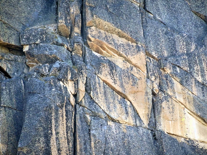
Valley wall at Cathedral Lake.
Today (Day Three) I headed back east, connected with the trail to Cathedral Peak/Cathedral Lake, and got lost.
I can get lost in my own bathroom. It's a talent. I'm well practiced at it.
Headed north, I somehow missed the obvious turn, or more properly, I took a turn when I should have gone "straight", and ended up looping back west and intersecting the first part of the trail I'd been on this morning. Which is confusing because going "straight", or sticking to the proper trail meant making a right turn, and turning off the trail meant actually going in a straighter line. (You had to be there.)
It was all so obvious at the time that I didn't bother checking the map, which would have helped, but why bother? I mean, it was so obvious. And if I hadn't gone off the trail I never would have found that great little bridge going over that wonderful little clear trickle of a tiny creek, and couldn't have stopped there to eat.
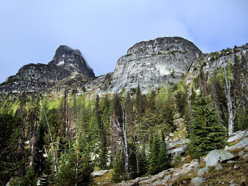
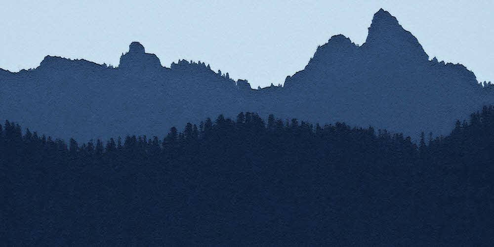
Cathedral Peak. (Image from 2009.)
So, fine. Color me dizzy. It's a nice day. I had some happy minutes after the swearing was over with.
Last time through, in 2009, I camped at Cathedral Lake but this time I was thinking of the tungsten mine area. So here I am at the tungsten mine site and it's too early, even though I've put on some miles today. I've gotten lost, wasted time, gone in circles, deliberately passed Cathedral Lake, continued on a few miles to the tungsten mine and it's early and I don't really like it.
Last time through, I continued far east to Horseshoe Basin, but I'm thinking No, not again, not this time. Not today. Because the trail out of Horseshoe Basin and back south from there to Thirtymile trailhead was disused and faint then, and coming in this time, two days ago, I could hardly locate it when I passed the junction. But more importantly, things are dry this year. Really, really dry. There is a little stream (Basin Creek?) paralleling the last part of the drop down from that route's 8200-foot (2500 m) highpoint, which is Windy Peak, I think, and the stream is dust, definitely. Too iffy. Don't want to get up there, lose the trail a third of the way down, and then go dry and get into real trouble, so then what?
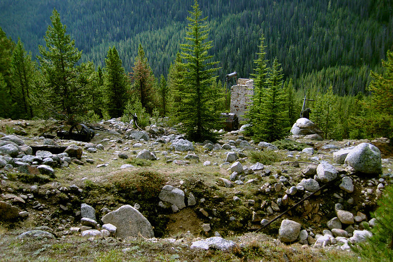
Tungsten mine site near Wolframite Mountain. (Image from 2009.)
It seems like the only reasonable thing to do is to go south from right here, at the tungsten, mine and see what's along this trail. Overall, the trip will be shorter, less scenic (possibly), and I'll end up covering ground that I walked two days ago, after seeing a new stretch of trail. But that's better than getting lost or hung up running a day or two late, without food and without water, so I go south. Right about now.
As noted under Day Four, the trail is unpleasant. Nice enough in its brutish way, as most trails are, though lumpy. Lotsa rocks. Then mud. Not nice. Mud not nice. Not like mud. For such a dry year there is an ungodly amount of seepage coming out of the mountain to goop up the trail. There is even a bit of current in spots. "Current", maybe. A tiny bit of flow. Creeping seepage.
I have to keep asking myself why I'm walking this route. I keep getting the same answer: Because it's all you've got.
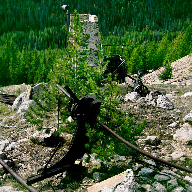
Tungsten mine site near Wolframite Mountain. (Image from 2009.)
Mostly, being careful, I am able to tiptoe from pebble to pebble, which makes for slow going, but dry feet. Then I am not able to. I put a foot in it and get damp. But it's not that bad. Only a slight wetting. Then I do put a foot in it and get mud — all the way through. Through the shoe, and the sock, and it's all wet and so is my foot. Then later yet it's more mud and water and pebbles and slow going, but only the one foot gets it all. This continues about forever, until the trail levels and levels some more, and some more, and I'm in a deep but young forest, of thin trees and here is a stream.
Beautiful. Lovely. Quiet
Where the trail crosses this stream I camp. Nice. I usually camp well above and away from streams but don't have much choice tonight. I can get only a few feet of elevation on it but I'm far enough away that I can't hear it and hope to avoid the downstream overnight flow of cold damp air. I'll see. At least I got past the mud.
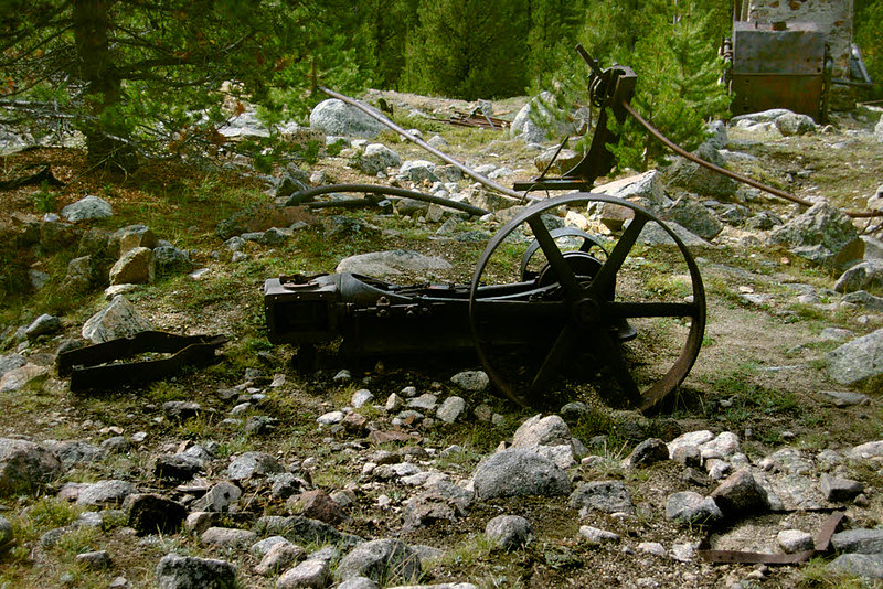
Tungsten mine site near Wolframite Mountain. (Image from 2009.)
I manage to put up my hammock perpendicular to what the downslope flow of air is likely to be, wash and eat, and that's it.
Time for bed then. My hammock is waiting and I am ready for it. I know that rain is coming sometime, but I think I have another day yet.
Day Two — Four Point To Somewhere Or Other.
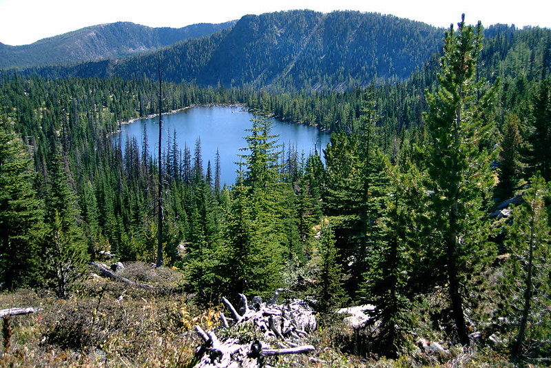
Four Point Lake, looking east. (Image from 2009.)
It's a good morning at Four Point Lake. No one else is here. I'm in a small grove off the northeast side of the lake, about 200 yards above and away from the nearest shore. Day Two begins.
It was a quiet night. To the left, upslope and northwest of me, a hard rocky ridge catches a bit of morning sunshine. It is cool, but so is every morning. I've had a quiet night, my favorite kind, and am ready for the new day.
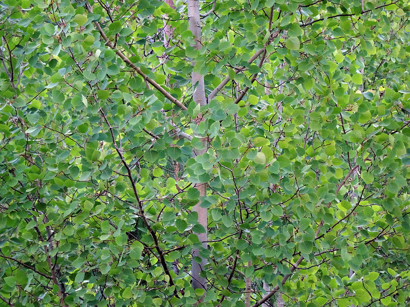
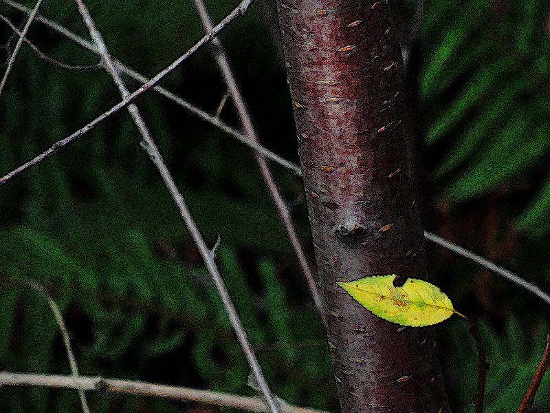
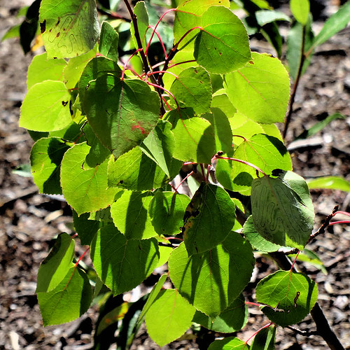
Poplar in quiet shade.
Yesterday was a little odd. (I'll save the exciting part for the next installment of this backward post.) I hiked along the Chewuch River looking for familiar spots and didn't see any of them. There was a woman here from Everett the first time I came through. I think that was in 2009. I met her the first day and she alerted me to the Border Patrol cowboys riding around on horses and checking the identification of hikers.
Then I headed up to Four Point Lake that time as well and came across her later, not yet breaking camp along the river. I haven't found that place today. It was a distinctive location right alongside the trail but I still couldn't see any trace of it. Gone. Gone somewhere. It's in with my other memories but no longer a part of reality. I can't find it. Nor most of the other spots I remember.
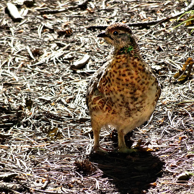
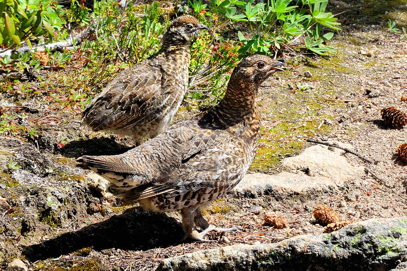
Immature blue grouse on trail.
At least I did find Four Point Lake. That is still real. Losing a lake of two or three acres (a hectare or so) would be really odd, but it was there waiting.
So this morning, it's back down the spur trail and then west.
It's a pleasant walk. Somehow I manage not to use my camera, not to use it much. I capture photos but later am unable to separate them into this day versus that day with any certainty. I am there. I walk. Time passes. Eventually the day grows late. I am in no hurry all day but every day ends and I need to camp. Nothing looks good.
Possibly a shadow, possibly a deep but fleeting meaning.
I walk farther and farther west, long past the turnoff to Cathedral Lake. I'll get to that tomorrow. It will wait, but now I need a place to sleep, and I don't see one. The trail begins descending, and crosses a small creek on a small bridge. Well, there is water here but otherwise the place doesn't seem particularly friendly. I continue.
As I do the trail descends more. My map says that I'm on the Boundary Trail, and before too long I'll hit a section of long, looping switchbacks and then be at the Ashnola River some way below, and will be far off my planned route. Things still don't look great for camping — either too open or too rocky or too brushed-in, and no water. I stop, think a bit, and turn back. The nameless creek behind me will have to do.
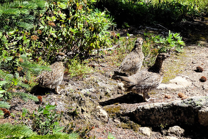
Peeping Pete peeking pensively.
I'm back. It looks the same. Not really inviting. The creek flows through a wide meadow and though the meadow is surrounded by forest, it's a loose forest. The trees are far apart. There is no privacy, and no possibility of a hammock hang here. I wander. Nothing here, nothing there...
I try farther out, to the southwest, looking, looking more. A little too far out there is a drop, and then what looks like a flat. Still open but well off the trail, well away from water, on an even and constant slope, and the trees look possible. I go there. It is delightful. I decide to stay. I negotiate with the trees for a hammock hang, and find another place for my food to sleep in safety. I feel welcome here. The trees haven't been planted but they almost form a circle. Good enough. No. Great. I like it.
Hey? Say what?
After arranging my things I return with only the bathing necessities to the creek, find a place, fill my water bottles, and try to keep inside a beam of sunlight while I bathe. The warm light comes and goes. I'm none too warm but get clean. Taking up more water, I return to my campsite and find a place to cook supper a safe distance from where I'll sleep.
Now it is getting late — just about right. I'm on schedule, in sync, on time. It has come together once again. I get everything put away and sink into my hammock. The night, again, is uneventful. If I dream at all, then I dream of yesterday, when something magical did come along.
Day One — A surprise finds me.
Cloudy. Somewhat. Rain is off in the distance, two or three or four days away. I know that, but today looks uncertain all on its own. Iffy. You never know. No choice but to hike or leave. Simple enough. I can handle that.
Morning meets the Chewuch River.
The other guy who parked here is still asleep in the back of his pickup truck, with his dog. It's early but I need to get moving so I start the engine of my car and move it off my level sleeping spot and park it right. It's a quiet car but I'm afraid that I wake him. I'm sorry.
Let's try a backrub.
He's a nice guy and even his dog is nice. For once it's a dog that doesn't snarl at me or bark, and has been quiet all night. Now I have to go and disturb both of them, but there is no way around that.
After the car is in place I move silently. I'm already packed, so I only have to get into my hiking clothes and stow anything valuable-looking into the car's back end. Doesn't take long. By the time I'm ready, my new friend is up. Up in time to say good morning and goodbye. He finished his backpacking yesterday as I was driving in, and now as I start backpacking, he'll be going home. Shift change.
Now a little leaning back and batting at this overhead stuff.
The sun brightens. The clouds break into small pieces and drift apart. The river continues talking to itself in the wet way of rivers. The trail lies beside it. I hike the trail.
From here it is a long way to anywhere, in any direction. This place, with the Thirtymile trailhead in the middle of it, burned out in 2006, during the Tripod Complex Fire. I was at the other end of the Pasayten Wilderness then, had begun a two-week trip a day before the fire started. Nearly walked into it. Changed plans. Changed direction. Bailed. That was July. The fire burned until October.
OK. Had enough — let's try something else.
This area had seen other fires recently not too many years before Tripod. You could tell. Some trees were dead, but others were curiously dark on one side. Sometimes black. The ground was clean. No twigs, no bark, no old dead shrubs. The grass was rich and tall and green. The Tripod fire blew through here and killed many trees but again left most of them standing. There wasn't enough fuel on the ground for a fire to rage over, so it kept moving, searching for a richer table to dine at. Until it lost itself in Canada.
Let's see...is there something fun this way?
Well, today there is no fire. Today the river is here, the trail is here, and I am here. I walk, along the trail, next to the river, looking here and there. Morning. Cool. Not too bright, because of the hour and because of the clouds. The usual. For a mile or so.
Sniff?
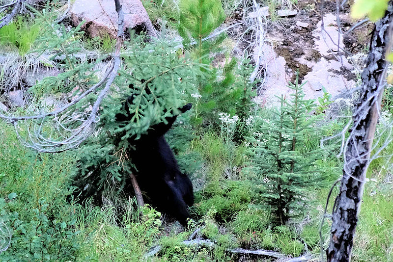
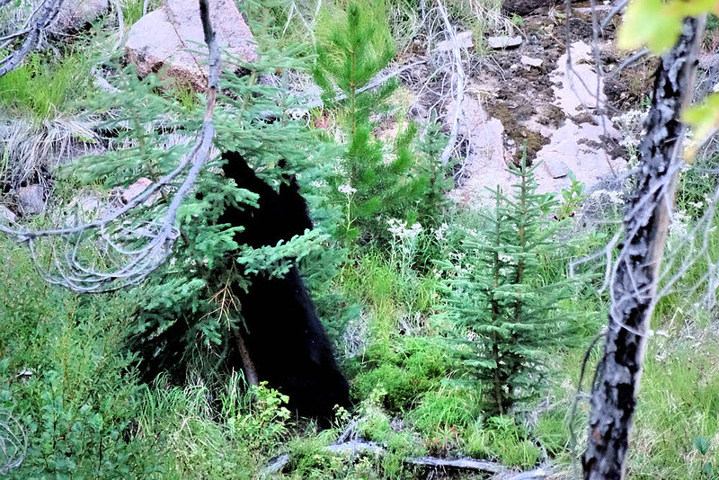
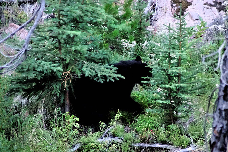
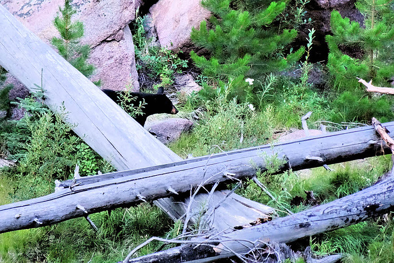
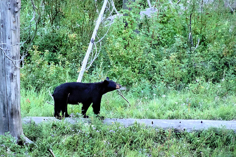
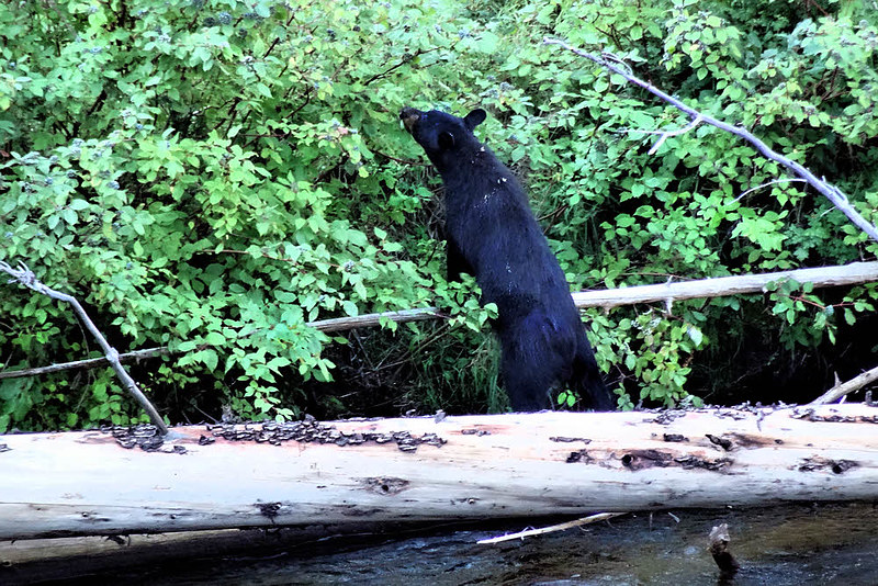
Then it isn't the usual. I find a friend. I see a bear.
The bear is across the river, in the shrubbery, playing. I didn't know that bears played. This one is playing.
Anything back here?
My camera is tight in its little pouch. Fumble. Pulling it out doesn't help much. Fumble. Fumble. It takes too long to get it switched on, and focused. Fumble. But the bear is still there. I grab a few shots. They are blurred. I keep doing this. The bear keeps playing.
I've been using a camera since 1973 and making the same mistakes since then. I should change my name to Dolt. Dick Dolt. One of the Dicktown Dolts. You've met my relatives. I know you have. We're all over. Fumble.
Nope. Maybe over this way...
I have trekking poles but keep forgetting to use them as support. One pole makes a fine monopod. Do I use it? No.
Two poles held together, along with one's body as the third leg, make a decent tripod. Do I do this? No again. We Dolts don't do that.
Ahhh — Smells like Giselle. I wonder where she is today.
So my first shots are hopeless smears.
Then I goose the ISO. Up to 800. It isn't enough, not hand-held, but 43 years of this isn't long enough for me to catch on, and I continue forgetting to use the trekking pole. Some of the shots might not be too bad, given enough editing, maybe. At least I have some that are recognizable, and the bear still doesn't see me, so it keeps up its bear dance.
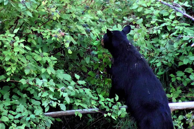
At first it's playing, like a giant black cat in a catnip garden. It stands with its back to a small tree, rubbing, reaching up with its forelegs to bat at the vegetation over its head. I miss all the best shots.
Well, no Giselle but it's still a nice day to mess around.
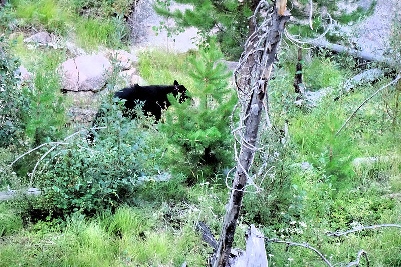
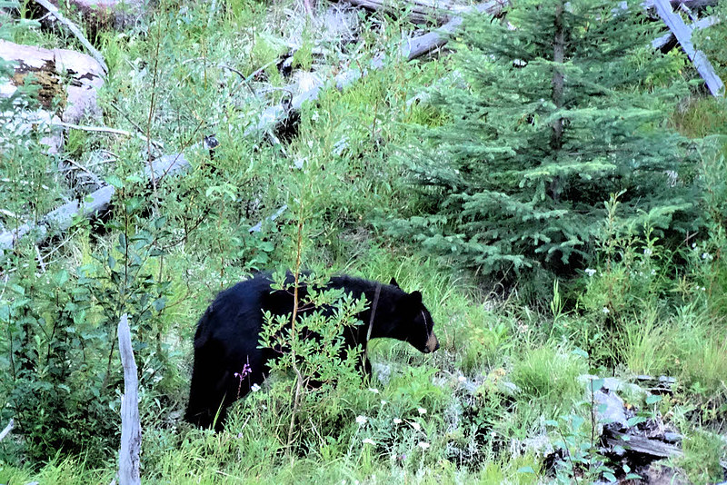
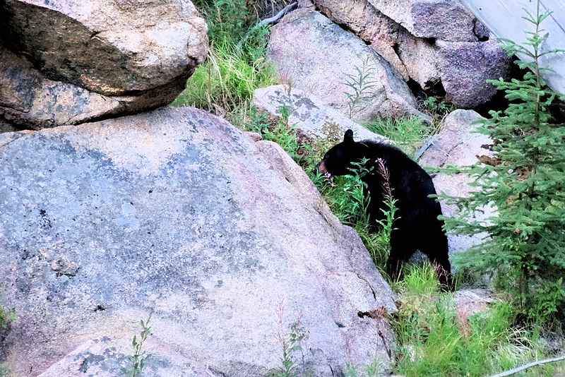
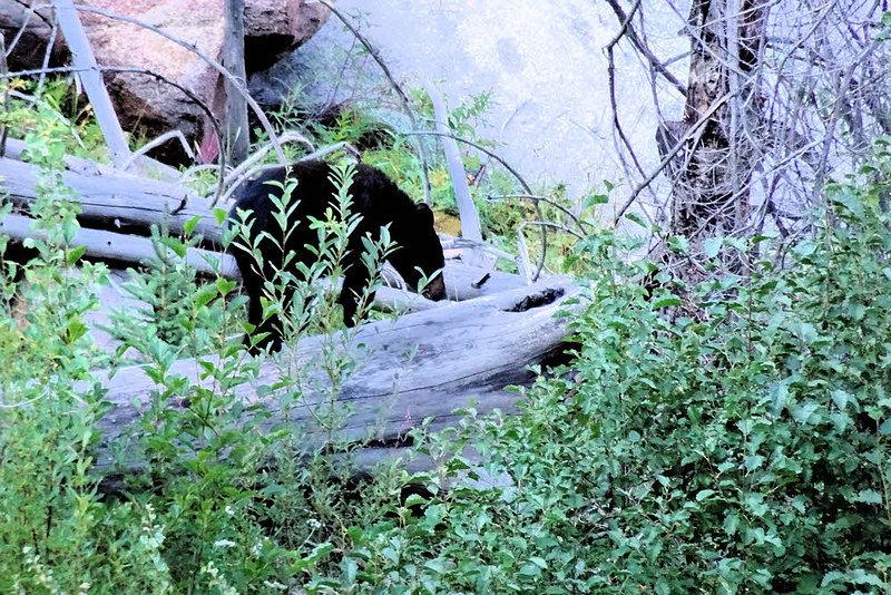
The river is wide enough and noisy enough. That helps. If I stand still the bear can't see me. I stand still. If I don't yell the bear can't hear me. I don't yell. I hardly move. The bear keeps at it, doing whatever it is that it's up to today. After getting its fill of shrubbery tussling it walks along the far side of the river and investigates this and that. I don't see a purpose. Maybe it has the day off. Maybe this is a fun bear morning in the park. It goes to and fro. It doesn't seem to be carrying a permit, unlike me, so maybe it doesn't need a purpose.
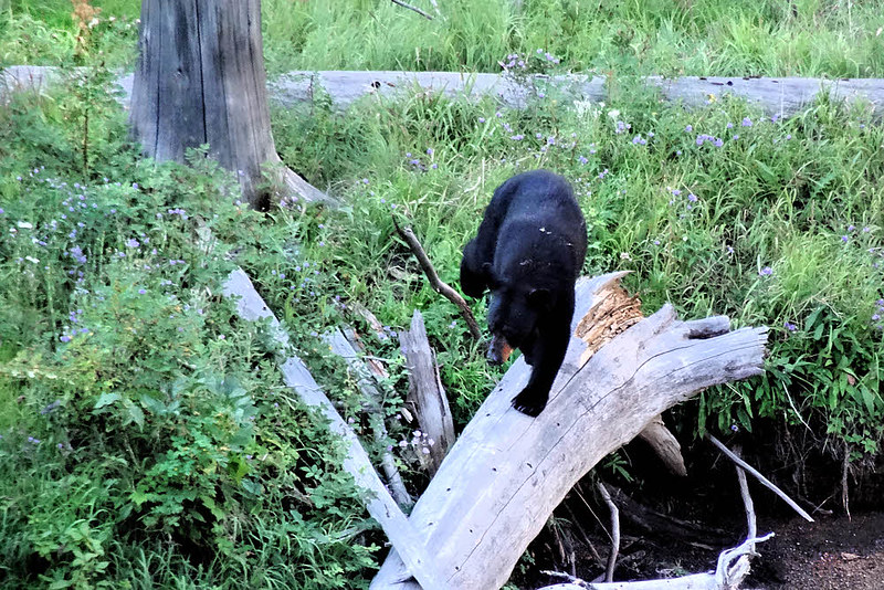
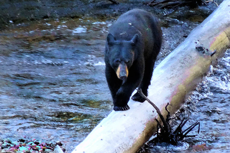
After half a dozen minutes, or more, the bear decides to approach the river. It finds a log and begins crossing. When it reaches my side, it vanishes in the willows. I put away my camera. Resume hiking.
I wonder where this goes. Have I been here before?
With the bear on my side of the river, I can't see it and have no idea of where it is or where it's headed. I don't want a clumsy meet-and-greet. Without the greet. No grip-and-grin desired. I move on. No point in ruining both our days. Even Dolts do the right thing every now and then. Even if only by accident.
Enough. I've gotten my blessing. I have lots else to see.
Eventually, miles farther on, there is a large flat along the river. I eat there, back, away from the stream.
Oh, wait. This is...interesting...
If OpenStreetMap, which is all I've got for maps as I write this, knows up from down from sideways, this is where the Tungsten Trail intersects the Chewuch River Trail. I think about camping here. The idea is inviting. So much space. But Four Point Lake isn't far, and I want to see it again. I cross the river and head south, mostly, and up.
Four Point Lake is all alone today. No visitors. I explore. Less than last time, when I went halfway up the far side of the valley, but it's enough for today. Enough to be sure that no one is here. Comforting feeling. No need to be someone when you're alone. Just be. Luxury.
Ah! Right here. Right...exactly...here. Mmmmm...
Now I'm near the end of the day. After eating I look for a hammock hang. I can't find the protected little spot that I had last time (someone always comes in and moves things around, and then your memory doesn't fit the facts any more) but I do find a friendly nook in the trees well above the lake on its northeast side.
Once that's over, it's back to the lake to grab water and pull back a respectful distance for a bath. This is not a huge amount of fun. The sky is hazy. The sunlight is weak, and fading. There is a breeze, luckily intermittent. But there is some sun.
OK. Time to see what's on the other side. Probably nothing new. But you never know.
Then the sun goes off somewhere over the ridge, and my bathroom becomes a large breezy refrigerator. Sometimes being clean isn't worth it. Sometimes it is. I missed a bath yesterday and have one today and then it's done.
After recovery, after regaining control of my limbs, after everything stops shaking, I fill up with water and climb to my camp site. By then I'm warm. Warm enough. Tolerably warm. Protected enough, by the trees. Cozy enough, on the mountainside. I sleep. This is good. Good enough. I've had worse.
Links
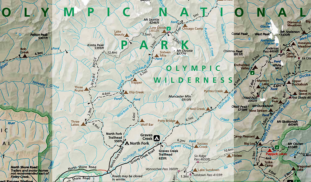
Cathedral Peak and Amphitheater Mountain, Pasayten Wilderness
Four Point Lake under Remmel Mountain
Forest was easy prey for raging Tripod fire
Western Wildfires Update