Thursday, October 24, 2013

Five Days Rocking With The Goats (Part 5)

Wherein I finally encounter a beast.

Dora goes missing in action.

Right. So another good night in the hammock. I could say another good night in the sack, but I don't want to be reminded of being a snack in a sack. Maybe I've just been lucky, but so far nothing has come along in the night and tried to eat me. Anyway, nothing big enough to take my hammock and me down in one bite.

Heading back to the main trail (which is also the Pacific Crest Trail), I found that someone had left a message for Dora. Since Dora is an explorer, I figured she'd be doing well enough, and didn't feel a need to get involved, so I tried eating some of the rocks that spelled out the message. Not much luck there. They were all actual rocks, and not hard candies, which spoiled the whole experience and left me a little sour on that whole "kindness of strangers" thing. So screw Dora and her friends.

Corn lily and blue doodles.

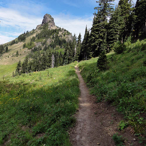
Continuing, I found plants.

Etc. Still blue, but with new friends.

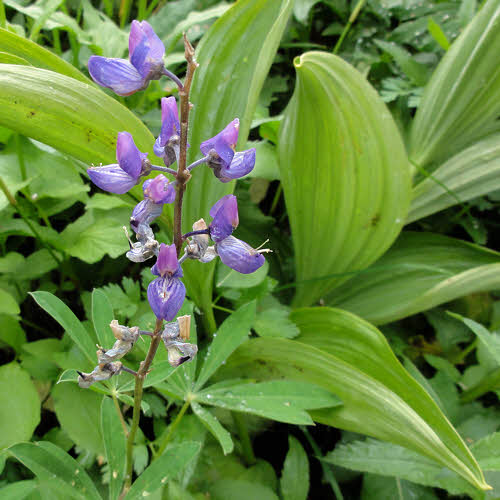
Some of the plants had flowers growing out of them. Maybe it was colorful parasites, but plants don't get a lot of sympathy from me, so I kept walking.

Yellow-Petaled Stem-Waver.

Then, wouldn't you just know it – there were more plants. Plants seemed to be all over the ground up there, like they didn't have anything better to do. I may have urinated on some of them out of frustration. Since then I've heard that plants actually like that, which gives you some idea of what they're really like, so now I hold it until I get home again. Take that, plants.

Morning rocks/Gilbert Peak. (Sans goats.)

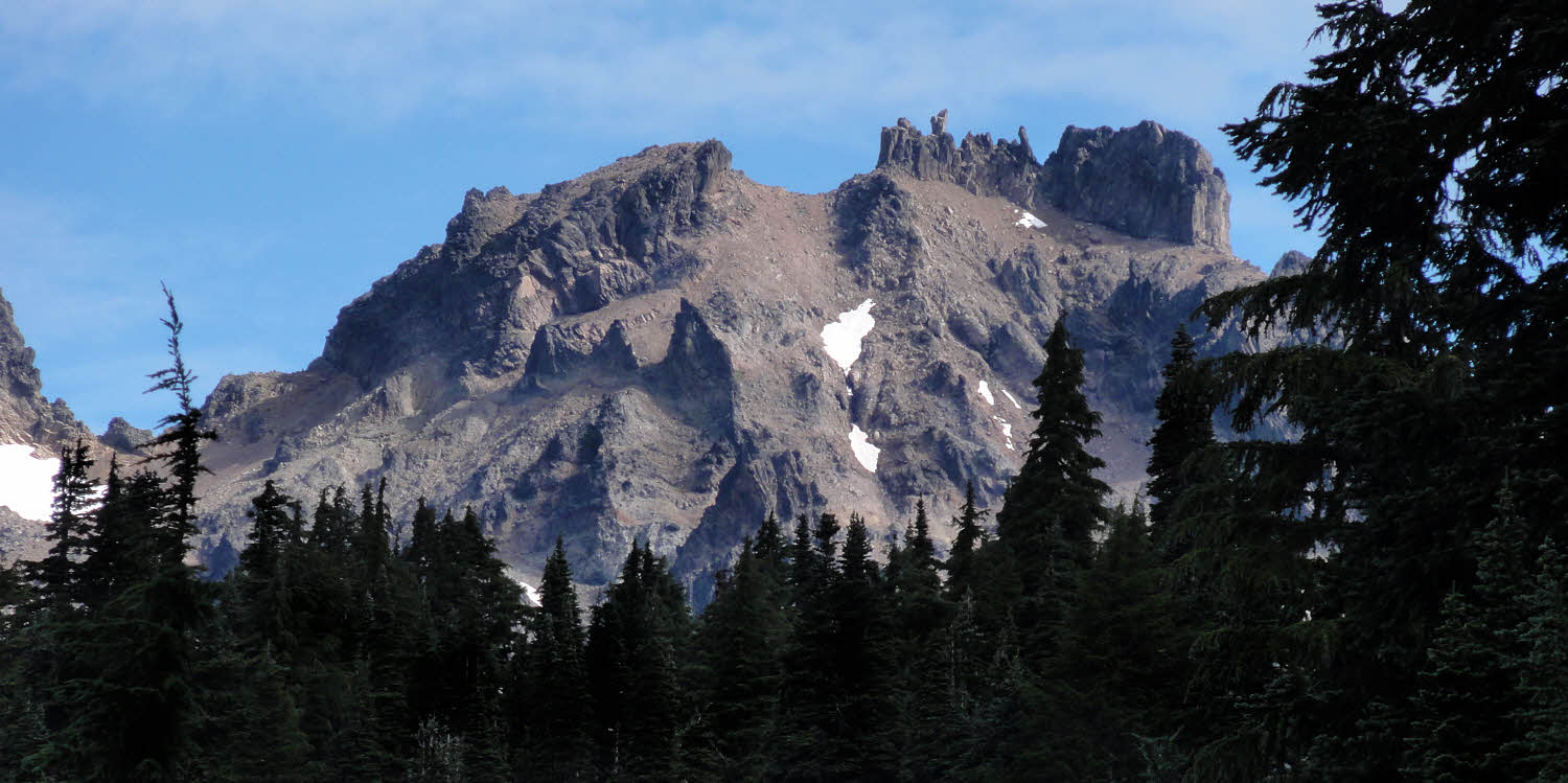
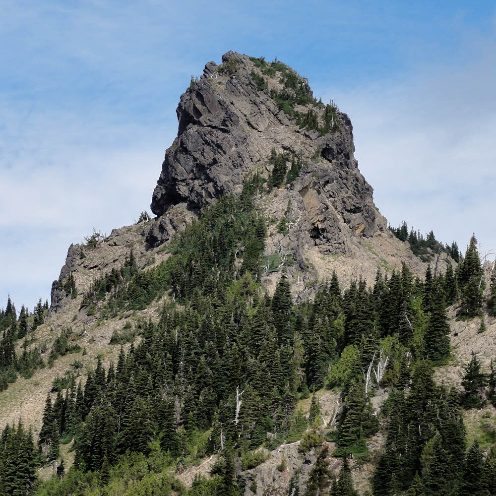
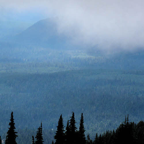
Eventually, I looked up. There it was. Gilbert Peak, formerly known as Mount Curtis Gilbert.

  • Type: Mountain/Rock
  • Elevation: 8184 ft / 2494 m
  • Consistency: Hard
  • Color: Gray
  • Taste: Mostly rocky with a crunchy texture and good mouth feel, though somewhat gritty. Practically no bitter aftertaste.
  • Locale: Washington, United States, North America
  • Mailing Address: 46.49000°N / 121.4074°W
  • Distinguishing characteristics: Old. Pointy on top. Somewhat crumbly, but heavy if you are the one that a piece falls on.
Closer, with pointy bits on top. (click/embiggen)

Or, as Becky Fred (Fred Beckey's former girlfriend) said, "A jumble of spires resulting from violent volcanic action, followed by periods of rapid cooling." Followed in turn by two million years of inactivity.

Closer, with even pointier bits. (click/embiggen)

But enough of that. Back to the trail.

The trail headed back north toward Cispus Pass.

There's this other thing – looks like a volcanic plug.

Unfortunately, the name of this isn't on my map. (click/embiggen)

I no longer have any of my nice Green Trails maps, and my current ones don't give any decent clues about this one, which leads me to suspect that it isn't really there, which would explain a lot.

Along the ridge approaching Cispus Pass. (click/embiggen)

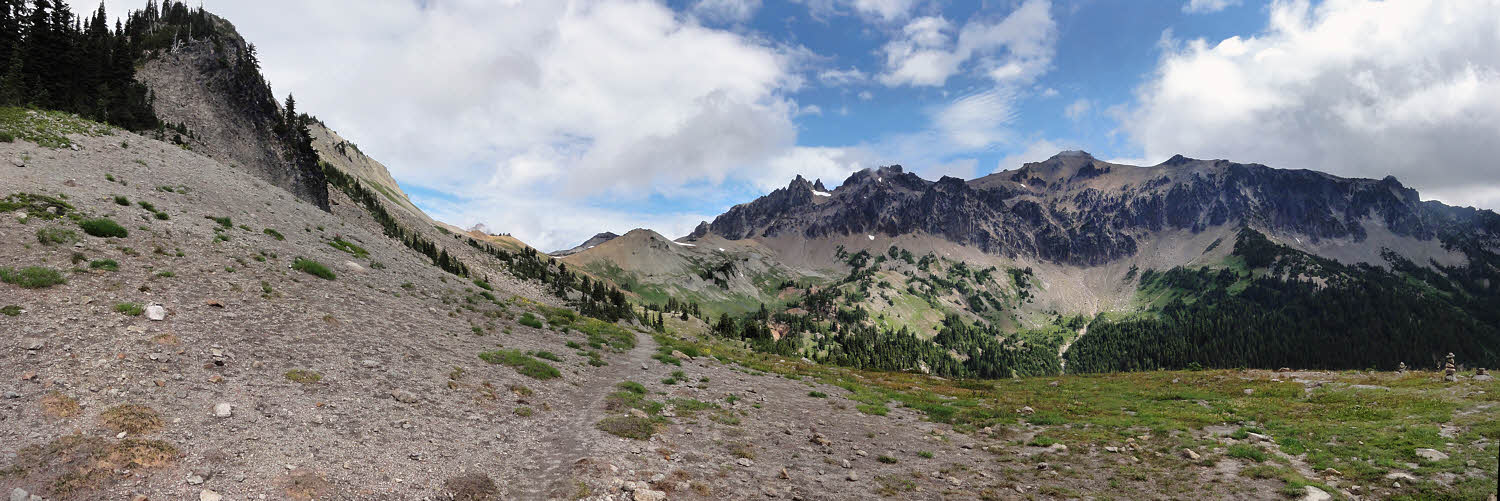
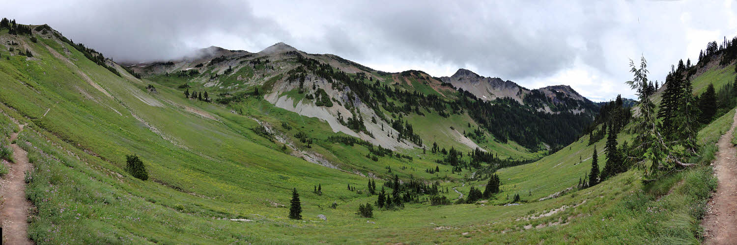
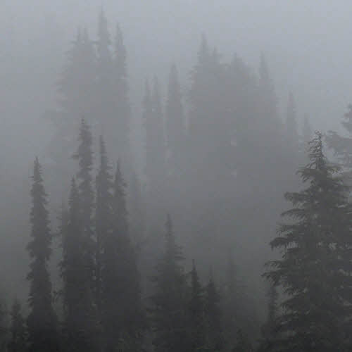
About then, as I drew nearer to Cispus Pass, I noticed that clouds were trying to sneak up on me from the southwest. They do that at times. I saw some of them scraping the ridge tops, which tells you about all you need to know about the intelligence of clouds. I mean, floaty and all, can go anywhere they want, and still they crash into mountains?

Gilbert Peak above Cispus Pass. (click/embiggen)

But quick to anger. I'm sure you've heard them growl, and at times they bite. Nothing that stupid should be allowed to play with electricity, but no one asked me up front, when there was still time to get the design right – they just went ahead and equipped clouds with heavy armament, and now where does that leave us? Oh, right – looking back over our shoulders.

More of the Gilbert Peak area. (click/embiggen)

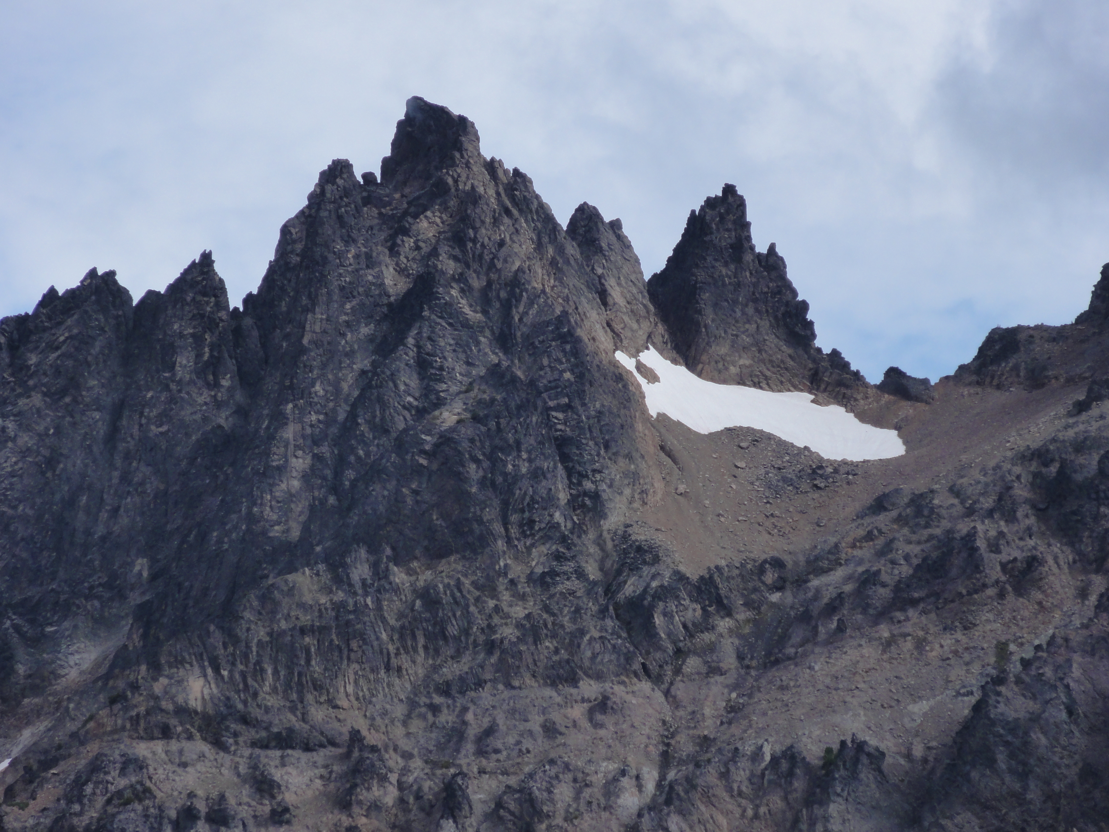
Even Mount Gilbert seemed to be shaking its pointy things at me.

Columnar basalt.

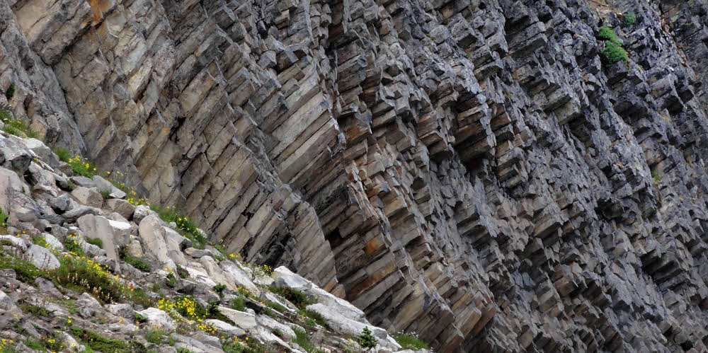
Meanwhile, over on my side of the valley, the columnar basalt was looking good. It's part of that two-million-year-old stuff, and has had enough time to cool and go chunky.

Solo woman and her arfy pal. (click/embiggen)

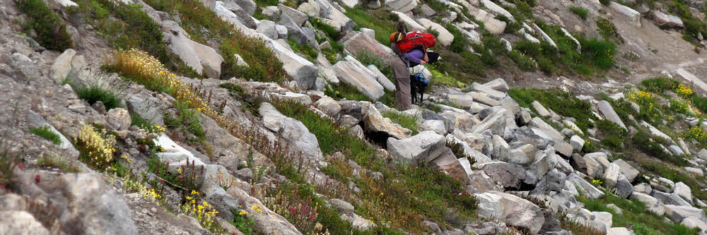
But to approach it, first I had to get past the dog. Dogs. They were all over. Everybody had a dog. Some people had two. I saw them coming in from all directions, but none leaving, so I had to do a lot of tiptoeing around them. Next time I'm bringing my cougar. Her name is Ellen and she likes dogs, which saves me a bunch of money on cougar food.

More columnar basalt. (click/embiggen)

So I pointed across the valley and said "Damn, look at that." Dogs, being even less bright than most backpackers, are easily distracted, and it looked away while I scooted past before it noticed. I did hear angry barking about a half hour later, when the dog finally caught on, but, you know – too late by then, right?

Mysterious mudslide. (Dry phase.)

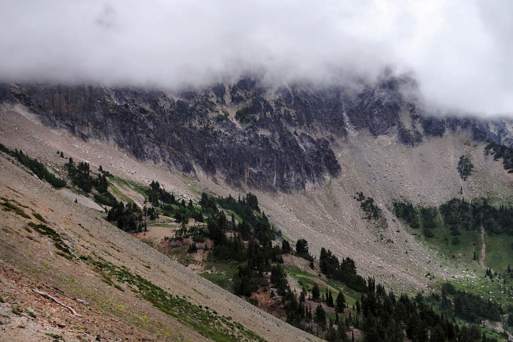
Even stranger, there were what must have been mud slides along the west side of the valley, at least a dozen of them. These were long, narrow runners reaching down to the trail from 100 to 200 yards up the mountain. The soil was soft, as though it had been deposited wet and then had frozen before finally thawing and drying out. I've never seen anything like that before.

Southeast into the Yakima Nation land. (click/embiggen)

A bit farther up and closer to Cispus Pass I noticed that the clouds were gaining on me. I tried making myself small so they wouldn't see me but they weren't bright enough not to notice, so that didn't work.

Yakima side of Cispus Pass. (click/embiggen)

They did help the scenery though. Somehow, sometimes, things look better when you can't see everything. I know I'm like that. People often remark on that quality of mine. It's like a talent, I think.

At the pass.

Since Cispus Pass is marked by a wooden board screwed into a tree, I found myself wondering what happens to the pass if someone cuts down that tree and takes it home? So I left it there. And does the elevation include how far the sign is off the ground? This information does not seem to be in any textbooks. Conspiracy? Hidden agenda? No one is talking, at least to me.

Cispus River.

Up here, the Cispus River is laughable, but knowing how touchy some inanimate things can be, I didn't laugh at it until I stepped over it, and then not out loud, in case it had friends nearby.

Downslope along the Cispus drainage.

Meanwhile, way down toward the southwest, the weather wasn't quite out of bed yet, but looked pretty rumpled and disorderly. It was still headed my way with its rain hair all disheveled.

Looking SE and back up toward Gilbert Peak. (click/embiggen)

Even Gilbert Peak or Mount Gilbert or whatever was looking iffy.

Weather. What!? (click/embiggen)

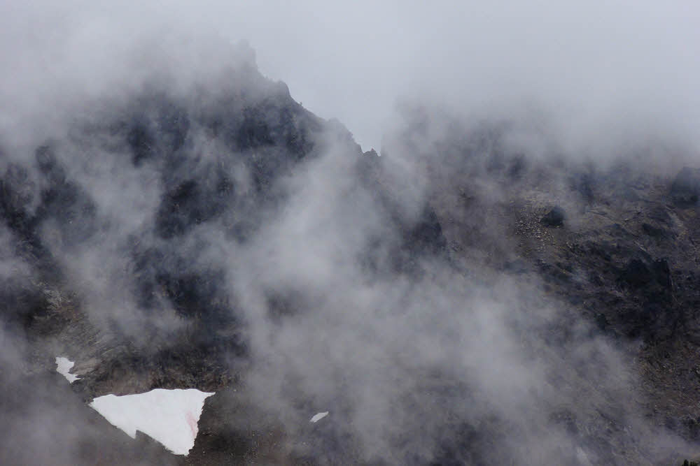
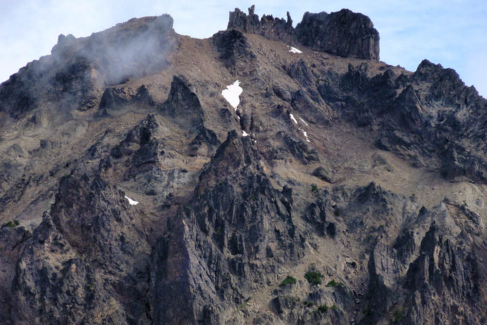
Especially when I zoomed in on the rocky parts and found that they were deep in negotiations with some of those clouds. This is usually not a good sign, so I resumed skedaddling, in a northerly direction.

Beast encounter. First, I get the hairy eye.

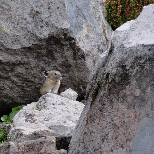
Some distance later I came to a boulder field, and while I paused to decide if I should lick any boulders to see how they tasted, I was accosted by a troll.

Then it's "Hmmm. Smells like backpacker."

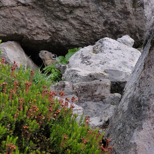
Prior to this, I'd thought that trolls were big and ugly, but this guy was cute as a squeaky toy, and tiny. He told me that he was going to gobble me up, but I said he should wait for the next backpacker, who was plump and much more toothsome. And had bathed more recently. After sniffing the air for a bit he decided that it would be better for both of us if I went on my way. Heh.

And finally, "You are staying how long?"

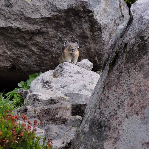
Just as I turned a bend farther down the trail I heard him squeaking that I'd better not be trying any tricks or he'd come after me. "Yeah, right," I thought, "On two-inch-long legs." The next backpacker to come along was that woman, who got her gaiters seriously twisted for being referred to as plump, and set her dog on the troll.

But when things calmed down he did come after me, in his airplane – sure it was small, but it worked, and I had to hide under a log for the rest of the morning while me made repeated strafing runs. Finally, after a really long time he gave up, for lack fuel (or ammo), or because some other more plump and relatively more toothsome and less aromatic hiker finally did come along. At least it wasn't me.

Lunch on the verandah. No extra charge for rain.

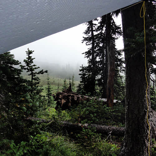
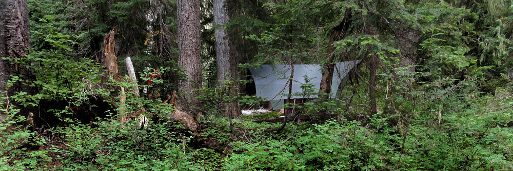
Or maybe it was the weather that grounded the troll, because all that gray stuff off to the southwest had finally caught up. Then it lunged and dumped liquid sky all over. I crawled out from under my log, but had to duck into a grove of trees and string up my hammock fly and cower under that. But since I had food and fuel and drinkable water, I decided to give lunch a go, and wait.

Great lunchtime view, given a tarp.

This turned out to be a lot more fun than standing out in the rain with my tongue hanging out, and I got a couple of photos of the clouds as evidence in case I ever get hauled into court to testify about where I was and what I was doing at noon on August 26, 2013. Under a tarp, munching, peeking out, and swearing. More or less in that order.

Clearing to the southwest. (Clearing? OK, whatever.)

Eventually the clouds drained themselves dry and went off to bother someone else, and I went back to hiking. There was a nice view off to the southwest by then, but all nice views are off somewhere, aren't they? This one looked sunny in a gloomy sort of way, and, as noted, it was far off.

Beargrass.

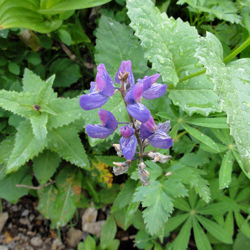
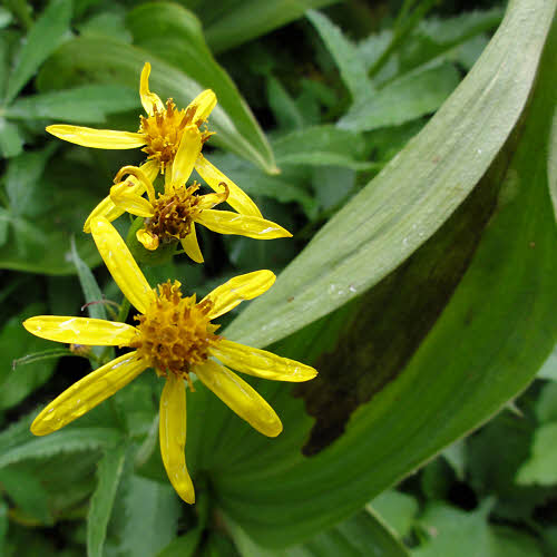
I saw more plants, with flowers on them, all of which seem to like clouds and rain more than is healthy.

Beginning the final descent. (click/embiggen)

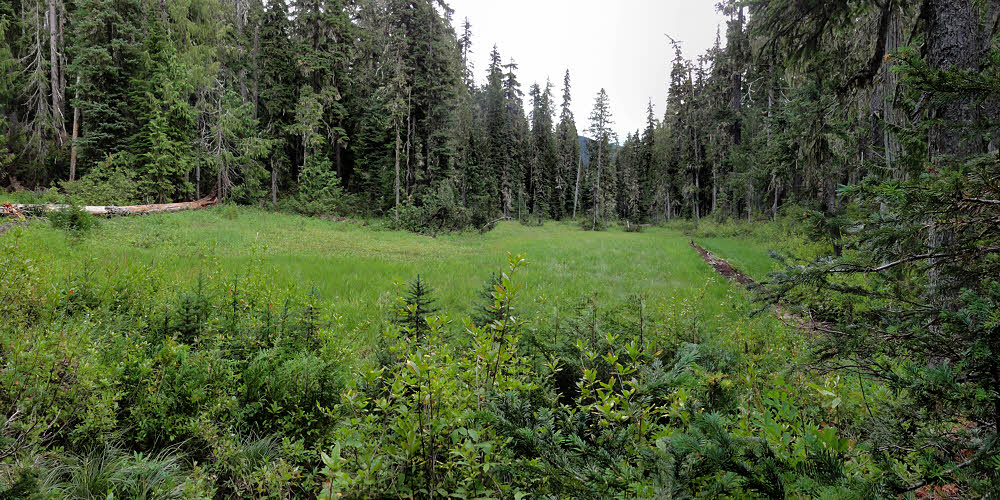
And then there was a sad meadow with more plants, and trees (Which also are plants – who knew?) around it. And then I got to the edge of the world, and it was mostly downhill from there, which was comforting in a way, since my life is normally like that and I know how to work a downhill drift.

Goat Creek at campsite, downstream.

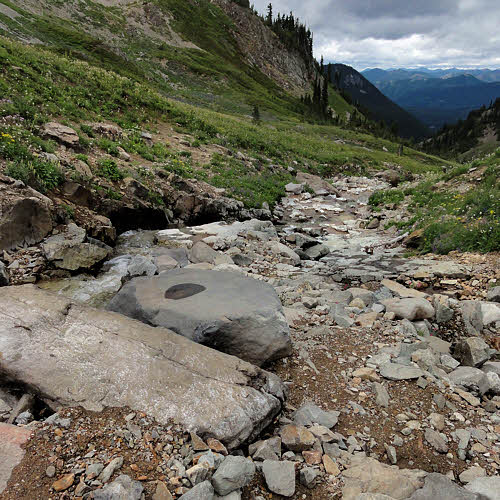
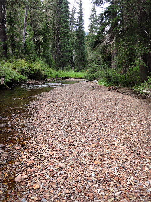
But before the end of everything I came to Goat Creek, off to one side. (No goats there either, just water.)

Goat Creek at campsite, upstream. (click/embiggen)

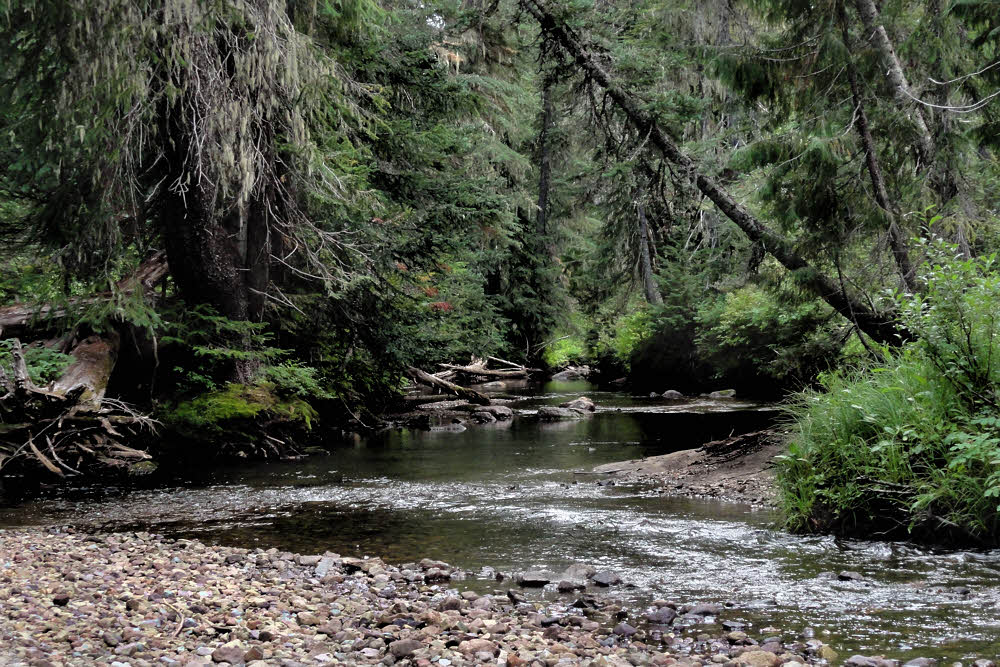
This turned out to be choice. (The creek and gravel bars and the forest and all.)

Goat Creek at campsite, downstream. (click/embiggen)

The trail is heavily used but since the trail crosses the creek so close to the parking lot (around a mile up / 2km), it isn't worth anyone's time to do too much searching for campsites there. Maybe earlier in the season, but not when I was there, so I had the place to myself, and to get to the creek a person has to go off-trail on spec and wander around here and there before finding the payoff.

Downstream, looking back toward campsite.

Most of the season's bugs were down by then too, and it was cool but not unpleasantly damp, and quiet. There was gravel beach (no mud) to walk on and cook on, and a pair of trees in just the right place for a hammock, so I had a good last night.

Campsite sheltered in the trees. (click/embiggen)

More, kinda:

Mount Curtis Gilbert

Gilbert Peak

Mount Curtis Gilbert - Conrad/Meade Glacier, Nov. 2004

The Pika Stove

Wednesday, October 16, 2013

Partly Organic

Mostly digestible.

Backpackers are special people.

They go outside carrying things on their backs, and suffer for their cause. This is doubly true for long-distance backpackers, the grimly-determined bunch who stomp along for months at a time.

All backpackers have one thing in common, though – they'll eat anything.

This is partly due to boredom, but hiking consumes mass calories, and hikers need calories to keep going. But food is expensive, and often hard to come by, so some forward-thinking backpackers have been experimenting.

For a long time there has been this MYOG or Make Your Own Gear movement among backpackers, many of whom do not have regular jobs. Even those who do work in the off-season don't make a lot of money, so they've gotten resourceful.

Well, the whole MYOG idea applies to food too, with a little twist.

You've probably heard the phrase eat your own dogfood. Normally it means that the best way to improve something you're involved with is to know it, and the best way to know it is to use it.

Fair enough, but backpackers live close to the ground, and are too literal-minded to grasp abstract concepts, so many of them just eat actual dogfood out of a bag.

Which makes a certain amount of sense.

For example, you blow into Pipe Wrench, WY on a Thursday afternoon during your Continental Divide hike, and you find a gas station. You already have gas, so you're OK there, but you do need food. Unfortunately, chewing tobacco, whiskey, beer nuts, and Hinkey Bars (at 98 cents each) are not going to serve you well, and that's all they have.

But every gas station and convenience store in The Real America does have a full selection of dog food. So you fill your pack with that, and clear out of town before sundown to avoid the people who do live on chewing tobacco, whiskey, beer nuts, and Hinkey Bars.

Some brands you might like are...

Taste of the Wild: High Plains Prairie Dog

"My personal favorite. It's DELICIOUS. I grab a handful at home whenever I'm hungry just to much on. I haven't tried Taste of the Wild: Roadkill yet, but my friends rave about it, so I'm going to." – Beth R.

Anything by Merric

  • Chicken with Brown Rice & Green Peas
  • Beef with Whole Barley & Carrots
  • Lamb with Brown Rice & Apples
  • Grain Free Cowboy Cookout (with real cowboy chunks)

"The only canned food I'd ever even consider carrying above the Arctic Circle." – Andrew S.

Sam's Arfy Chow

"Chicken, Brown Rice & Green Pea Senior Classic Recipe Dry Dog Food isn't just for old dogs. Make your own golden years slide by as smoothly as possible with Sam's Arfy Chow products. They contain omega fatty acids for skin and coat health and glucosamine and chondroitin for joint support. You'll be romping down the trail like a young pup again in no time." – Flyin' Brian R. (You know who I am.)

California Munchy

"I always try each new dog food (never Iams, Beneful or anything with by-products – that's a little scary). CA Munchy Lamb Meal supports lean muscles. Plus the whole-grain brown rice has vitamins, antioxidants and fiber. The white rice gives me a quick energy boost, and the sunflower oil is hopping with those essential fatty acids." – Jennifer PharStride Davis

"I've tasted a few other brands, but this stuff is truly great. When I'm really hungry, I can't hardly wait, and it all smells awesome!! My next bag will either be Leepin Lizzerd or Blue Buffalo. They're supposed to be pretty tasty, and they're made with real hemp oil residue." – Josh Gosh! Garrett (PCT Record holder, if I may say so.)

Q: What about cat food?

A: Freak – that's DISGUSTING! Get outta here!

More:

Best-tasting dog food, in YOUR (not your dog's) opinion?

Wednesday, October 9, 2013

Hike To Crater

Public not invited.

"Indeed, I never thought I would live to have an experience quite like this."

So said Pelton van Husen, one of the lucky few accepted for this year's introductory run of Crater View Hikes at Mt St Helens in south-central Washington State.

Mr van Husen, who paid $300 for the privilege, sipped wine and tracked hikers' progress from a shaded table set up near the mountain's Windy Ridge parking lot, which was roped off for the event. His manservant did the actual hiking.

"Hiking – a tedious and unclean activity – resembles nothing so much as the sorts of work the lower classes are most suited for," van Husen remarked between nibbles of caviar. "I prefer to send one of my people in such situations. After all, Rodney is marvelously skilled with the camera. I'm sure his photographs will bring the experience fully to life once he is returned to me."

While the cost of physically climbing Mt St Helens via the south-side route is only $15 per person, and is limited to 100 climbers a day, the Helens Institute is offering professionally-guided two-day climbs into the actual crater itself, from the northeast side. These trips are exclusive – by invitation only. The cost is $600 per person for those deemed worthy of the privilege, or for their hired help.

Other guided climbs up the south side of the mountain to edge of the crater, and led by an Institute geologist, cost $200 per day. These trips however, are not catered, and involve movement of one's legs and unfiltered exposure to sunlight and air.

For the pedigreed and perspiration-averse, the Institute maintains a comfortable camp at the end of a private road, watched over by armed guards. Food and wine are provided, along with an evening campfire talk, hot tubs, fresh linens, and directed meditation exercises.

The Forest Service will use the fees it collects to fund ranger patrols. These will cull herds of free-roaming, unregulated hikers whenever their numbers threaten to interfere with paying guests.

"There's a safety concern because the crater hike is so remote – it's off the pavement, after all – and research areas are nearby, too," said Lisa Rorschach, Director of the Helens Institute. "We can't risk having ordinary people milling around out there, not on public land."

Once returned to their base camp before they helicopter out, most of the day's elite hikers were more than weary from hours of lifting wine glasses, but nevertheless enthusiastic.

"Fabulous," said [name withheld for national security reasons] of Woonsocket, Rhode Island. "Special."

"Absolutely," added [name also withheld] of Hadley Wood, Hertfordshire, UK. "In fact, I may just buy the place for my daughter to play in – she's at that stage, you know."

More:

Trails for prime views of volcano crater may open next year

Close-up Mount St. Helens crater view is worth the hike

Wednesday, October 2, 2013

Five Days Rocking With The Goats (Part 4)

I face the truth – there is no Goat.
Morning becomes gray.

After spending a quiet night hanging from the trees (in a hammock – not by my hind claws), I continued down toward Walupt Lake a bit farther down the trail.

Pacific Northwest sapling (horizontal phase).

This was a cool, gray day. Good for hiking but bad for photos. Which is fine. No one guarantees good photo weather. At least by this time of the year there were few mosquitoes.

Flora droopica (trailside).

I did grab a shot of a fallen douglas fir across the trail. If I wasn't so ugly and hadn't been so lazy I'd have handed the camera to a passing sasquatch and posed next to the recumbent lumber to illustrate scale. But you can probably guess at the dimensions. Even the flowers were droopy that day, but they work so hard at being happy-faced all summer that you have to expect some burnout.

Nannie Ridge Trail (boring section).

From Walupt Lake, the trail climbing Nannie Ridge passes through a lot of quiet landscape. Or boring landscape if you like that description better. There was some intermittent drizzle which added to the thrill. For me it always does.

Looking sort of east over a wide expanse of gray. (click/embiggen)

From the edge of a small open shoulder along the trail I caught a panorama looking generally east – clouds, drabness, haze. All in all not bad, except for several more exciting and suspensful episodes of drizzle.

Depressing southeasterly view.

From there or somewhere in the general vicinity I tried to capture the glory of nearby ridges, but the glory was not cooperating, or I just didn't understand it. Maybe that's it.

Depressing easterly view.

I tried again, looking in a slightly different direction. Not any better. Still depressing – I had to stop and hang myself from a nearby tree for a few minutes to perk myself up again before trying to go on.

Sad forest (dead phase).

Ahead – more kissed-by-death forest.

Looming rock (pre-suicide).

Along the side of the ridge there was a nice little cliff looming over the trail. It looked as though it might jump at any moment. I tried to talk it down but it wasn't listening so I moved on. Sometimes that's the best thing to do. We can't save all of them.

Mt Adams (no longer sure if life is worth it). (click/embiggen)

After looking over my shoulder to see if anything was back there, and had unpleasant ideas, I found that there was – Mt Adams, with its head in the clouds (it doesn't have an oven, not one big enough). It definitely had the blues. Poor guy. I might have heard a distant moan, but that could have been me..

Miscellaneous pointless landscape with haze. (click/embiggen)

And then, turning back the other way, there was the rest of it – half a dozen furry ridges trailing off into pointlessness in more exhaust-colored air. But who am I to judge?

Looking off toward something or other in the distance. (click/embiggen)

I guess I decided to split the difference between Adams and the receding, sagging ridges, and took another photo. Well, things were a little brighter there, with slightly more hopeful clouds. That's good, I guess. Whatever.

Sheep Lake and hopeful hiker (nearing letdown). (click/embiggen)

And all too soon there was Sheep Lake, and a couple of other backpackers. If I remember, this was a Monday, and at least the weekend crowd had gone by then. No one else was there that morning. Vacancy can be reassuring some days, when you want to suffer alone.

Explorer's gentian (Gentiana calycosa – closed for the day).

It's a nice little lake, but everyone in the world camps there. There is a cozy grove of trees on the north side of the lake. And a short distance back of that there was a pile of used toilet paper sitting on top of some other stuff that I decided not to investigate.

Saddle above Lake Corral, which is a sad wet spot. (click/embiggen)

I had my heart set on camping a bit beyond – up a creek I'd crossed the day before. Walupt Creek. After putting up my hammock I dumped my pack into it and headed up the creek on an informal trail to see what was there.

Pointy deer prints (indecisive phase).

This trail led to a grassy saddle forming a pass, which in turn led to a hidden lake below and to the southeast. Enticing. I got a look at it but didn't want to get too far from my pack, a mile back by this point, so I stopped it there.

Looking west (in case anyone cares).

But the pass would be a fun place to camp. There's room for around 400 tents, and no water, guaranteeing plenty of parking space, and no complaints about my snoring. If I slept in a tent.

Looking east (as if that matters).

There is so much room that a dedicated snorer wouldn't even have to worry about running out of air. Not for a minute. The place is chock full of it. And snoring keeps critters away – it sends them running straight the other way, screaming sometimes, so you could leave all your food out on the ground, on plates, with flatware and everything (even napkins) and nothing would touch it. True.

Finally – a place to get over the day. (click/embiggen)

And then it was back to camp, followed by a bath, followed by supper, followed (surprisingly) by no rain overnight. All quiet. No goats.

More:
The lakes. (click/embiggen)

Explorer's gentian: This common late-blooming flower of wet mountain meadows is dark blue with yellow spots. The flower is held upright on the stem and has a bell shape. It opens when the sun is shining on it. (PDF)