Wherein I display pedestrian photos.
I didn't notice the spelling until a few minutes ago.
Man, this is not working out pretty well.
We've had three years running of bad summers. Late springs, much snow. Little chance to get out.
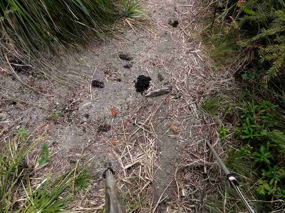
Ah, poo in the trail.
I tried this route at the end of July and had to give up at the end of the first day, after colliding with deep, hard, cold snow. So I went back at the end of August, which was about a week after the real start of backpacking season. And then the weather became iffy.
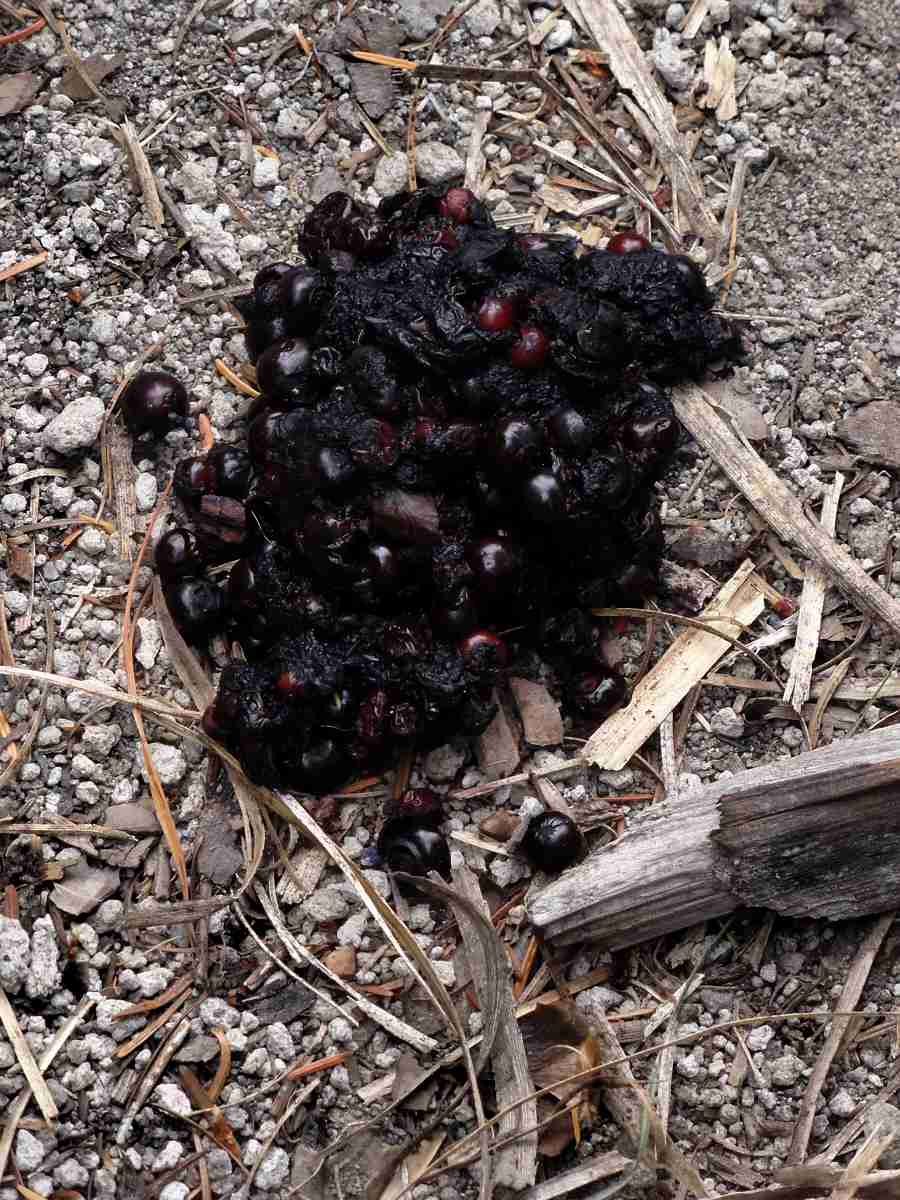
Definitely poo. Someone is getting too much roughage.
The first two hours of this trip were glorious, really. I managed to make the roughly three-hour roughly 125-mile (200 km) drive early enough that I was able to start before 10 a.m. If that doesn't sound aggressive enough, I'll have you know that there have been days when I drove to this area, parked, ran for the bushes for the usual reasons, got dressed in my official hiking togs, pulled the right straps, adjusted the right adjustable bits, noodled quite appropriately, checked things, double-checked, triple-checked, locked the car, checked that the lights were off, checked that the doors were really locked, checked that I had the keys with me, checked the lights again, thought about it, put on my cap, and set off, all well before 8 a.m. Which means getting up three-thirty-ish, hustling everything into the car, without major incidents, and driving in the dim morning light, only 10% conscious.
Once it was so windy there that I could barely stand. Had to do the first five miles holding on to my hair.

Old guy by tree. Comparisons for (1) size and (2) ugliness. I lose.
But not this time. It was really nice. Really, really nice.
For two hours.
Then a wall of clouds came along and I hoped they had only come around to see the mountain, the way fighter pilots seem to do, now and then, ripping the air apart with their sharp jet exhausts, but no. Clouds it was, a lot, long time.
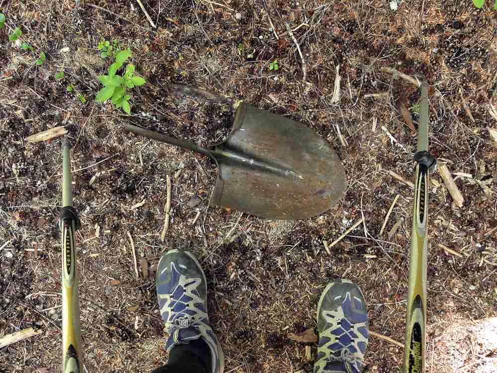
Remains of a shovelhead hiking staff from the olden days.
Things got cool and gray. Not so bad the first day, better the second, worse later.
One good thing, shortly after the first road crossing, at the Bear Meadow viewpoint, was seeing two coyotes. They always look guilty, coyotes do, loping, looking over the shoulder at you again and again, slinking off behind trees and stopping, taking off again if you stop, or look too hard. I did have time to get my camera out but they only laughed and ran some more. I almost got one shot at about 150 yards/meters, with my pocket camera's tiny weak little lens racked out all the way, panting and grinding with the effort, but the buggers only laughed again, and evaporated.

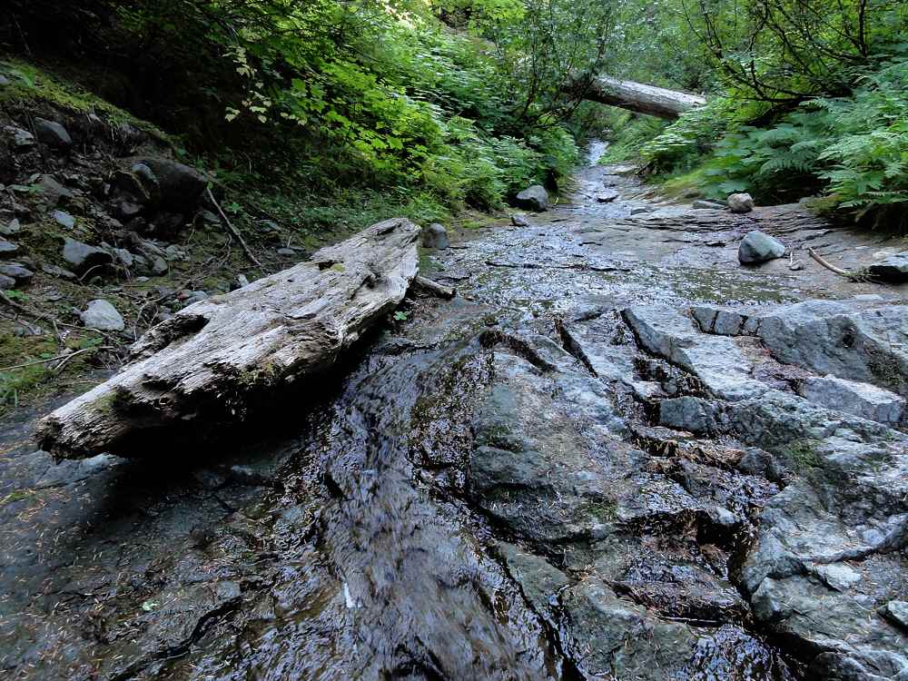
Nameless stream on Trail 5C.
I half expected the two to circle around, bite my butt from behind, and steal my nummies, or simply munch me, cracking my bones simply for the pure pleasure the sound would give them, but they must have eaten someone else already that morning and I didn't see them again.
So Badger Lake looked good. I got water there but by then the day was cold and breezy and this place is strangely inhospitable once you actually get to it, so I walked on nearly forever, putting on around, I don't know, 15 to 17 miles (27 km) total, and found a dandy spring down low near a mushy, marshy, fenny area, and shelter from wind.
Ditto. On way down to Quartz Creek.
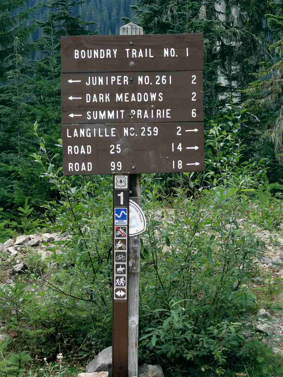
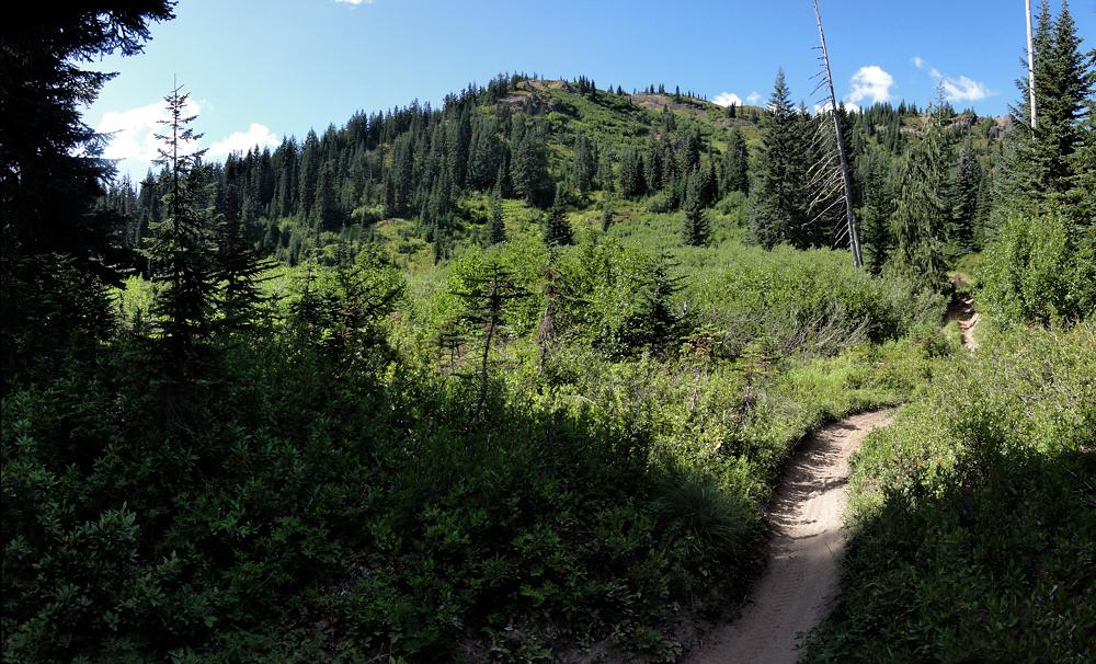
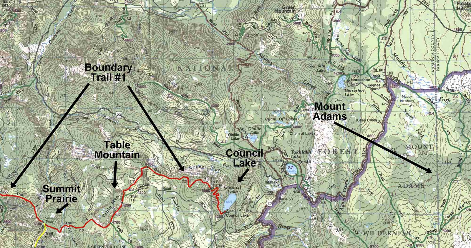
Next day, which these photos cover, was spent tromping down to a trail junction (first photo), and then leaving the Boundary Trail and taking the scenic route farther down toward Quartz Creek.
This alternate begins as an abandoned road. Its culverts have been ripped out. Not bad walking but odd. The surface is old gravel so hardened and stale it feels like the earth was built up around it, with a slight green scant fuzz of grass living on only the hope of nutrients. Then you get to one of the culverts and there is a huge V-shaped gash in the ground with near-vertical sides and a dribble of slimy wetness at the bottom as though the hillside is drooling while passed out from drinking.

This is what? Oh, right. Trail.
This is strange walking. You go down a gentle slope for a good quarter mile (0.4 km), hit a hairpin turn, and reverse direction, but on a lower level. After more of this tramping you near another culvert and wonder what you've gotten into. "This can't be right, right?", you think, and look around, but no alternative is obvious. Eventually, if you don't give up you see an old trail sign, one of those jobs with the little roof on it over a flat vertical board, with maybe a hand full of registration forms in a little compartment.
This one is old and long retired. But it's there. You see it. You think "Trail!" After all. And then you disappear into the trees and begin to feel your way ever lower, along a trace so little used that it hardly remembers what hikers are. But it is good. It is sweet. It is gentle. It is quiet. It is kind.

Blue grouse, blurred phase.
This trail resembles a man who has slept too long and can't quite reawaken, remaining all day in his bathrobe, sloppy, disoriented, scruffy, unwashed and unshaven, but pleasantly genial. Good natured after all.
After more downhill walking, navigating by instinct, brushing encroaching foliage on every side, led by the tingle of uncertainty, sighting the rare knot of orange tape dangling on the odd branch, you get to a stream coming off the blunt back side of Dark Mountain. The stream has no name, and neither, really do you by now. You are only another beast moving in the forest and you come to this stream sluicing over a short flat where the trail meets it, and you stop to eat and bathe and scratch beneath your fur.

Looking west, roughly toward St Helens, Mt Margaret.
Or, if not you then I. You didn't. I did, but you are welcome to, too, any time at all. This is a fine place.
There is the quiet sound of clean water sliding over smooth rock and no other sound, aside from your own breathing, if you are good enough to hear it. If not, you don't care. I didn't. I still don't. I had lunch and gladly washed up, having gone to bed the night before sticky from the first day's long hike. I ate and washed and waved at the trees. That was enough.

Adams, hiding. Peek!
From there down to Quartz Creek the slope is gentle and the trail is silent, but good. The trees are taller here, and the trail has not deteriorated as much as it has higher up where there was obviously recent logging. This is splendid. Splendid is an odd, old word. We don't use it often these days, and it is exactly right. This lower trail is a splendid palace of bark, bejeweled by leaves. It is the kind of place that is a friend to every backpacker.
Tromping down the trail I eventually came to a flat, almost at stream level, where at least some had camped, once upon a time, and later crossed two or three small streams. True to my nature, after continuing, I completely missed the turnoff and followed the trail to its end at Quartz Creek, where I spent many long eons thrashing in the nettles and the thorns of berry bushes before giving up and heading back. I do take full credit for being a dolt. My specialty. I am a champ at doltishness. I do it so well.

Summit Prairie. Has water if you go down the far side.
But the map is wrong too. The connecting trail, the one I wanted, that goes severely and steeply up, is far from where the map says it is. So duh.
By now it was getting late-ish again, and you know how it is when you're on a slope where it's simultaneously one step forward and one step up. Hiker heaven, Bub.

Jumbo Peak. Like a giant cork in a dry bottle.
After passing several ever-smaller, ever-goopier, and ever more bug-filled trickles of almost pure mud I finally stopped at what was the smallest, slickest, slowest, muddiest, and the last one of all and got barely enough water to make it to the top.
Duh, but someone has to be a dope so you don't have to.
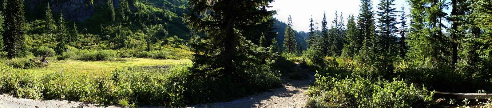
Approaching Dark Meadow from the southeast.
I made it though. Close enough.
After some more eastward tromping I got to Summit Prairie, a sort of dry fen. It's lovely. Flat, grassy, ringed by trees, lots of which are agreeable enough for hammocks, but there is no water. In the middle of this place is a small opening, sort of a wallow. Or would be if it was wet, or even damp. No. Iron hard dried mud is all.

Ditto. Jumbo in right background.
Ha. Clever trick I'm learning, finally.
If there is a slope to the land, follow it. I did, and far enough down slope, which isn't far here, there is mud, then a little stagnant, oily water, and then more, and finally a place where the water is sort of moving around a bit as though having an uncomfortable dream, and if you keep going it becomes a thing you could call a proto-stream. An idea which you could call a stream. If you were hopeful enough. If you were dry enough.

Cold-damaged bent tree. OK, not a great photo.
Worked for me.
Someone once broadcast a tip. I happened to be standing near enough to be hit by the spray, and it eventually sank into my tiny mind. Take a square of thick fleece when you backpack. It is handy for everything. Scratchy, it scrubs you well. Synthetic, it dries fast. Small, it is light. Blue, it is my favorite color, but for you, take what color works.

Dark Meadow. Crystalline Dark Creek kisses its behind.
I had this. My teeny-tiny trickle of water was wet enough for a wipe-down, I had just enough water to drink, and my hammock didn't fall down. I was in heaven. Of course I once again forgot to take a photo of my camp but I have only the one brain, so.
Dark Meadow and Trail 1, seen horizontally.
Next day, number three of the trip, I continued east, toward Mt Adams. I wanted to get far enough for a good look at the beast, but the eastern terminus of the Boundary Trail is at the end of a radically steep decline, howling with switchbacks, and it seems to be heavily wooded. The top of it was as far as I went. Color me not caring. Close enough.
Not wanting to tramp to the end only for the glory of claiming I've been there, of being pig-headed as well as dense, I bailed. I doubled back from there , past Table Mountain (which might be worth exploring for its own sake), past Summit Prairie again, and farther back, west, to Dark Creek in Dark Meadow under Dark Mountain on the south end of the Dark Divide.

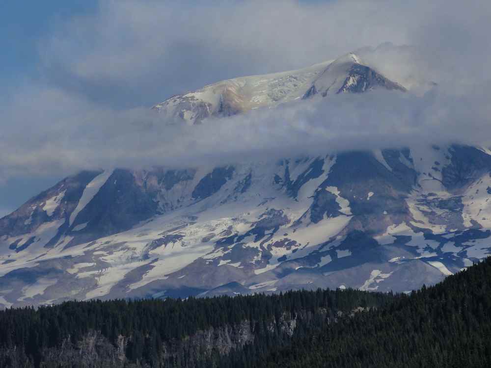
Mt Adams, the gentle giant.
Even though all this "Dark" stuff was only named after a ranging, rambling, rock-tapping prospector called John Dark, and I've seen it with my own face, and it's trees growing out of dirt just like any other place, the name still gives me a tingle and the water is famously good. You almost expect, when you see Dark Creek, that if you tap it sharply with your finger tip it will ring like a bell, for long minutes.
It doesn't.
It's wet. It's water flowing on the ground like other water flowing on the ground, but it's grand for all that, the only good drink for miles.
Mt Adams, like an old, beat-up boxer.
So I had a great bath, ate, and strangled a couple more trees (in a friendly way) with my hammock while snoozing the night away contentedly.
The next day was different, very different. Oh, yes, my friend.

West 1/3 of trail.

Middle 1/3 of trail.
East 1/3 of trail.
More:
Boundary Trail 1
Boundary Trail 2
Washington's Dark Divide Roadless Area, by Susan Saul, Forest Magazine, July/August 2001
Exploring the Dark Divide, Southwest Washington's threatened gem (PDF)
Dark Divide Washington August 10, 2008 (video)
See tabs at the top for definitions and books.
Have extra info to add?
If the commenting system is out again, then email sosayseff@gmail.com
Me? Recently nominated for this year's Doofus Awards. (Next year's too.)