Though I'm still a minor league player.
Twenty-four miles of hiking on day one, including a mile of vertical gain, was enough. I was more than happy to slither into my hammock for a sleep. But I forgot my Teddy bear. Boo.

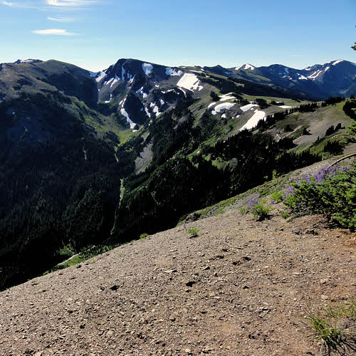
Day 2: Morning arrives along the ridge above PJ Lake. (click/embiggen)
Morning came, as it does, and the sun arrived some time later, after having to climb up the eastern side of the valley I was in, which kept it cool, but it was another vertical hike to get out of the PJ Lake valley, so I got sweaty nevertheless.
First, it was a hike along Obstruction Point Road, which was still closed. Due to federal financial shenanigans, the Park Service was unable to plow the road and so left it to melt out. But there was no snow.

Lupin growing along the road to Obstruction Point.
Which was fine with me because with the road closed (for whatever reason) there was no traffic, and so there were no clouds of vehicle dust to coat me, layer after layer.
But there were flowers in the shade, and a few small patches of snow hiding from the sun.

And a bit of thistle too.
Most flowers were lupins, though there were a few thistles to even things out. Overall, it was a nice spring along the road, though the calendar said late July. But then this was about a mile up.
Valley west of Obstruction Peak.
Eventually Obstruction Peak came into view, with more snow on its shady side, and a few small streams.

Obstruction Point Road from above, along a hiker shortcut.
Even in a normal year, with traffic, it is possible to escape some of it by hopping up onto a hiker shortcut trail that goes across several meadows and allows some views of the road from above, which isn't great as views go, but it's always nice to look down on people confined to live in the ruts.

And that hiker shortcut looks like...
And it is always nice to walk across a meadow, or a bald, or whatever you wish to call it, and have only grass under you and sky above.

Mikey Marmot guarding his grass.
I didn't see any exotic animals on the backpacking part of this trip, but it's always nice to skirt around a few marmots who are agreeable enough if you can make it clear that you know you are a guest and not likely to cause trouble. So far none of them have written me up over bad behavior.

Badger Valley from Obstruction Point. (click/embiggen)
Then, not too much later, there was Badger Valley hanging under Obstruction Point, with Deer Ridge along its north side, Grand Creek in its bottom, and a surprising number of snow patches.

And another view of Badger Valley.
From here you can head up to Deer Ridge and walk along its top, or skirt along the north side of Badger Valley and climb later. I chose Option Two, since I needed to wash up, and the valley was where water was hanging out. But it was glad to play with me when I showed up.

Flats inside Badger Valley along Grand Creek. (click/embiggen)
But after a wash, and a fill of the water tank, it's a long and hard climb up to Deer Ridge, made especially difficult because you've just given up altitude to descend into the valley.

Junction with Deer Park Trail. (click/embiggen)
Although, having tanked up on water, it's nice to munch lunch in the shade of trees toward the top of the ridge, and to enjoy great views toward the ranges to the south which show how rugged this park really is.

More hikers seeking sunburn.
Rugged, and also significantly shade-free along this stretch, though popular with hikers. There is almost always someone hiking this east-west stretch. On the east there is Deer Park, and to the west is Hurricane Ridge, so hikers can park a car at each end and not have to backtrack, though driving to connect the two points is also a long grind.

Ridge-top trail to Deer Park.
But again, if you can defeat the sun and carry a minimal amount of water along this dry section, the views are wide open: saltwater to the north and stony peaks to the south, with only wind and gravity filling in between them.

View southeast toward Buckhorn Wilderness.
Buckhorn Wilderness is part of Olympic National Forest, just to the east of Olympic National Park and is no less rugged or interesting, though it has fewer rules and if you go there you are essentially taking sole responsibility for your survival and safe return.

Toward Maiden Peak. (click/embiggen)
Meanwhile, back in the park, the trail continues eastward along an endless bald through the sky.

Two hikers under Maiden Peak.
And every now and then there is a chance to stop and quit walking for a few minutes to compare notes with another hiker going the other way.

Blue grouse along Gray Wolf River.
Eventually, Deer Park drops off the back, and it's down Three Forks Trail toward the Gray Wolf River. Every now and then in Washington's backcountry, you'll suddenly come across a blue grouse. Sometimes you'll see them far ahead, or way off to the side, but they're as likely to show up right ahead, and stubbornly stay on the trail. Or you may notice one of them in the brush almost beside you, which can be spooky if one happens to be perched at shoulder level, eyeing you calmly.

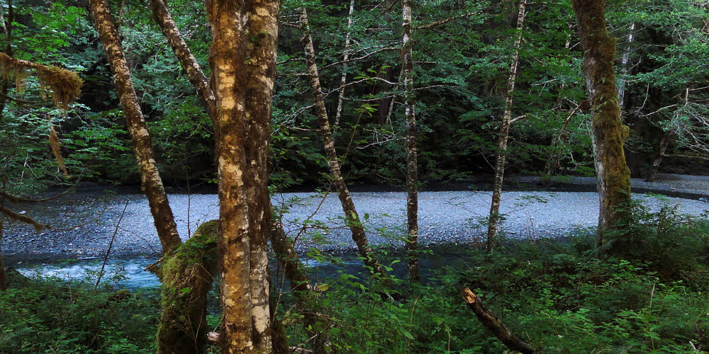
Fallen tree along Gray Wolf River.
This year the trails are having problems. First, there is no money to get trail crews out to repair bridges and freshen and reshape the trails. Then, there are many blowdowns, especially high up. Most hikers and backpackers stick to the river bottoms, and so don't see all the problems, but for those crossing passes, who climb over those passes, the situation is different. There are dozens and dozens of trees fallen across trails.

Tiny forest flower.
There are small plants as well as large trees, though I don't know the names of many, but I see them, and at times remember to photograph a few.

Lilly.
Like this lily. Whichever one it is.

To the southeast near Gray Wolf Pass. (click/embiggen)
Pushing ahead along the Gray Wolf River eventually brought me to the pass. Leaving the forest reveals the bones of this land and shows how rugged it is.

Along Gray Wolf Pass (may be Mt Deception).
First the forest thins, then it devolves into copses, and then the trees realize they've reached their limit and hold back. Above, the landscape is owned by rock, by altitude, and by snow.

Looking north from Gray Wolf Pass. (click/embiggen)
But effort finds its reward once the pass is reached. The entire river valley reveals itself, which is especially nice on a day without clouds.

Inside Gray Wolf Pass. (click/embiggen)
Especially nice to see from above it the little lake snuggled beneath the pass.

From the top of Gray Wolf Pass. (click/embiggen)
And at the very knife's edge above it all there is a great view in every direction. Aside from one peak to the west and another to the east, I realized that every direction was down, so, being reasonable, I descended.

And guess where this is...
Proof.

Sawdust pile under a carpenter ant nest.
Somewhere far below and many miles on I found one of the markers of this habitat – telltale orifices in a log's end and a pile of sawdust. Carpenter ants.

Carpenter ants at work. (click/embiggen)
They pick away at the inside of dead wood, breaking it up grain by grain, carrying it through long passageways, and then dropping each grain to fall on the pile. Carpenter ants don't eat wood like termites, but only live in it.

Honeymoon Meadows near Anderson Pass. (click/embiggen)
Much farther on, and after another climb, there is Honeymoon Meadows. To the south is LaCrosse Pass, which I intended to cross. I decided to lop off that part of the trip because of the poor trail conditions and some footwear problems, and so turned west, toward Anderson Pass.

Frog at Anderson Pass.
Short of the top there was a large frog – the largest I've seen in western Washington. We left each other unmolested, and I hopped along.

Looking southest from Anderson Pass.
The east side of this pass is sweet and fine, with a smooth, wide trail. Which I missed, and ended up thrashing around in the brush for an hour before deciding to go back and see if I wasn't wrong. Yeah, right. There was the trail, waiting patiently for me to come to my senses.

Closeup (Mt LaCrosse?) at Anderson Pass. (click/embiggen)
Once on it for sure, I was able to enjoy the hike again and got great views back east and to the south, of what might have been Mt LaCrosse, and if it wasn't, it was good enough.

Mt Anderson from Anderson Pass.
Too bad that I wasted time or I might have taken the one-mile (1.6 km) spur trail to Anderson Glacier, which would have been fun, especially considering how Mt Anderson looked from the west.

Late season snow cave under Anderson Pass.
The trail descending to the East Fork of the Quinault River was not nice. This has been neglected for years, scoured by rain and avalanches, and although mostly clear of blowdowns because there are no large trees there any longer, it is brushy, rocky, and hot to hike, even while losing altitude.

Closeup.
Across the valley I saw a vanishing snowfield with a large cave in it. Later on I caught sight of another late-season snowfield with two or three caves. Both must be gone now (nearly a month later). That evening I made it down to the flat part of the river valley before dark, and found a campsite on a large island that wasn't an island the last time I came through here in approximately 2006.

Bridge over East Fork Quinault River. (click/embiggen)
The hike down this valley used to be almost a superhighway, and the next day it almost seemed like that, given the traffic, but the trail has been chewed up over the years and it's no longer possible to simply walk along at maximum speed and not worry about where one's feet are coming down, or on what.

Flats, Enchanted Valley, East Fork Quinault River. (click/embiggen)
The first time I went through this area I had to backtrack because of foot problems, and found myself hiking by starlight until 10:30 p.m. one evening. Not any more. This is now just another trail, though as I hiked downstream on Saturday, at least 50 people hiked upstream, ready for a fine weekend with the crowd.

Lupin again.
And, by paying attention, it's possible to notice that there is more to traveling than desperate hiking. Comfort and color show up here and there, if one only looks.
Gravel bar, East Fork Quinault River. (click/embiggen)
Ahead, at the bottom of the valley, there is a 10-mile (16km) road walk, but all along the way there is river access here and there, and many fine spots to hide from the crowds of hikers whose only goal is to grab a spot of hard-pounded ground before the next person.

Slug attack during lunch.
After lunch, while packing up to resume hiking, I found that my map had been attacked and slimed by a slug. Since I am a fourth-rate hiker, this sort of event is common, but I compensate by being lazy, while keeping one eye open for that horse-sized, backpack-eating slug rumored to be roaming the woods.
Previously: Part 01